
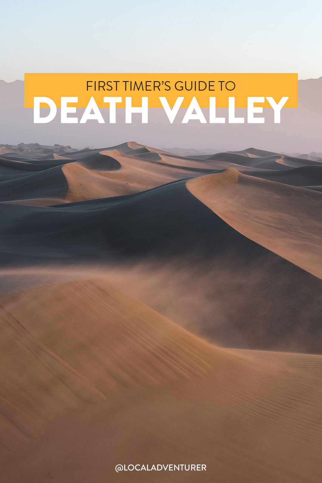
Visiting Death Valley National Park? Don’t miss these things!
Now that we live only a few hours away, we visit several times a year. On our first visit, we were working our way down our West Coast road trip list and decided to camp in Death Valley National Park while it was still spring. One of our travel buddies had been before and knew all the best photo spots. We arrived late afternoon and quickly realized how hot it was.
Death Valley holds the record for the highest recorded temperature on earth, 134 °F, and it lived up to its name. Friends, Death Valley weather is no joke. We thought we were smart by going shoulder season. We went in late April, and at sea level, it was around 100 degrees.
Luckily, we weren’t camping at sea level, and the temperature drops 5 degrees every 1000 feet above sea level. It’s also a large park, and within two days, we drove over 100 miles to get around, so make sure you give yourself enough time getting from place to place. Click the links below for more photos and info on each location.
This post may contain affiliate links, where we receive a small commission on sales of the products that are linked at no additional cost to you. All opinions are always our own. Read our full disclosure for more info. Thank you for supporting the brands that make Local Adventurer possible.
Last Updated: April 16, 2024
Essential Tips / What You Need to Know Before You Visit
- Death Valley is the largest National Park outside of Alaska, covering 3.4 million acres. There are almost 1000 miles of paved and dirt roads.
- The America the Beautiful National Park Pass can help save you money if you visit more than two national parks yearly. Entrance fees vary from park to park.
- Cellphone access within the park is very limited. For your best chance to get service, head to Furnace Creek or Stovepipe Wells.
- You can purchase wifi in Furnace Creek at The Oasis at Death Valley or the Death Valley Lodging Company in Stovepipe Wells.
- Furnace Creek Visitor Center is the only visitor center at this massive park.
- Have at least one gallon of water per day per person in the summer.
- Light, long-sleeved clothes can help protect you from the sun. Layers are also good if you plan on exploring higher elevations. Nighttime and daytime temperatures can also drastically vary.
- Do not hike in low elevations when the temperatures are hot. Head to the mountains if you want to get on the trail.
- Stay on paved roads in the summer.
- Don’t reach into places you can’t see. Rattlesnakes, scorpions, or black widows may be hiding.
- Get out of the sun and hydrate if you feel dizzy, nauseous, or have a headache. Wearing damp clothes can help lower your body temperature.
- Avoid canyons during rainstorms. Flash floods can happen.
When to Visit Death Valley
- Death Valley is an International Dark Sky Park. Visit around the new moon to see stars more clearly. In the summer, go during the new moon to see the Milky Way. Some of the best spots to view the night sky are Harmony Bora Works, Mesquite Flat Sand Dunes, and Badwater Basin.
- Death Valley is best known for its heat. It is the hottest place on earth. The summer season runs from May to September, with temperatures well over 100°F and often over 120°F.
- The Fall season doesn’t start until late October. It is still warm but much more manageable. Winter is cool during the day and cold at night, which is our preferred time to visit. At higher elevations, you may find snow.
- Spring is the most popular season for the park. In addition to the warm weather and sunny days, wildflowers attract many visitors.
15 Incredible Things to Do in Death Valley National Park
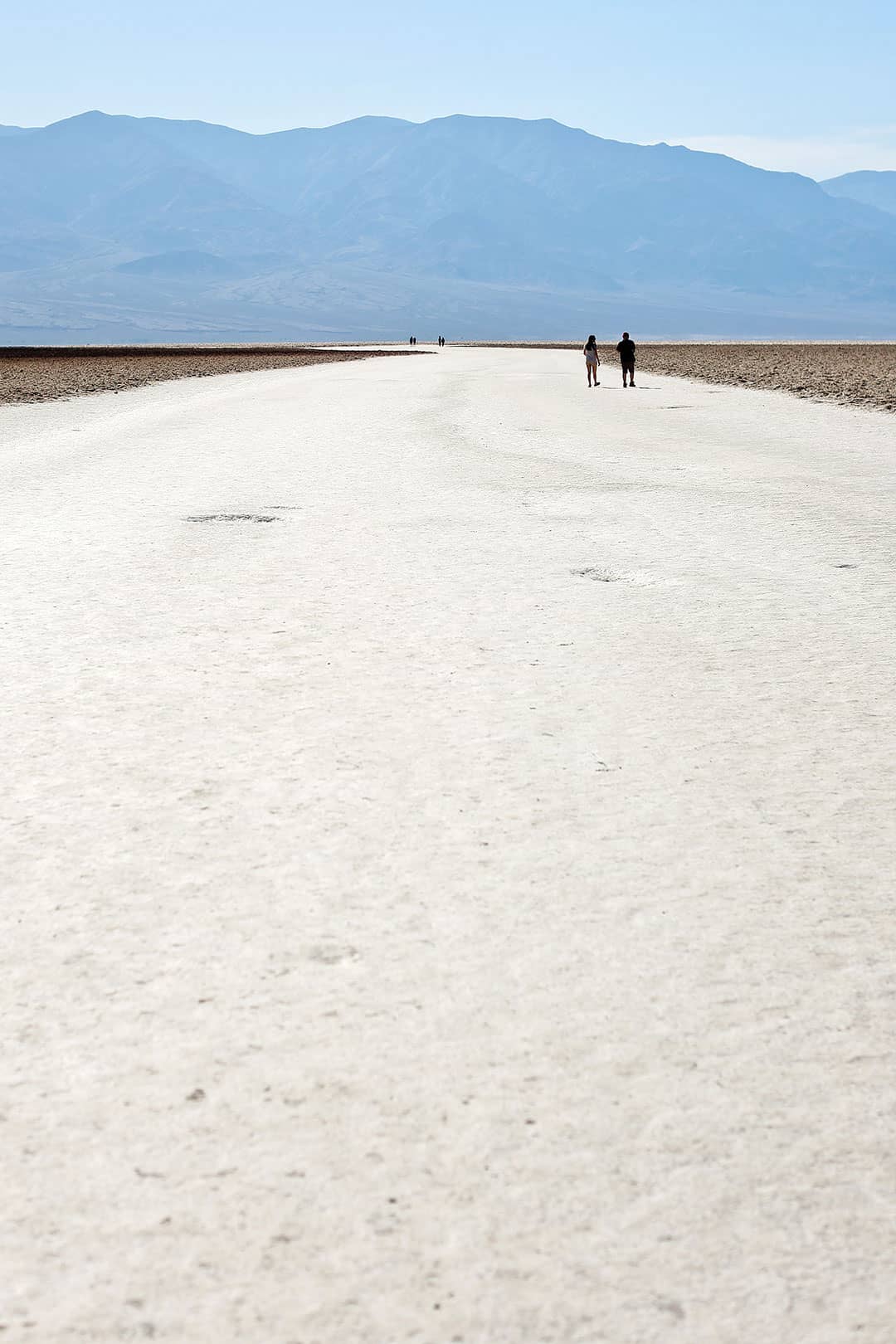
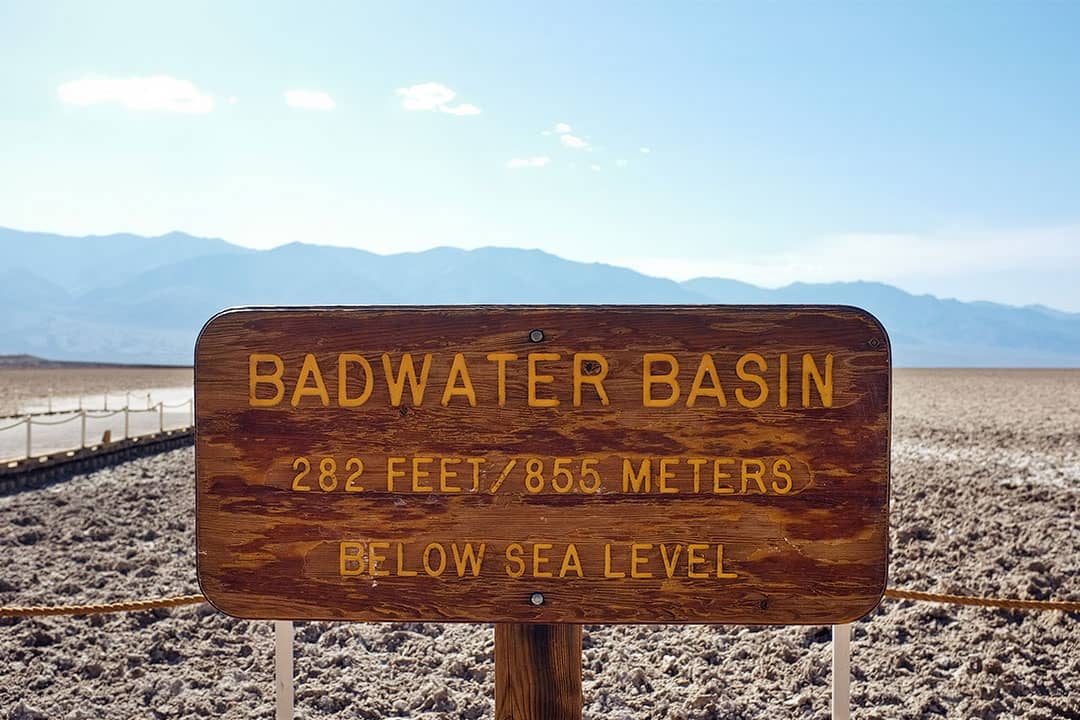
1. Badwater Basin →
36.230210, -116.767388, map
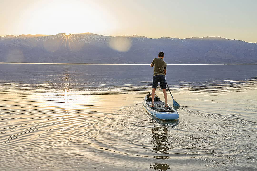
Badwater Basin has the lowest elevation in the US at 282 ft below sea level. It’s extremely hot in the summer, and since we only live a few hours away, we prefer to visit in the winter.
This past March (2024), they had the rare opportunity to kayak and SUP at Badwater Basin. The unprecedented rainfall and flooding caused a lake to form, unofficially called Lake Manly. For about a week, it was one foot high in certain areas (see a video of our experience). You still have the opportunity to walk through or along some of the water on the Badwater Basin walkway, but it may dry soon!
Photo Tip: For reflection shots of Lake Manly, go at sunrise for less wind and less activity from other paddlers.
Kayaking / SUP Tips: Park on the shoulder by mile marker 18. In order to leave no trace, don’t attach fins or anything that will make your watercraft drag.
More: Photo Diary of Badwater Basin
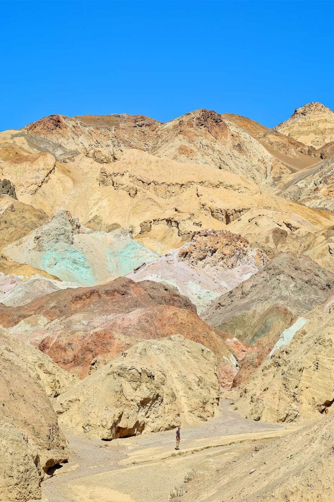
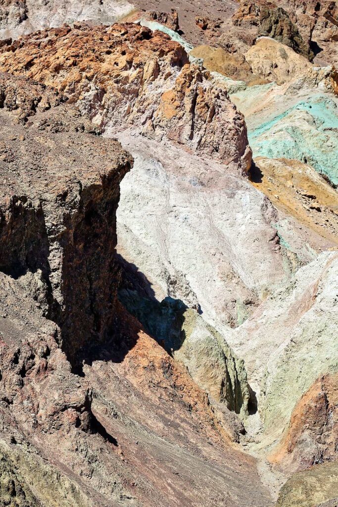
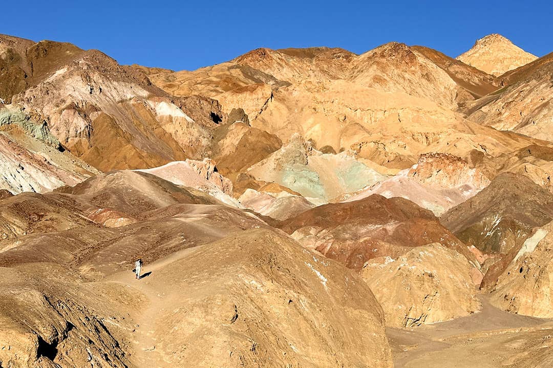
2. Artists Palette and Artist’s Drive →
36.363676, -116.802634, map
A scenic drive and views of colorful rock formations from the parking lot. The view requires no hiking, but you can venture further to see them closer.
Photo Tip: Many people up the saturation when they edit their photos so Artist Palette may not look as vibrant in person. However, the colors can still be vibrant if you visit during sunset or sunrise on a sunny day vs. mid-day when the sun washes out all landscape colors or during a cloudy day.
More: Photo Diary of Artist’s Palette
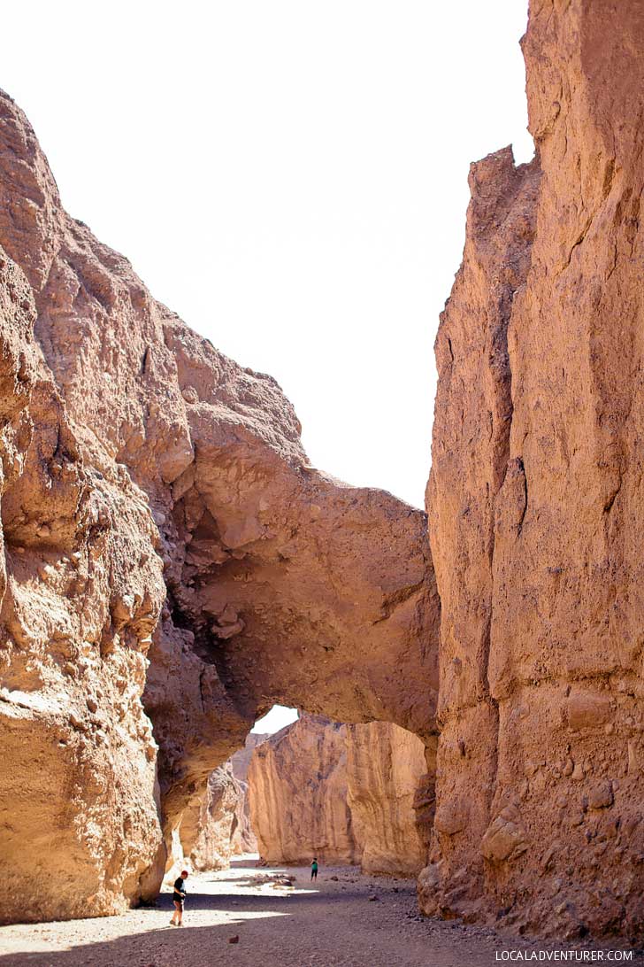
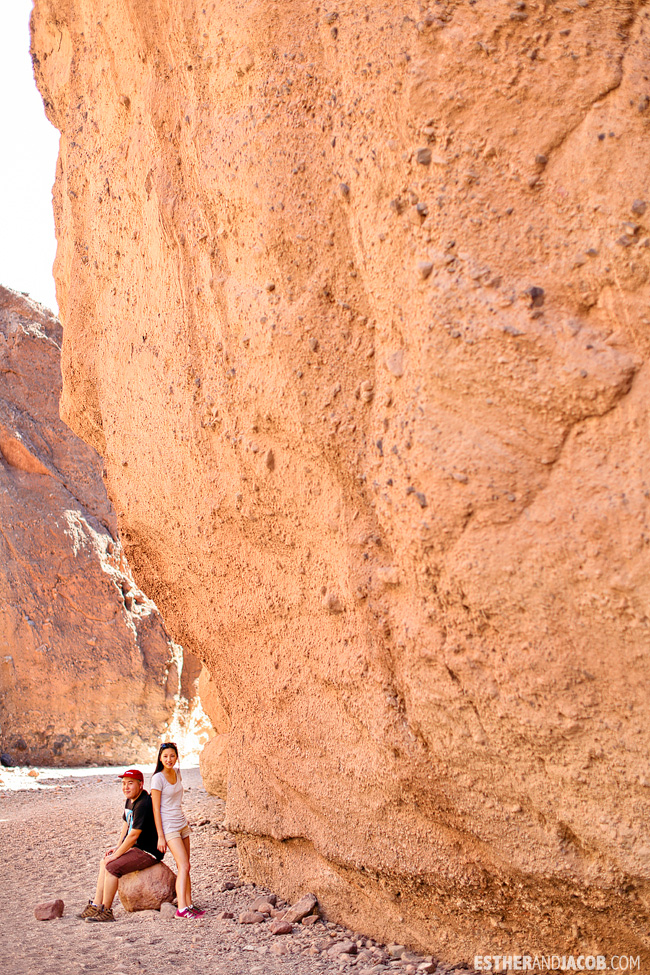
3. Natural Bridge →
Trailhead Coordinates: 36.281023, -116.769909, map
A 2-mile round trip hike through a canyon. It’s worth the easy, flat walk.
More: Photo Diary of Natural Bridge
4. Furnace Creek
36.462124, -116.866556, map
Get on their cell service if you need it. We ate lunch at the 49ers Cafe, which is the only restaurant in sight for miles. It’s definitely overpriced, but the Hiker’s Pasta was decent and filling. Again, it’s the only thing available. We also bought a patch souvenir at their souvenir shop since we collect National Park patches.
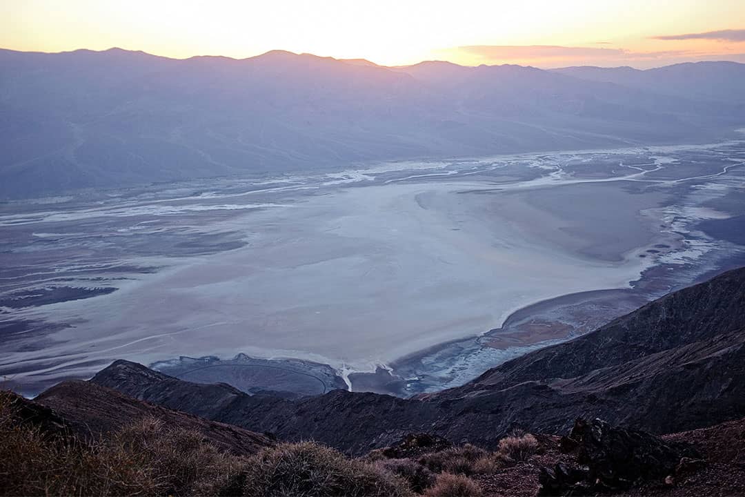
5. Dante’s View
36.220834, -116.726607, map
Dante’s View is along the Black Mountains where it gives you a panoramic view of Death Valley. Viewpoints are only a short walk from the parking lot.
6. Wildrose CAMPSITE
36.265815, -117.188182, map
These are free campsites that are great for car camping. There’s a pit toilet (like a porta potty) and also a spigot outside to use.
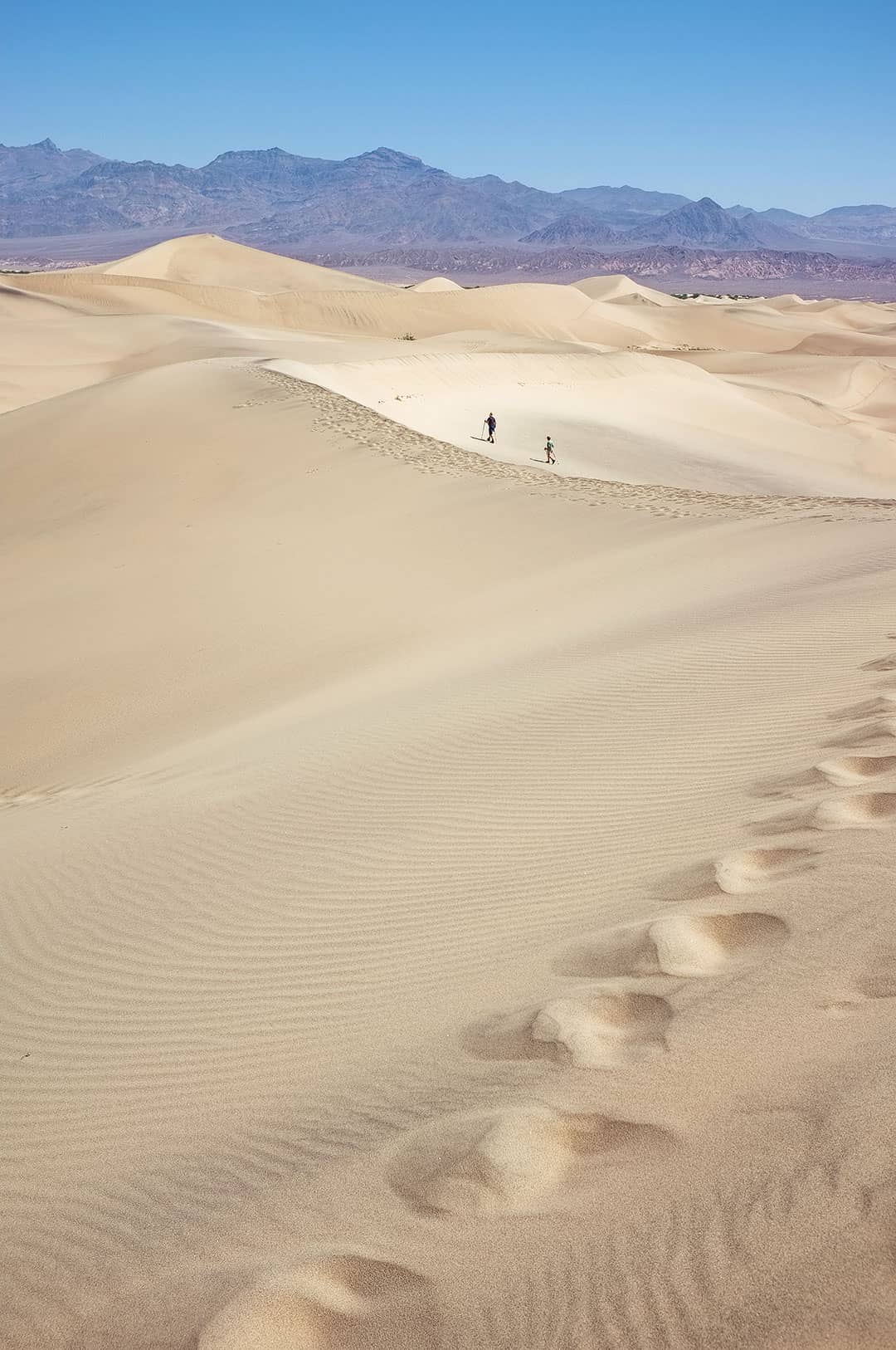
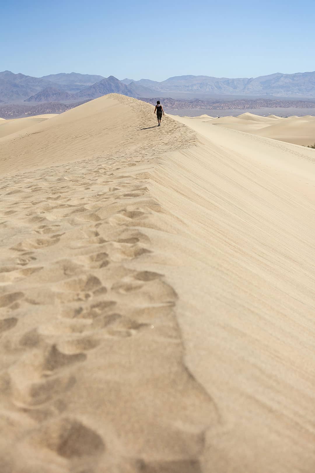
7. MESQUITE FLAT SAND DUNES →
36.615297, -117.113130, map
We headed here around 10:30 AM the next day. It’s incredible how there’s a desert in the middle of the different mountain ranges. It seems so out of place! We started walking onto the dunes, and before we knew it, we could barely see the cars.
Note: Don’t forget your water like we did. It is extremely hot during most parts of the year, and when you’re thirsty, you feel like the dunes go forever.
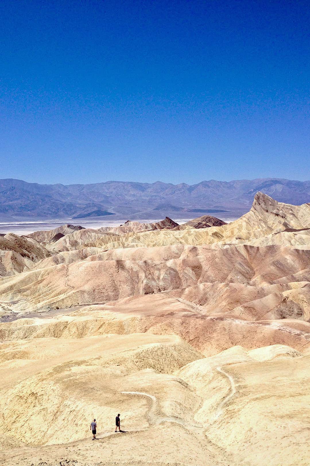
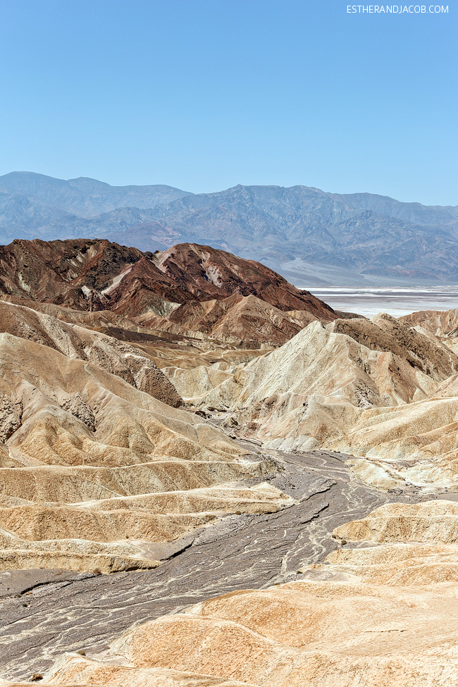
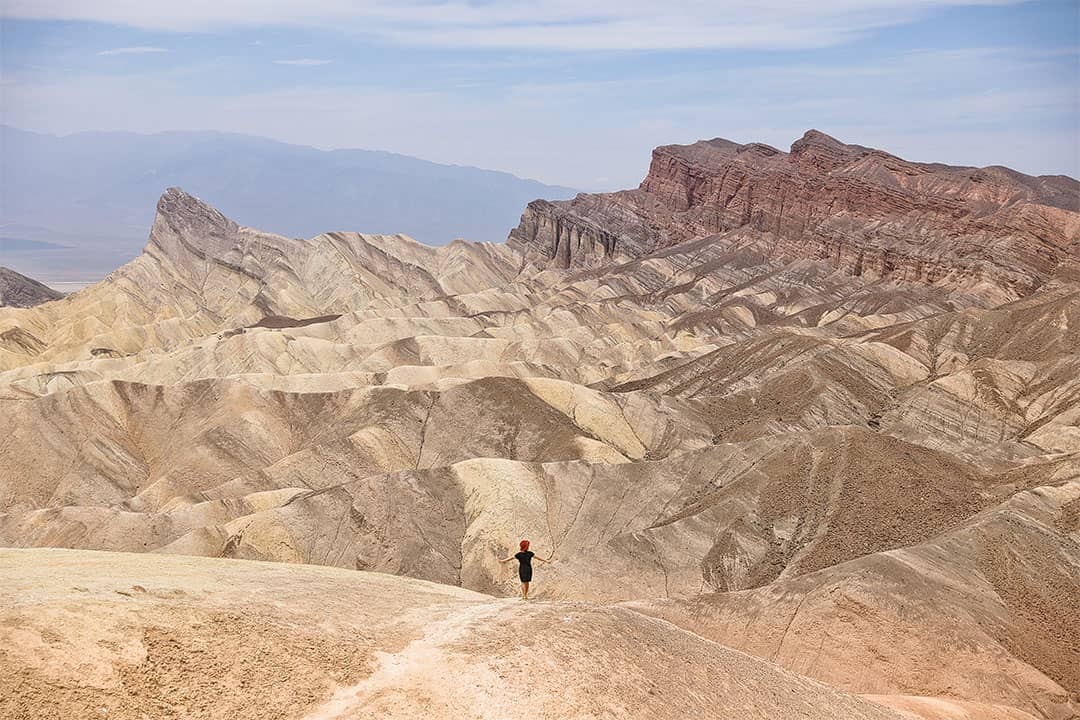
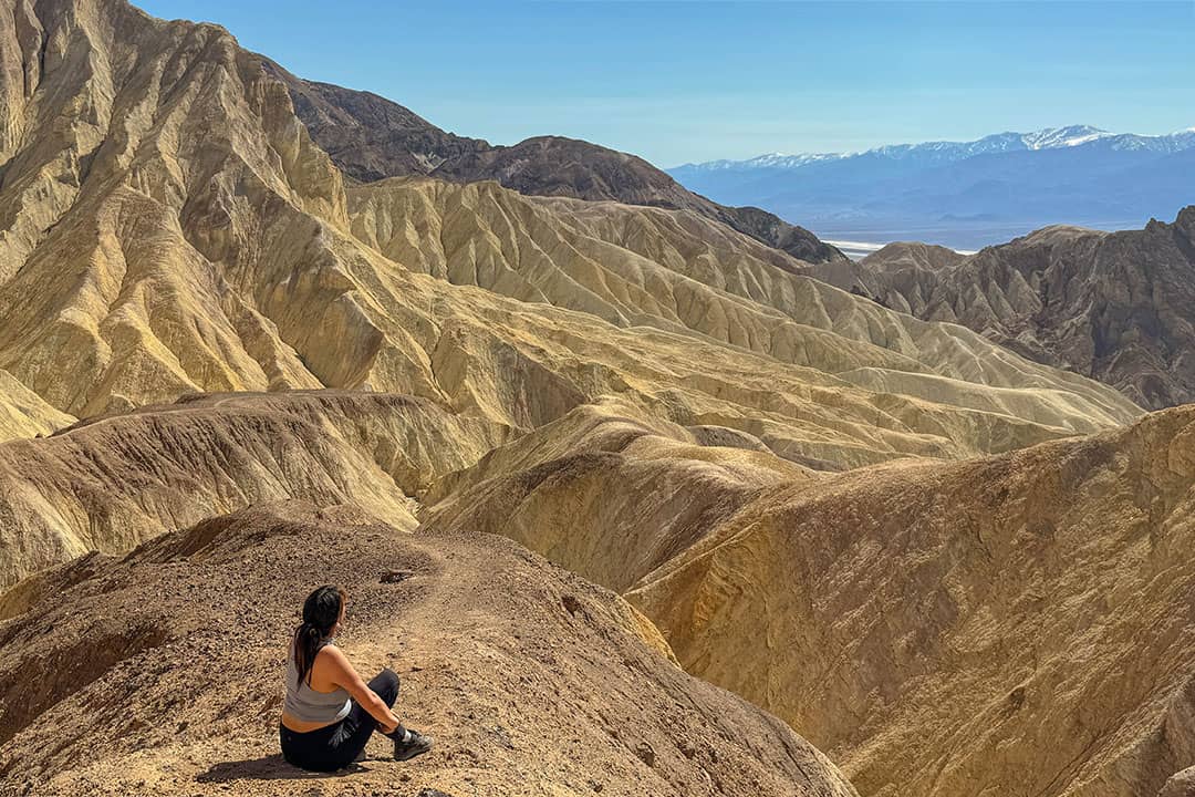
8. Zabriskie Point →
36.420149, -116.812215, map
Originally, we wanted to take sunset photos at Zabriskie Point. Since everything was so far apart in Death Valley, we didn’t make it back in time.
We decided to end our trip at Zabriskie Point instead. It was a beautiful view, and we regretted not being here for sunset. Next time we also want to hike through the badlands from here.
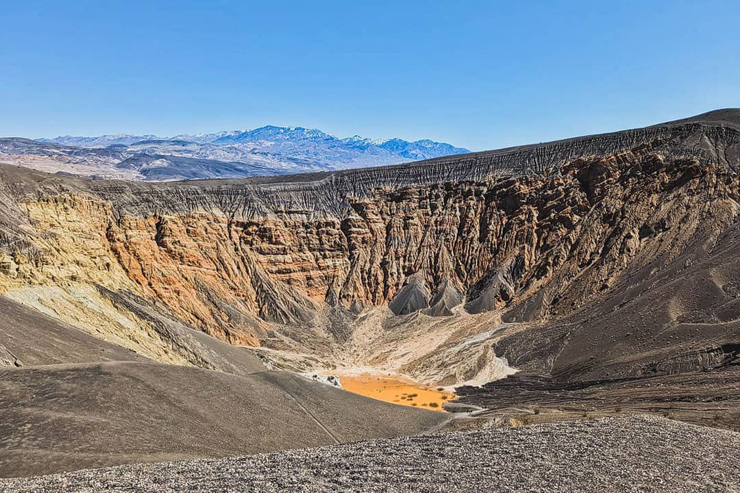
9. Ubehebe Crater
37.0099504,-117.45857, map
Ubehebe Crater is 600 feet deep and a half-mile across. You can appreciate it from the parking lot or hike to the bottom.
Remember that the walk down is easy, but coming back up can be exhausting. There is also a trail around the rim that is roughly 1.5 miles. Along the way, you’ll see other small craters, including Little Hebe.
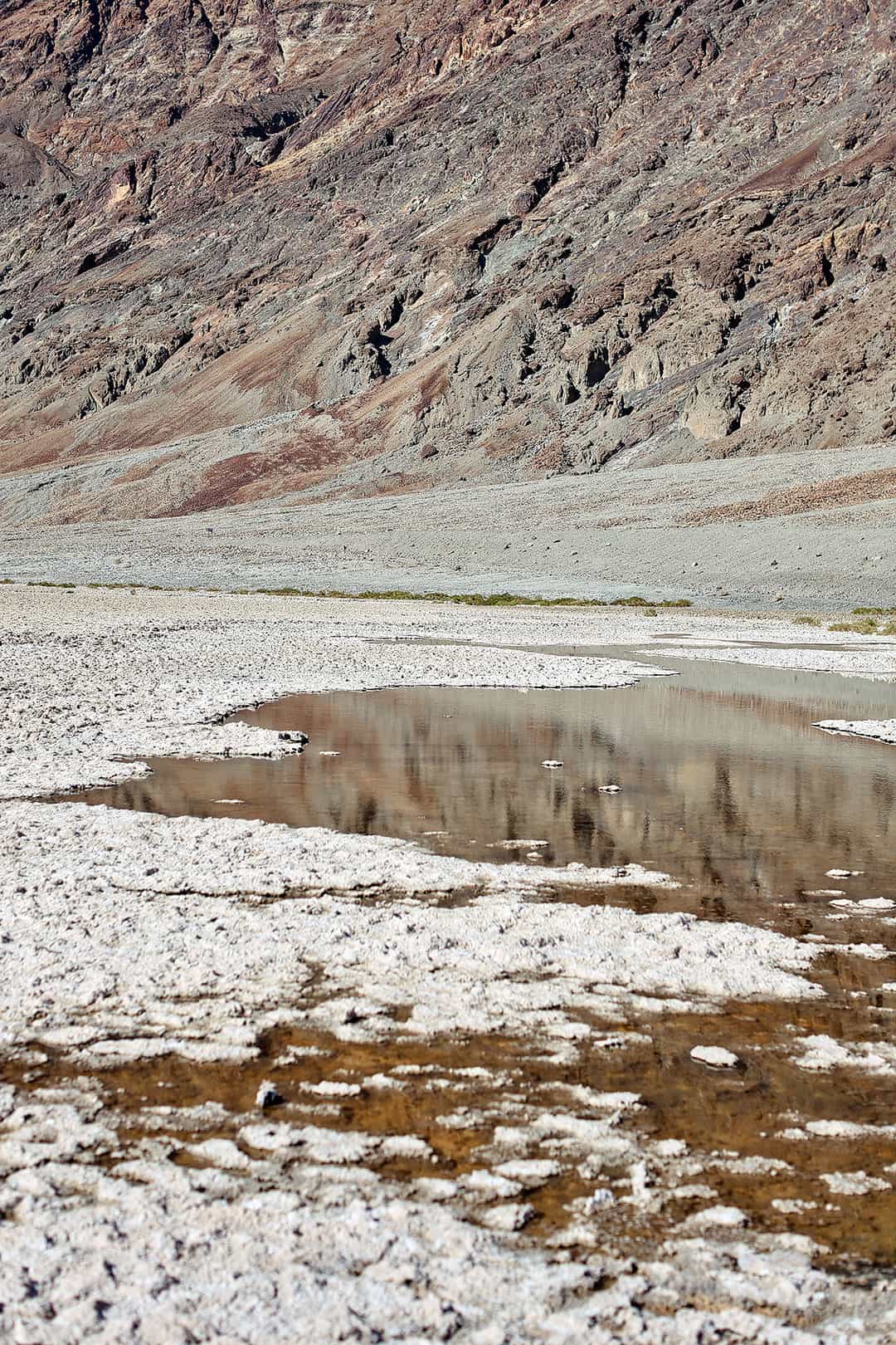
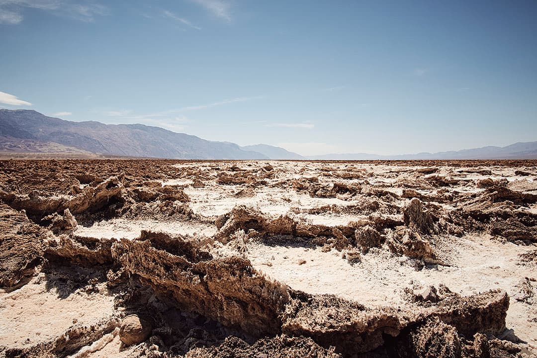
10. Devil’s Golf Course
36.3282724,-116.864449, map
The Devil’s Golf Course got its name from a guidebook in the 1930s that stated: “Only the devil could play golf on such a surface.” Since its elevation is several feet above Badwater, this area has remained dry, and the weather has sculpted the salt into crazy formations.
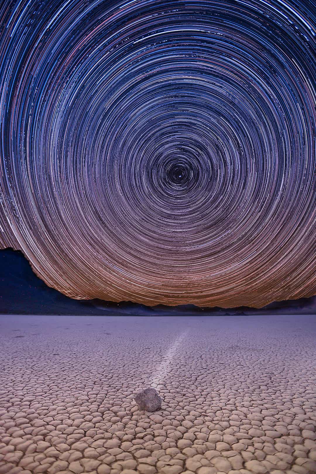
11. The Racetrack Playa
36.681547, -117.562620, map
The Racetrack is a dry lake bed known for its mysterious moving rocks. It’s in a more remote part of Death Valley, and I dreamt about shooting astrophotography here for over twenty years. This past April, I finally had the chance to attempt an eight-hour star trail here.
It took us two hours to drive the 27-mile road to the Racetrack Playa in our Subaru Ascent.
Note: You must have a 4×4 and a high-clearance vehicle. The road is rough with sharp rocks. Rangers warned us people often get flats, towing is expensive, there is no cell signal, and you may not see a single soul. Our friend’s Element made it out alive but got so roughed up that they had to replace many parts. Next time, we may rent a Jeep.
More: 63 National Parks in USA
12. Golden Canyon
36.4213541,-116.8552173, map
Golden Canyon Trail is one of the most popular hikes in Death Valley. The 3-mile roundtrip hike takes you through large canyons to the Red Cathedral at the end.
Star Wars fans may also recognize the mouth of the canyon as “Jawa Canyon” from Star Wars Episode IV: A New Hope. They shot several other scenes in the canyon, too.
If you’re not into hiking, you can get similar views at Zabriskie Point for way less work, but if you want to feel accomplished and work for a view, this is one of the few official hikes in the park. The end feels a little scrambly.
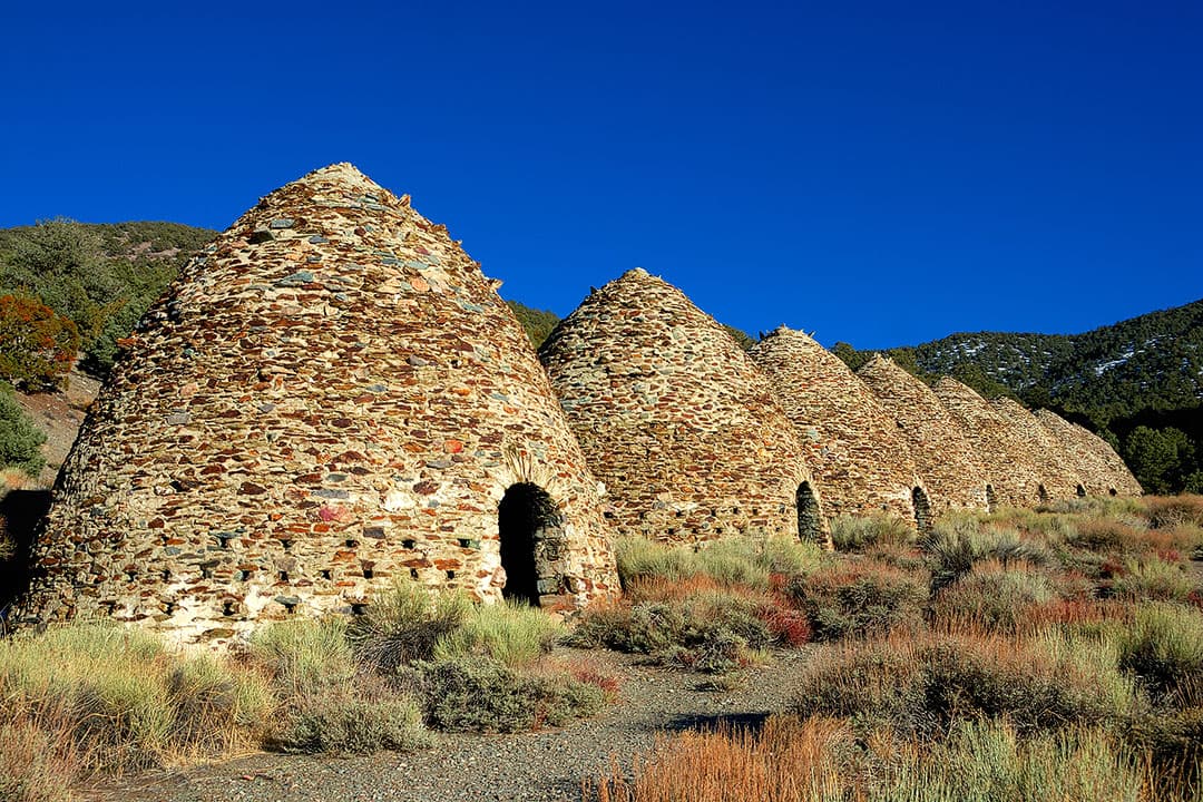
13. Wildrose Charcoal Kilns
Ten beehive-shaped kilns stand 25 feet high, giving you a glimpse into history. Completed in 1877, these kilns were used by silver miners. We saw similar kilns in Nevada during our road trip through the state.
More: Nevada Road Trip – Best Places to Visit in Nevada
14. Salt Creek Interpretive Trail
36.5915665,-116.9955217, map
This is an easy 0.5-mile hike along a wooden boardwalk. It’s open year-round, and if you visit between November and May, you’ll find water flowing. Between February and April, you might see Salt Creek Pupfish spawning too.
Pro Tip: If you’re looking to get away from the crowds, there’s a sandy footpath at the furthest point of the boardwalk.
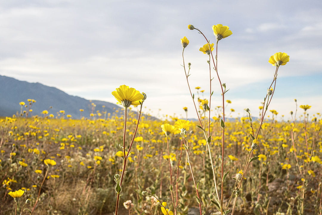
15. See the Superbloom
36.5915665,-116.9955217, map
Spring is one of the most popular seasons to visit Death Valley because of the weather but mostly because you might see the amazing wildflowers blooming in the park.
The conditions have to be just right, but when they are, the superbloom is spectacular. Check this page for the latest updates.
Pro Tip: Keep in mind that the timing of the superbloom is different at higher elevations.
More: 11 Beautiful California Flower Fields You Must Visit
Death Valley Map to Help You Get Around
More Things to Do in Death Valley National Park
- Eureka Dunes – more remote but cleaner dunes than Mesquite since it has so many visitors.
- Father Crowley Point
- Keane Wonder Mine
- Mosaic Canyon
- Rainbow Canyon
- Twenty Mule Team Canyon Drive
- Wildlife – Find desert kit foxes at Mesquite Flat Sand Dunes
Death Valley Hikes from Easy to Difficult
All the hikes are out and back, and mileage and time needed are round trips unless specified as a loop or point-to-point hike.
- Harmony Borax Works (0.4 mi loop, 50 ft △, 30 min, easy)
- Salt Creek Interpretive Trail (0.9 mi, 26 ft △, 30 min, easy)
- Natural Bridge (1 mi, 86 ft △, 45 min, easy)
- Badwater Salt Flat (1 mi, 0 ft △, easy)
- Mesquite Flat Sand Dunes (2 mi, 185 ft △, 1.5 hr, moderate)
- Ubehebe Crater Loop (1.5 mi loop, 500 ft △, 1 hr, moderate) – has parts that are exposed that might be difficult for those afraid of heights.
- Darwin Falls (2 mi, 450 ft △, 1.5-2 hr, moderate)
- Badlands Loop (2.7 mi loop, 300 ft △, moderate)
- Golden Canyon (3 mi, 574 ft △, moderate)
- Desolation Canyon (3.6 mi, 600 ft △, 2.5 hr, moderate)
- Mosaic Canyon (4 mi, 1200 ft △, 2.5-3 hr, moderate)
- Willow Canyon (4.2 mi, 776 ft △, 2.5 hr, moderate)
- Gower Gulch Loop (4.3 mi loop, 715 ft △, moderate)
- Sidewalker Canyon (5 mi, 1580 ft △, 6 hr, difficult)
- Fall Canyon (6 mi, 2460 ft △, 3.5 hr, moderate-difficult)
- Dante’s Ridge (8 mi, moderate)
- Panamint Dunes (8 mi, 1028 ft △, 4-5 hr, difficult)
- Little Bridge Canyon (7 mi, 1900 ft △, 5 hr, difficult)
- Corkscrew Peak (7 mi, 3093 ft, difficult)
- Wildrose Peak (8.4 mi, 2200 ft △, 6 hr, difficult)
- Telescope Peak (14 mi, 3000 ft △, 7 hr, difficult)
What to Pack
- Boots: We love our waterproof Danner Boots, but since it’s not a hiking-heavy park, we tend to wear any type of shoe. Also, check out our favorite travel shoes here.
- Layers: Layers are essential to shed when it gets hot but layer up when it’s cold. Here are our favorite jackets.
- Socks: Comfortable boots are only helpful with good socks.
- Sun Protection: Just because it’s cloudy doesn’t mean you don’t need SPF.
- Sunglasses protect your eyes from the sun and debris during certain activities.
- Camera: We brought our R5.
- Battery Charger: this beast of a charger charges two phones simultaneously.
- Bug Spray: these have come in so handy. The Bug Bite Thing is also helpful if you use it immediately after a bite.
- Reusable Water Bottle: These are the best travel water bottles we tested on the road.
- Backpack: A day pack is nice when you’re out all day. If you carry camera gear, check our favorite camera backpacks or travel backpacks!
- Hiking Poles: If you plan on doing longer hikes, pack your trekking poles!
- Want to know what to wear to the airport? These are our ideal airport outfits.
- Carry on essentials to improve your next flight.
Where to Stay
Camping in Death Valley National Park
There are nine campgrounds in Death Valley. During the summer (May to September), only a few are open since it’s so hot. All sites during the summer are first-come, first-serve so it gets really busy during holiday weekends.
From October to April, it is rare that all campgrounds fill up. All sites are first-come, first-serve except for Furnace Creek Campground.
Here is a list of campgrounds:
- Furnace Creek (open year-round) – 136 sites, 18 hookups
- Sunset (Oct-May) – 270 sites
- Texas Springs (Oct-May) – 92 sites
- Stovepipe Wells (Oct-May) – 190 sites
- Mesquite Spring (open year-round) – 30 sites
- Emigrant (open year-round) – 10 tent-only sites
- Wildrose (open year-round) – 23 sites
- Thorndike (open year-round) – 6 sites (requires high clearance)
- Mahogany Flat (open year-round) – 10 sites (requires high clearance)
Read all camping rules and regulations here.
What’s Nearby
Distances are from the Furnace Creek Visitor Center.
- Amargosa Opera House (30.6 mi SE, 35 min, map)
- Rhyolite Ghost Town (37.7 mi N, 50 min, map)
- Ash Meadows National Wildlife Refuge (42.8 mi E, 50 min, map)
- Tecopa Hot Springs (65.3 mi SE, 1 h 15 min, map)
- China Ranch Date Farm (75 mi SE, 1 h 30 min, map)
- Dumont Dunes (83.2 mi SE, 1 h 30 min, map)
- Trona Pinnacles (111 mi, 2 h 20 min, map)
- Manzanar National Historic Site (115 mi W, 2 h 10 min, map)
Planning Checklist
- Get comprehensive insurance for your trip.
- Download these helpful language apps.
- Find a great deal on Death Valley hotels.
- Arrange a rental car for your trip.
- Book a tour for your visit.
- Get airport lounge access.
- Buy a travel charger to keep your devices charged.
- Get a new backpack for your trip.
- Buy a Death Valley Hiking Guide.
- Pack the appropriate shoes for your trip.
- Don’t forget your in-flight essentials.
What’s the hottest temperature you’ve ever experienced? Can you think of any other fun things to do in Death Valley National Park that we missed?
SEE MORE NATIONAL PARK GUIDES
⟡⟡⟡⟡⟡
“Discovery consists not of seeking new lands but in seeing with new eyes” – M. Proust

Esther + Jacob
Esther and Jacob are the founders of Local Adventurer, one of the top 5 travel blogs in the US. They believe that adventure can be found near and far and hope to inspire others to explore locally. They explore a new city in depth every year and currently base themselves in Las Vegas.
Follow on Instagram (E + J), YouTube, TikTok, and Pinterest.