
Looking for things to do in Sequoia National Park and Kings Canyon? Don’t miss these spots!
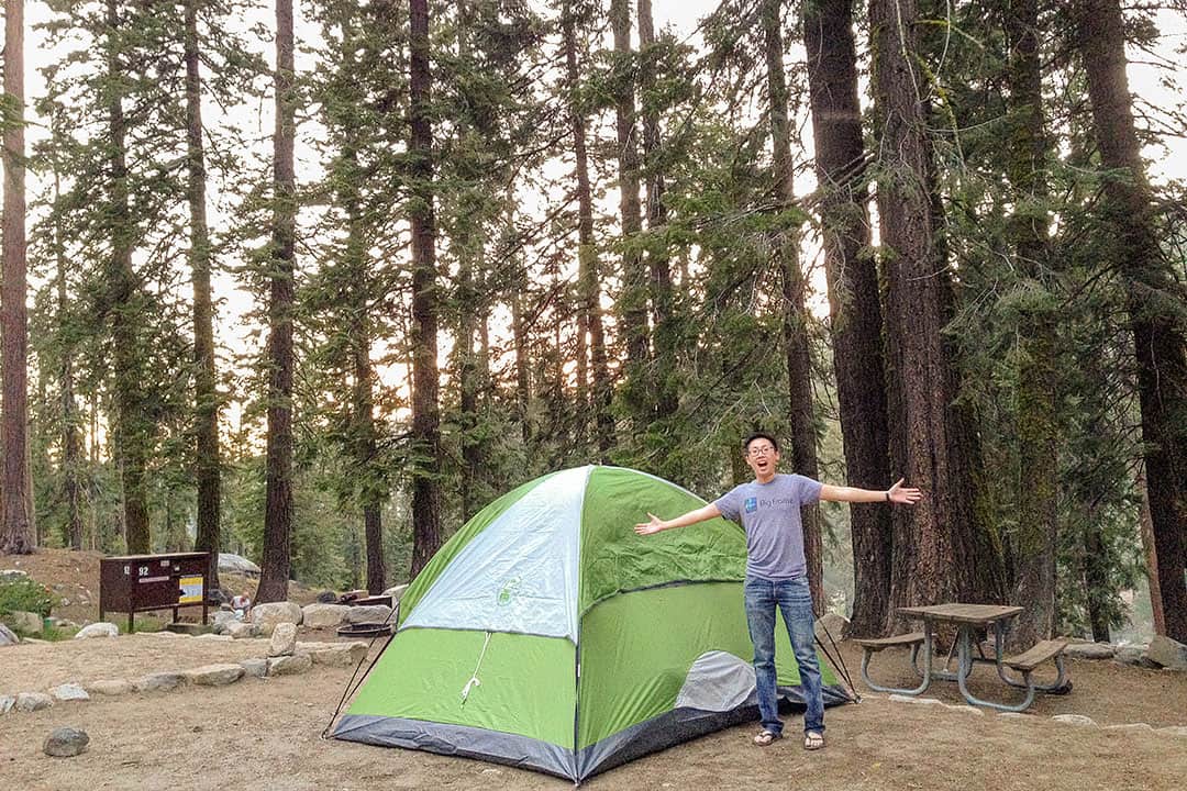
Sequoia National Park and Kings Canyon National Park are home to natural giants. These two parks are connected, which makes it easy to see two National Parks on one trip! Most people end up doing both. During our visit, we camped one night in Sequoia and one night in Kings Canyon.
This post may contain affiliate links, where we receive a small commission on sales of the products that are linked at no additional cost to you. All opinions are always our own. Read our full disclosure for more info. Thank you for supporting the brands that make Local Adventurer possible.
Last Updated: December 29, 2025
What You Need to Know Before You Go
- Pick up an America the Beautiful National Park Pass to save money on multiple park visits.
- The five visitor service areas are Grant Grove, Giant Forest, Foothills, Cedar Grove, and Mineral King. Cedar Grove and Mineral King are open from late spring to early fall, while the others are open year-round.
- Cell service is limited in the park. You can find free public WiFi at Kings Canyon Visitor Center or Foothills Visitor Center.
- Bring layers. Elevation and weather vary throughout the park. While you may find flowers blooming in the foothills, there can be snow at higher elevations, which limits access to certain parts of the park. Check the park’s website to see what the current conditions are.
- You must have tire chains in certain parts of the park during the cooler seasons.
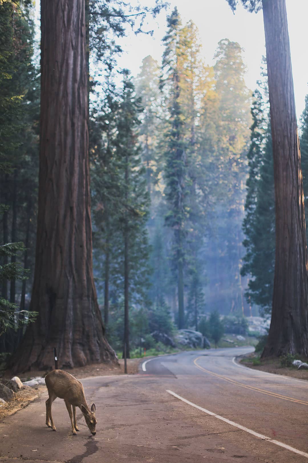
- Wildlife – There are black bears in the park, and they can break into cars that contain food. Learn how to properly store food here.
- Free shuttles run through the Giant Forest and Lodgepole areas during the summer.
- Check yourself for ticks after. Ticks are common in the foothill and Kings Canyon grasses.
- Poison Oak is expected up to 5000 feet in elevation. If you touch any part, wash your skin and clothes immediately.
- Stay inside a large building or vehicle if you see dark clouds or lightning. Do not stand under trees, in shallow caves, or on high points like Moro Rock.
- They recently had some massive wildfires go through the park. Fortunately, none of the significant trees were destroyed, but it did change the landscape quite a bit.
- Alltrails+ is helpful if you’re doing hikes where you need the trail maps offline. I’ve used the free version with the map open before, but sometimes it crashes on me mid-hike.
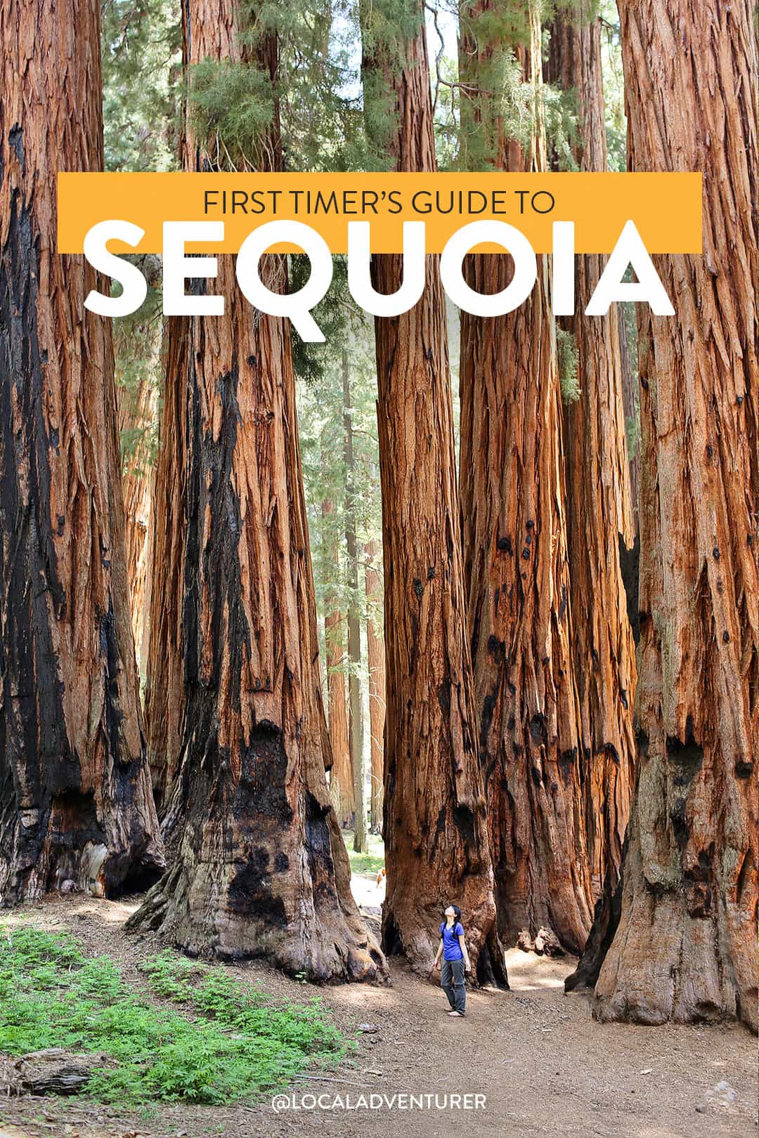
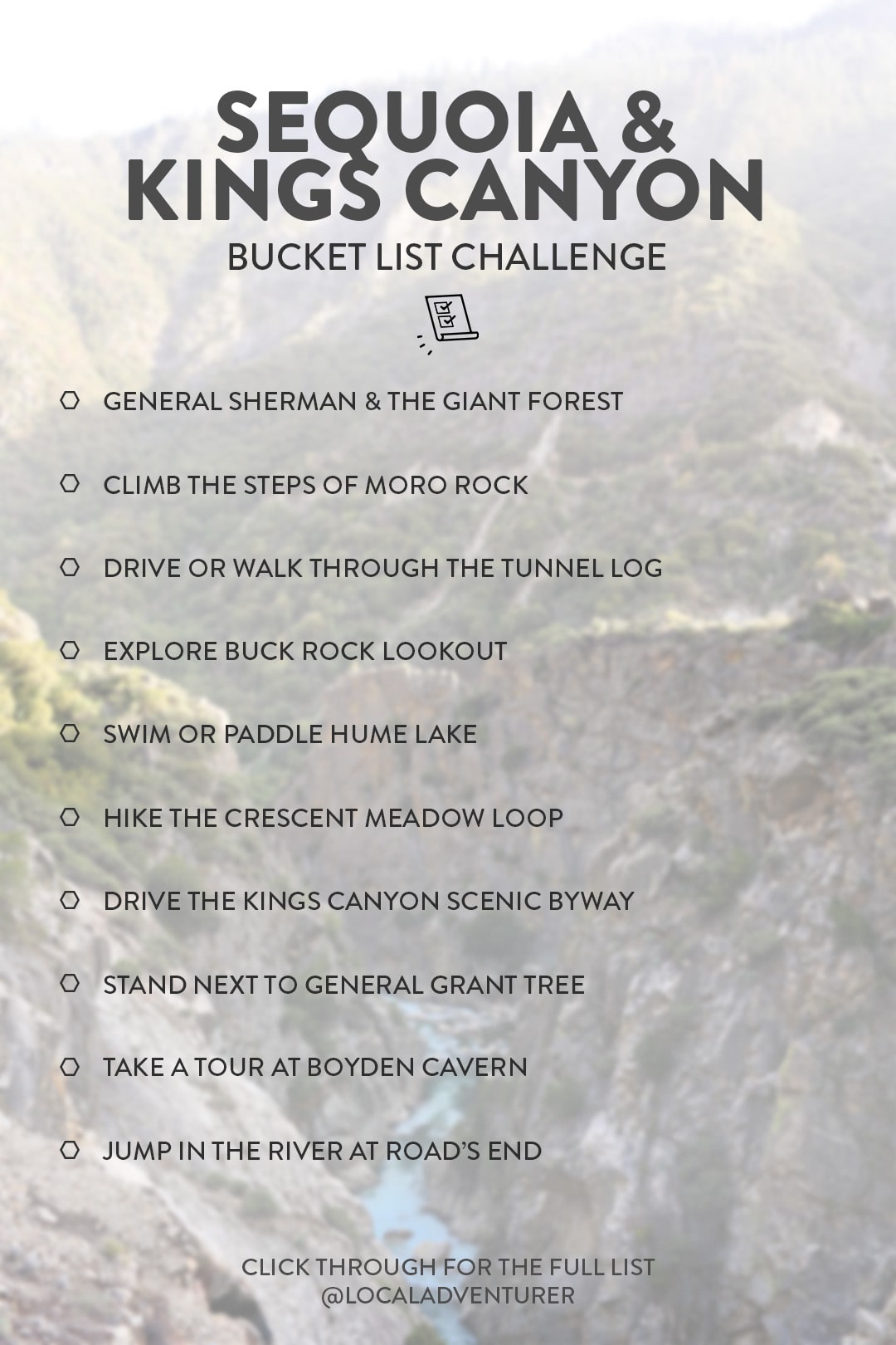
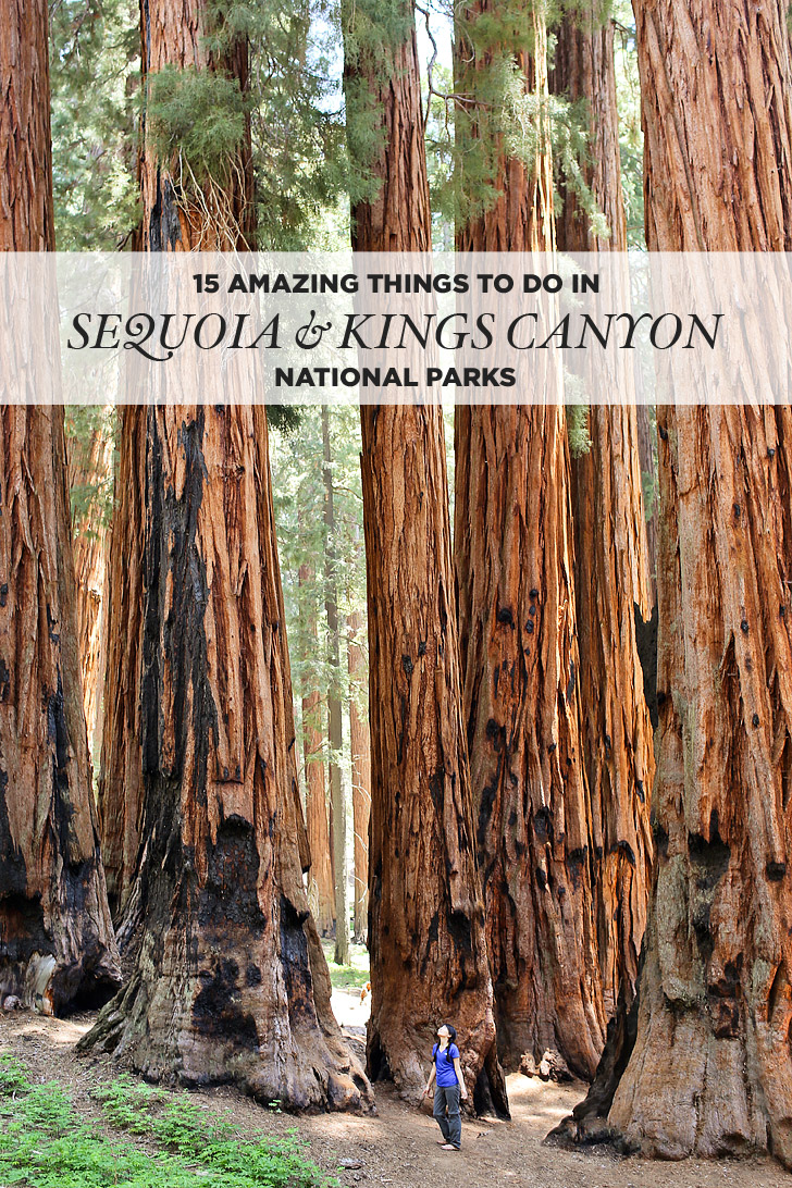
15 Amazing Things to Do in Sequoia National Park + Kings Canyon
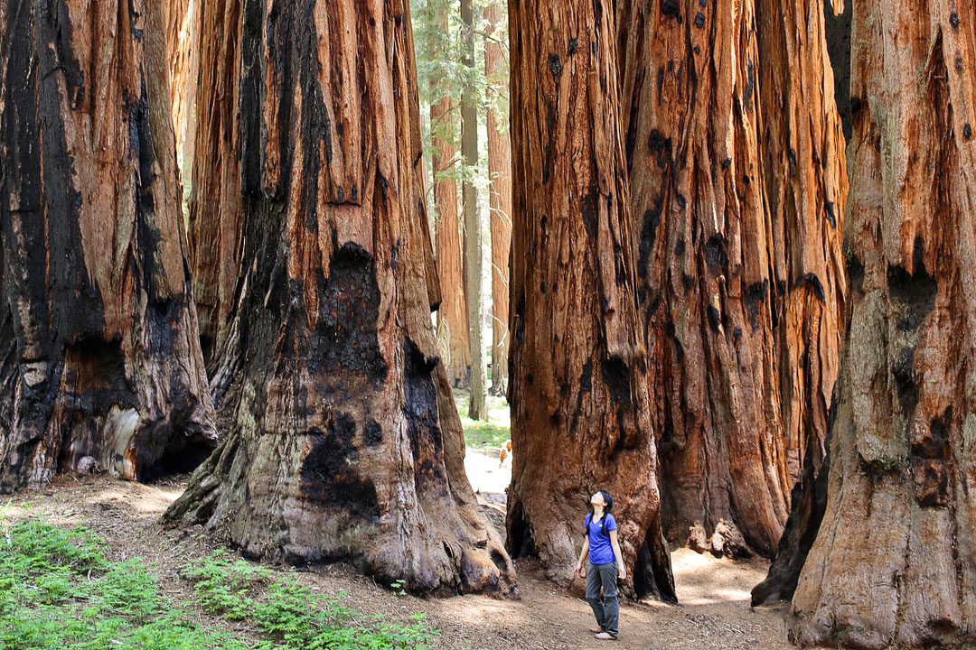
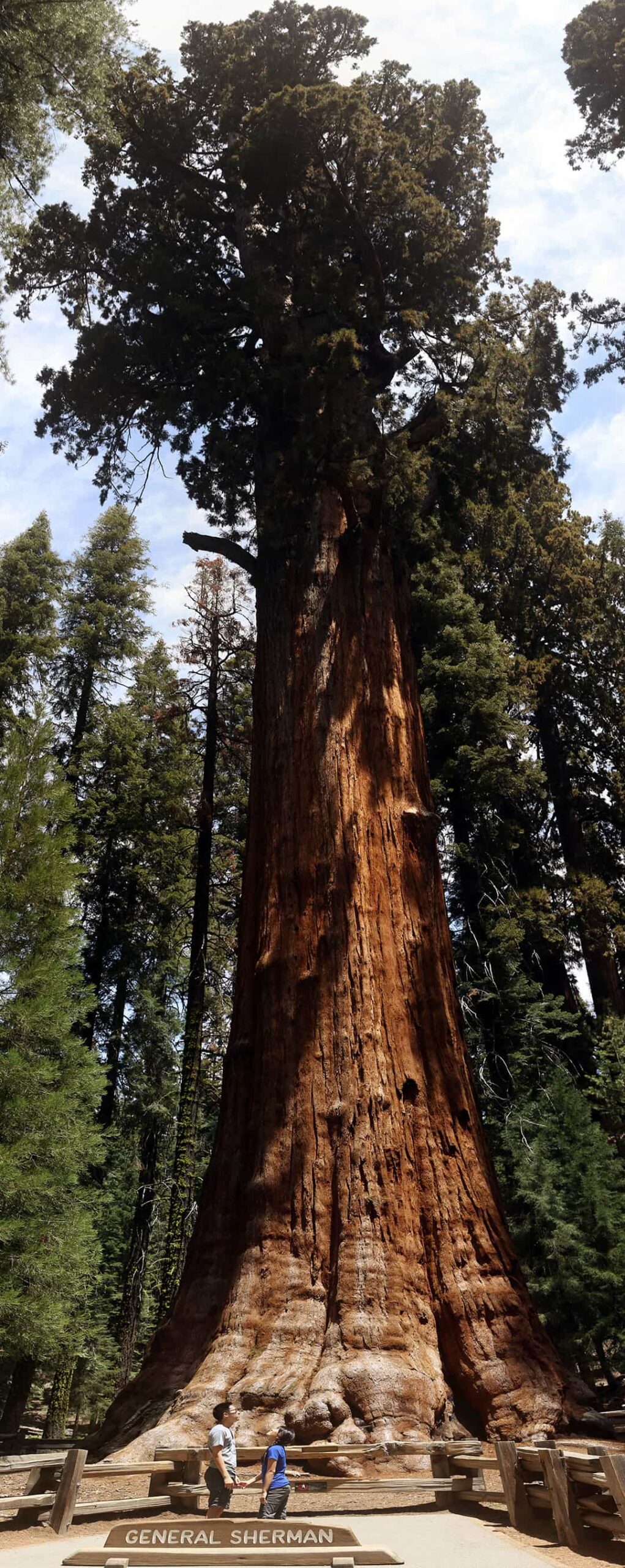
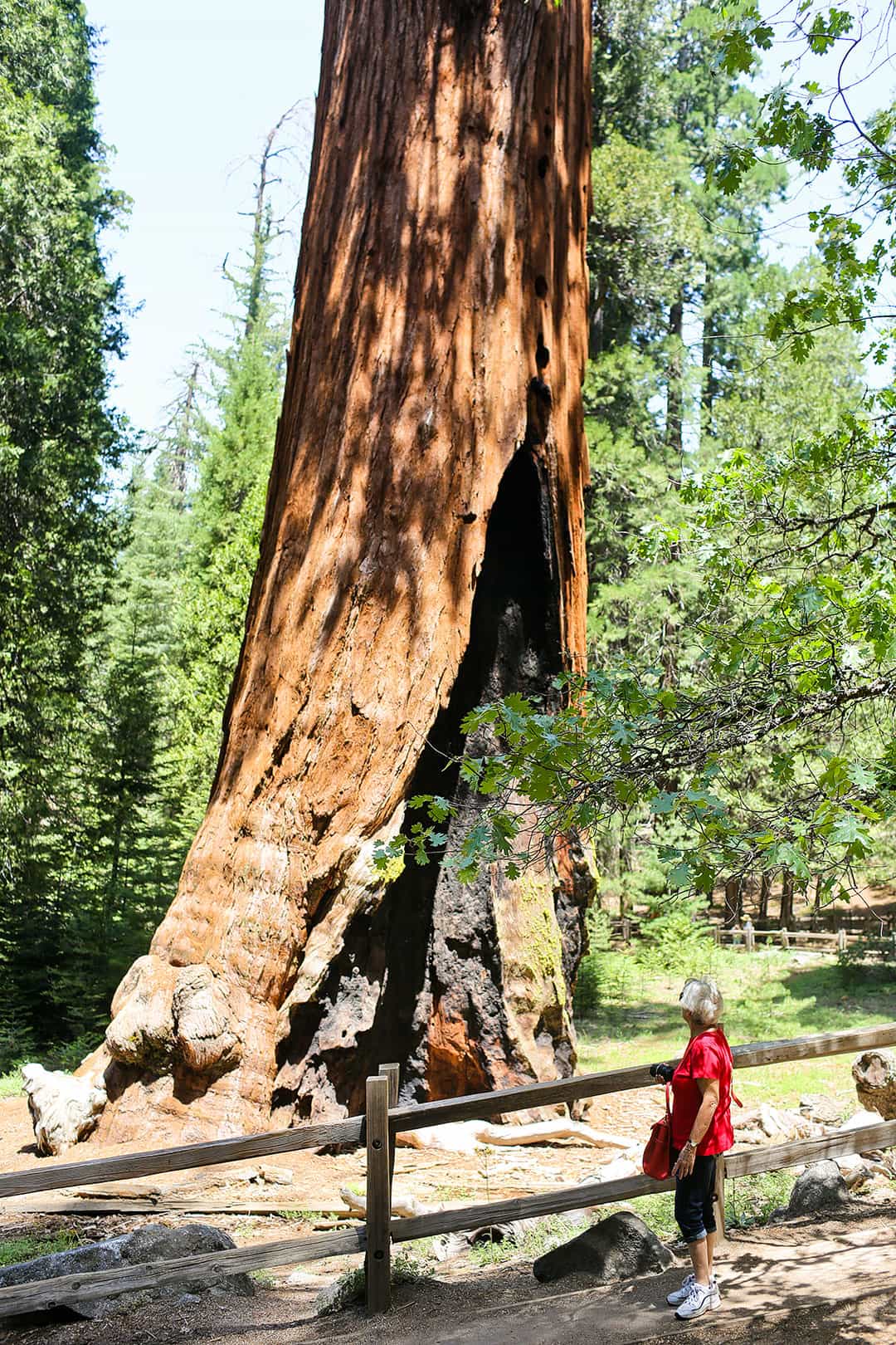
1. General Sherman and the Giant Forest →
36.581705, -118.751431, map
The Giant Forest is precisely like it sounds. When you walk amongst these giant trees, you’ll feel tiny. On this trail, you will find the General Sherman Tree, the largest tree in the world by volume, weighing 1,385 tons!
Also, check out the President Tree (the 3rd largest tree) and the 2-mile Congress Trail that takes you on a pleasant stroll away from the crowds.
See More: 11 Most Beautiful Trees in the World to Put On Your Bucket List
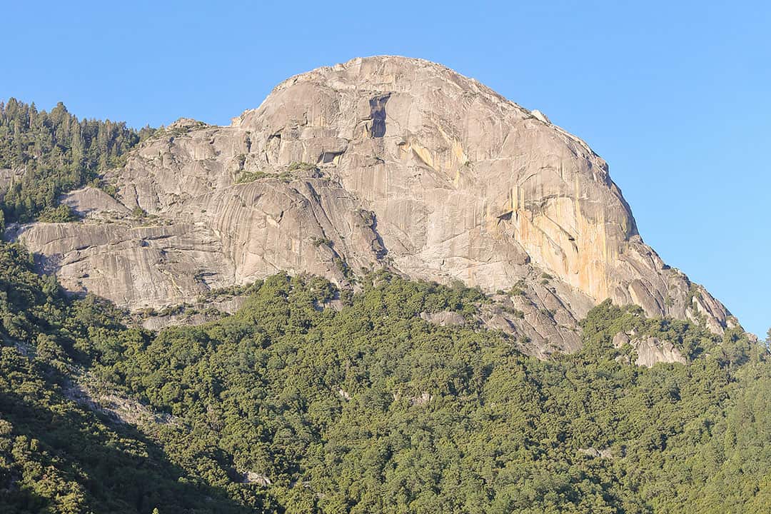
2. Climb the Steps of Moro Rock
Trailhead Coordinates: 36.546869, -118.765593, map
Rising above the Giant Forest, you can climb 400 stone steps to the summit of the granite dome to get some of the park’s best views. Watch as you drive through the park to get views of it from a distance.
3. Mineral King
Coordinates: 36.450084, -118.593040, map
Only open in the summer, this is the only car-accessible backcountry in the park. There are plenty of hikes, and it’s worth the 28-mile windy road trek.
See More: Complete List of National Parks by State
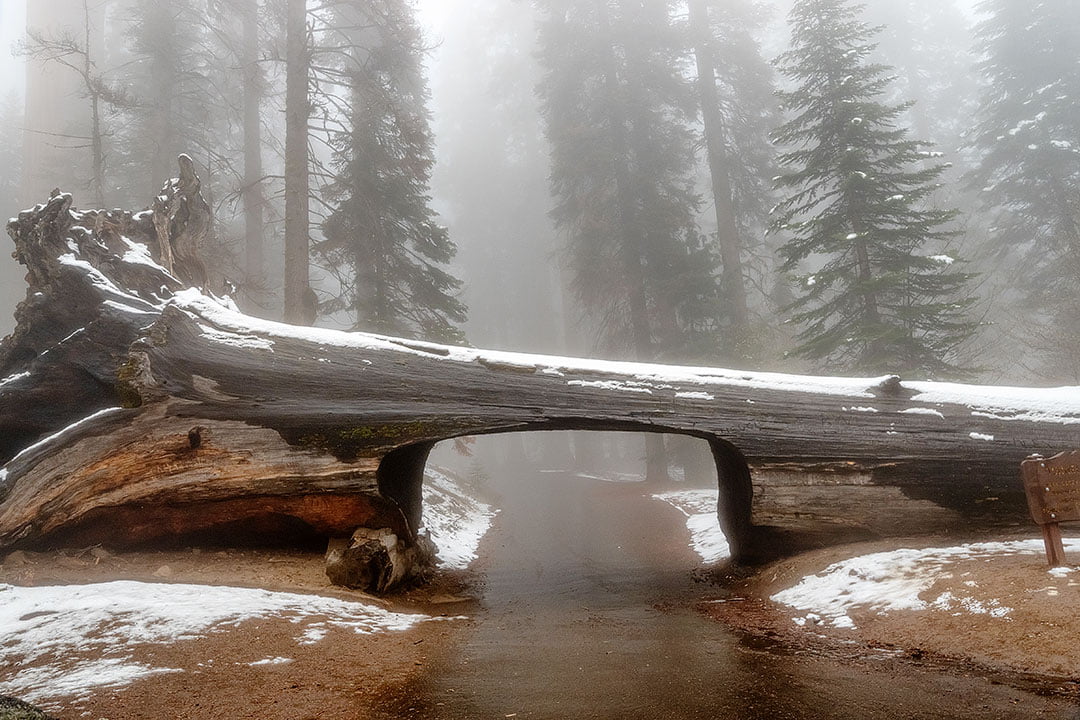
4. Drive or Walk Through the Tunnel Log
36.5525706,-118.7635707, map
This fallen sequoia is the only tree you can drive through in this national park (as long as your vehicle isn’t over 8 feet tall)! Also, make a quick pit stop at Auto Log. You can’t drive over it anymore but can hop out to take photos.
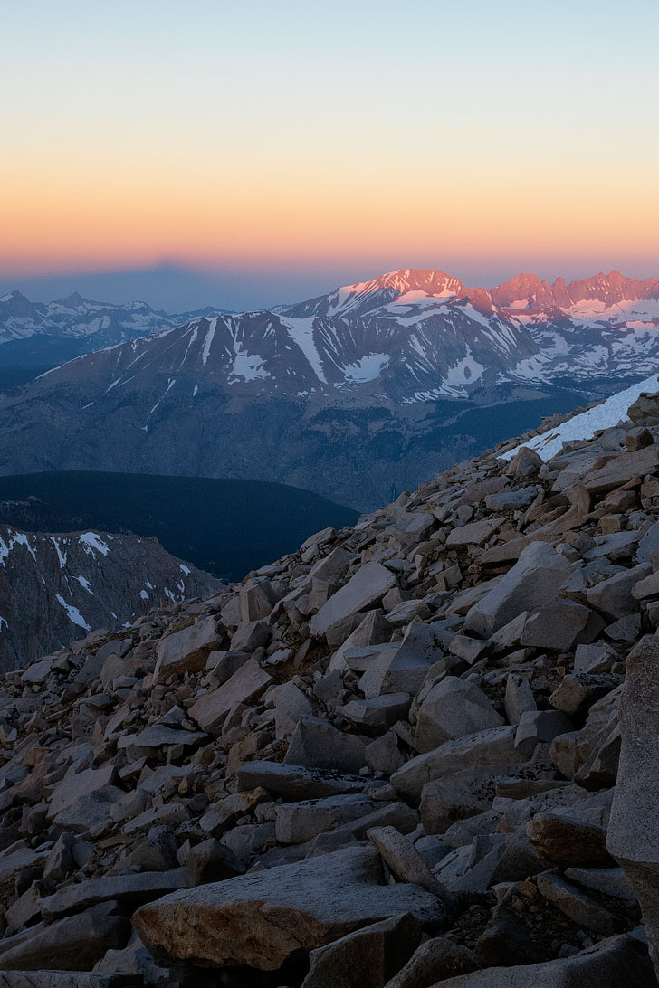
5. Summit Mount Whitney
36.5875618,-118.245369, map
Mt. Whitney is the tallest mountain in the lower 48 states and sits between Sequoia National Park and Inyo National Forest. If you’re looking to climb the mountain, you’ll need to get a permit.
Although there are trail options from the Sequoia National Park side, most people go from Whitney Portal in Inyo National Forest, which is almost 5 hours away. Find more information here.
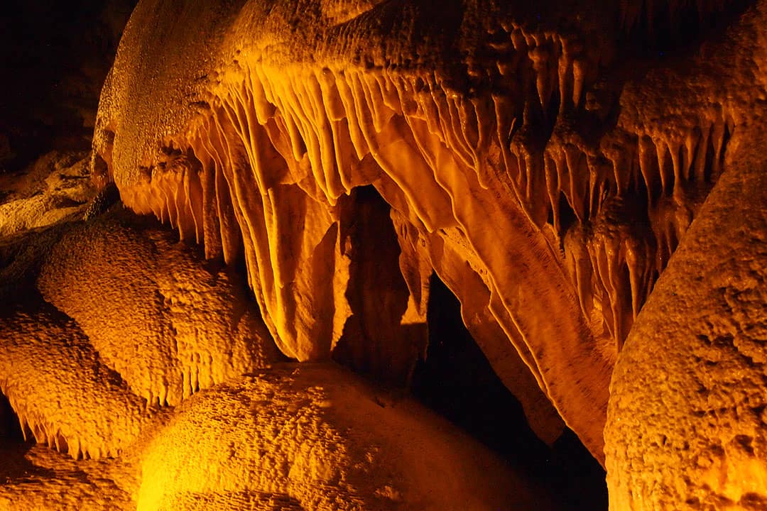
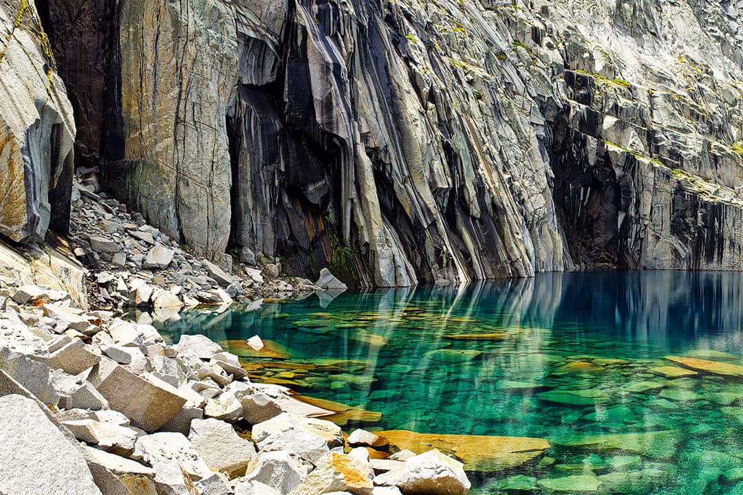
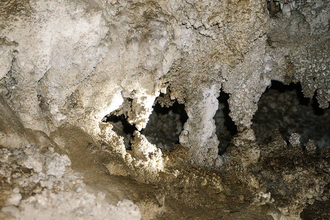
6. Crystal Cave
36.5874504,-118.8325747, map
Purchase tickets for a tour of this beautiful cave at the Foothills Visitor Center or Lodgepole. The cave is only open in the summer but is worth checking out for anyone into stalactites and stalagmites.
Pro Tip: They recommend purchasing tickets online at least two days before and earlier for weekend or holiday tours. If you’re already at the park, you can purchase tickets at visitor centers (not at the cave).
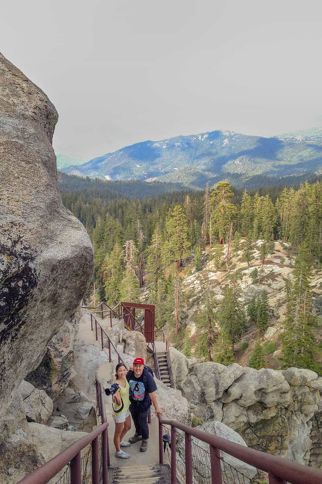
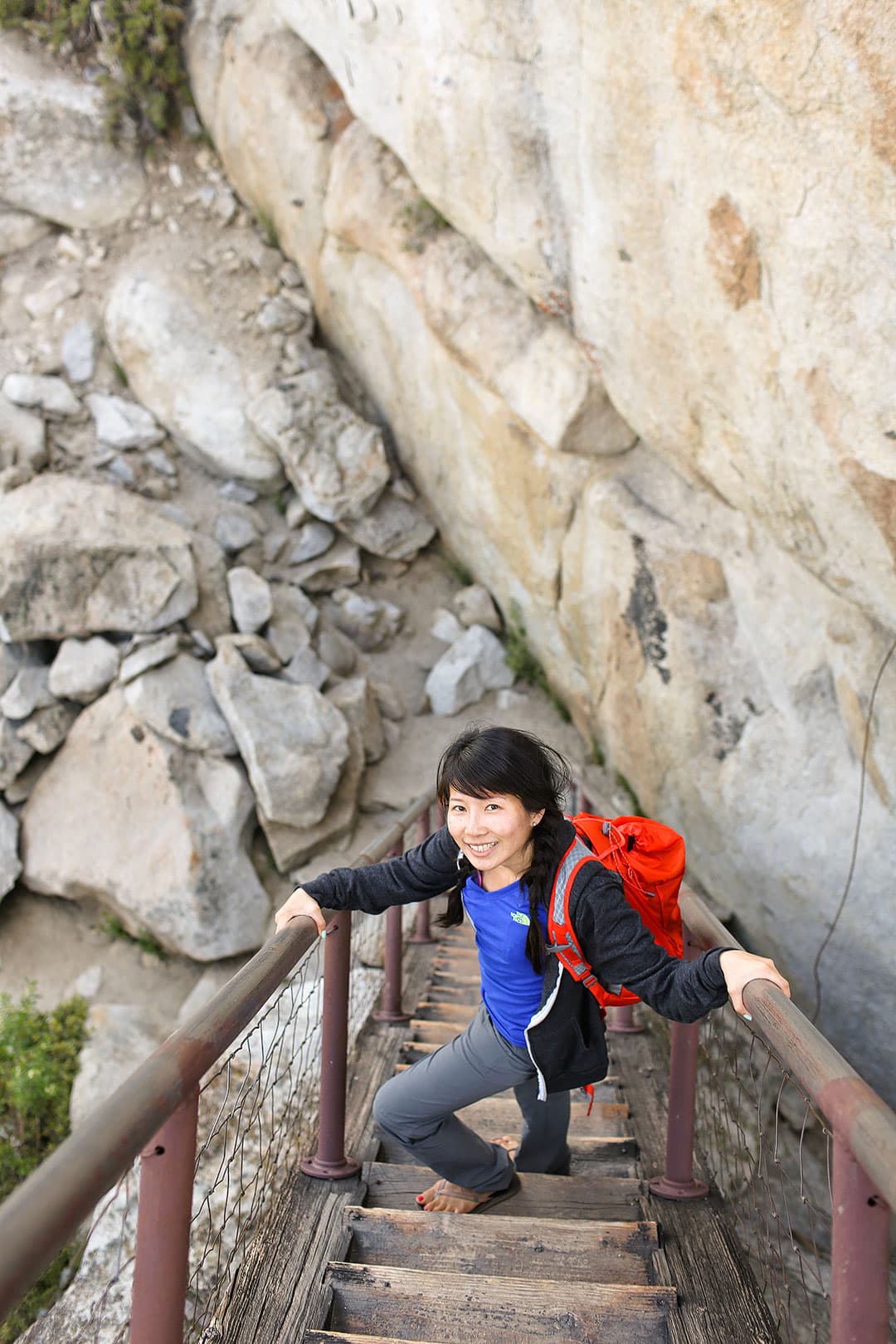
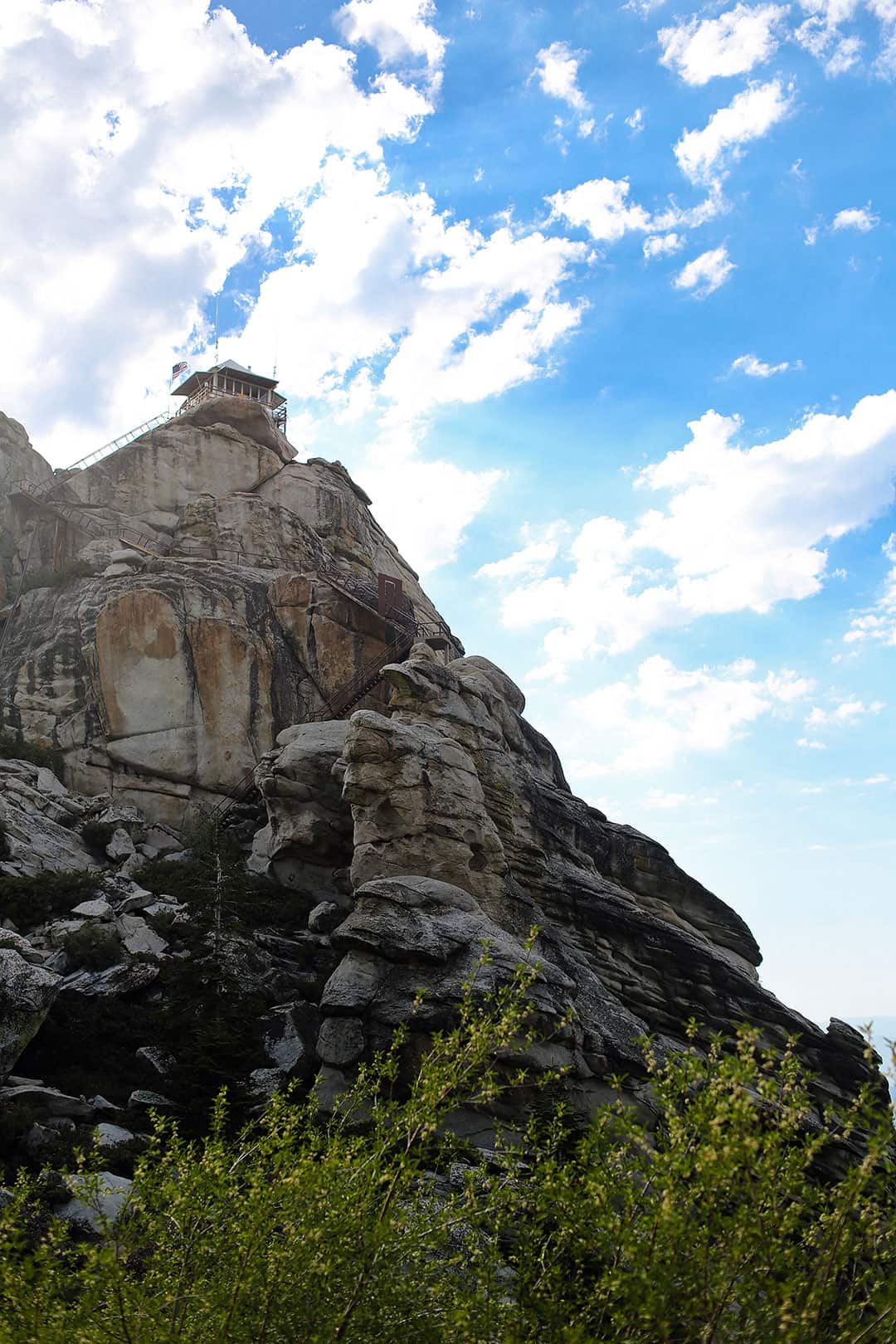
7. Buck Rock Lookout
36.7372813,-118.8628677, map
This fire lookout gives you amazing views of the area. Climb the 172 metal steps and chat with the folks up top.
Note: Hold onto your stuff; it can get windy up there.
8. Hume Lake
36.7907137,-118.9112774, map
This beautiful lake between Grant Grove and Kings Canyon was initially built as a water supply for a flume. Now it’s a recreation area where you can swim or paddleboat.
9. Crescent Meadow Loop
Coordinates: 36.5541654,-118.7705703, map
This treeless meadow seems out of place amidst all the giant sequoias. Here you can take a walk, picnic, or rest and enjoy the views.
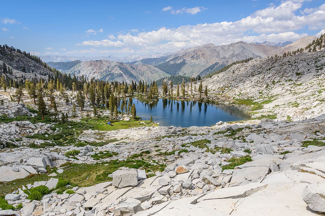
10. High Sierra Trail
Coordinates: 36.5548094,-118.7511753, map
For serious hikers, Sequoia National Park is the start of the High Sierra Trail. If you want to trek to Mount Whitney, the park suggests taking six days (10 miles a day) to enjoy all the views.
See More: 15 Best Day Hikes in the US
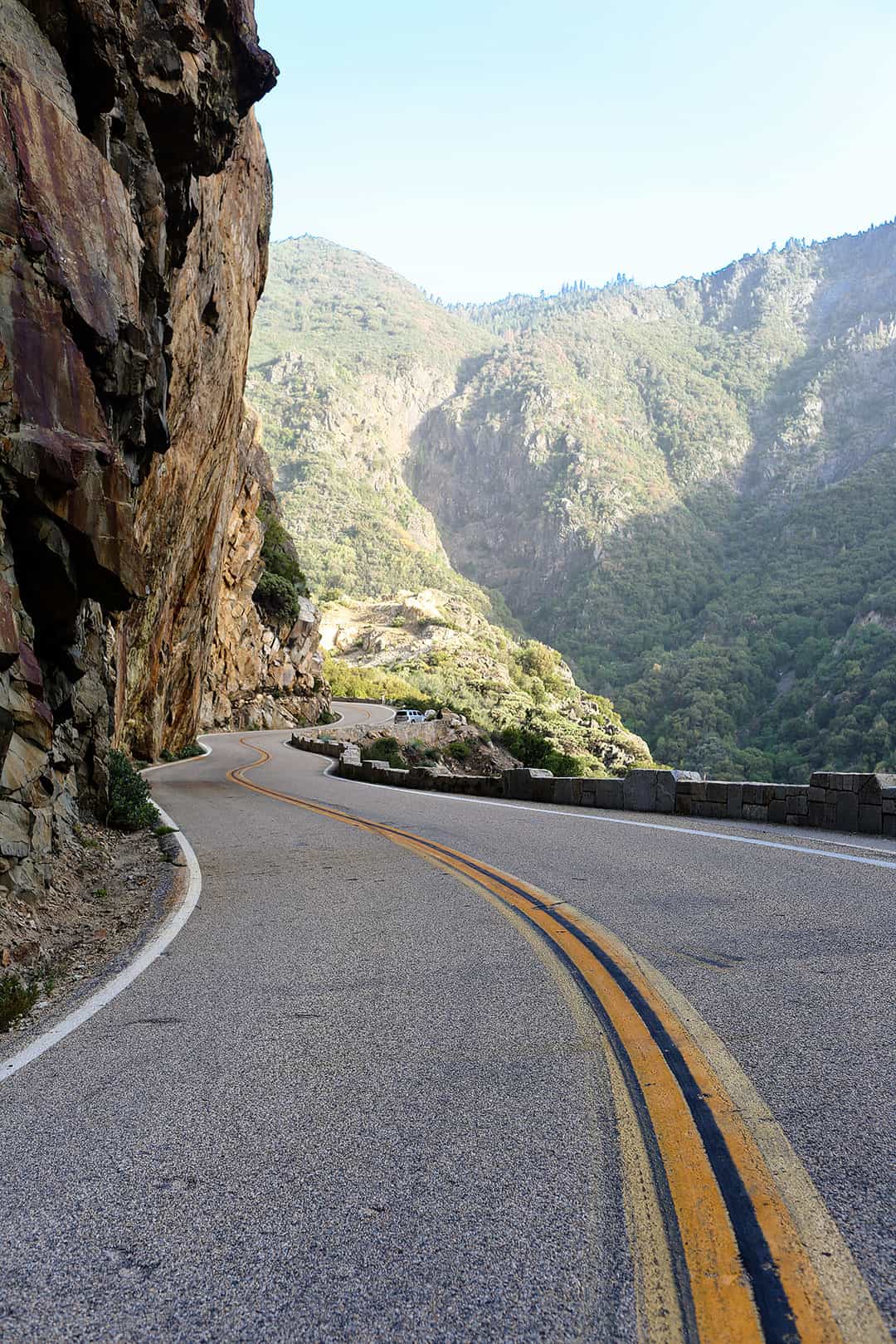
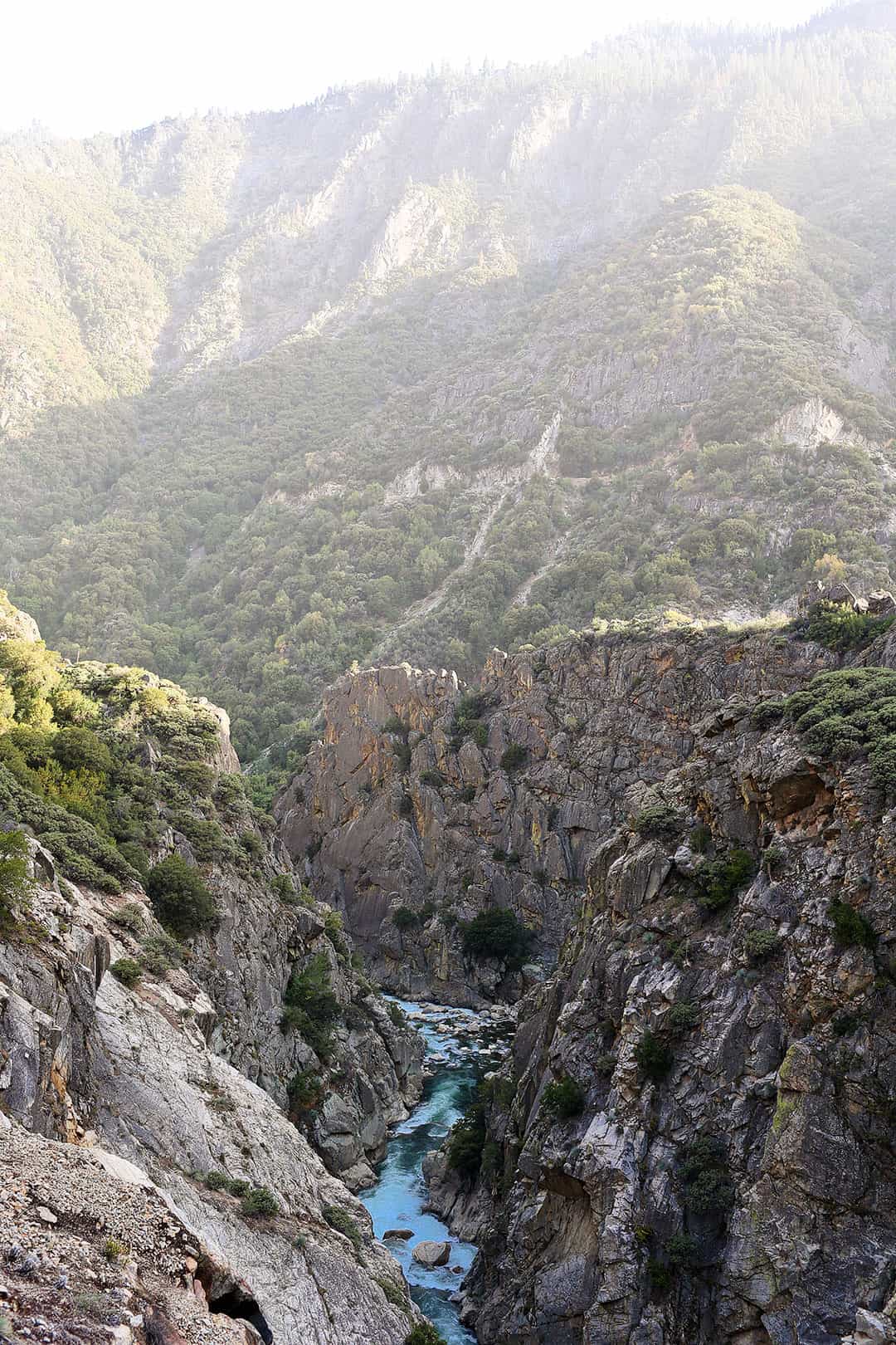
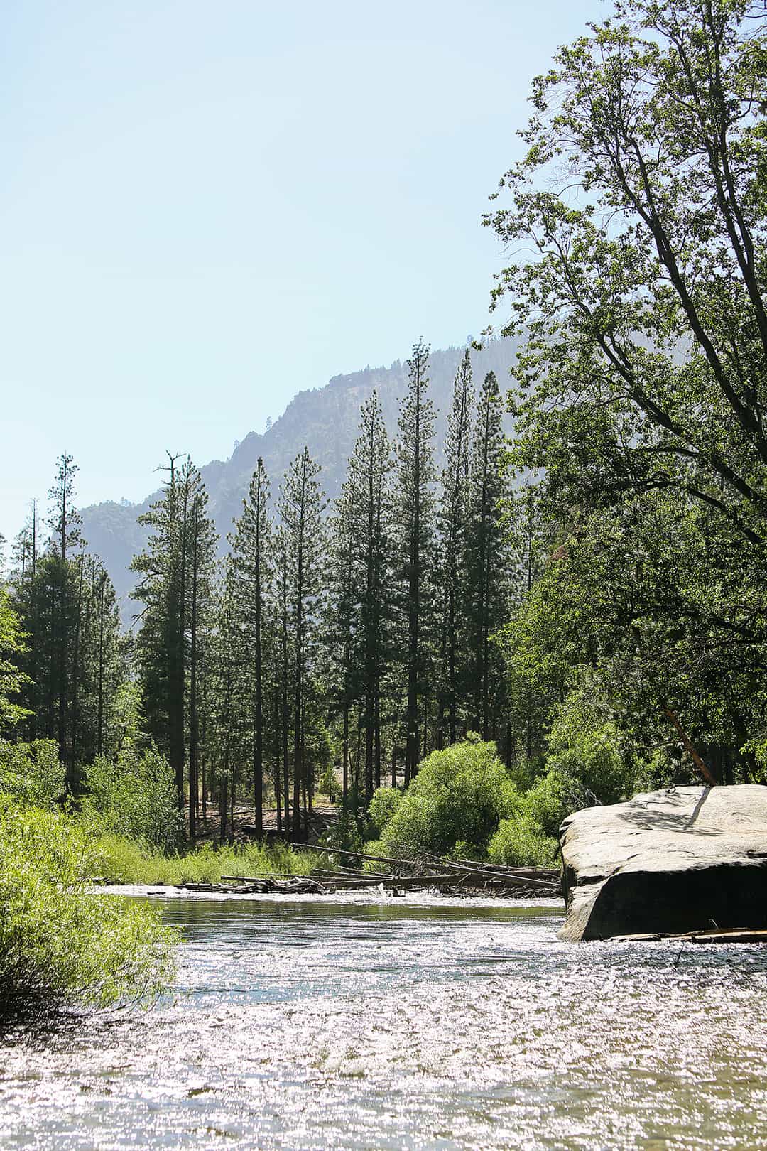
11. Kings Canyon Scenic Byway
Coordinates: 36.7663785,-118.957835, map
This scenic 50-mile drive has gorgeous views of the river and mountain ranges. There are plenty of pit stops.
See More: 21 Epic Road Trips in America
12. General Grant Tree
Coordinates: 36.7482726,-118.9733441, map
The General Grant Tree is the second-largest tree in the world, and it makes its home in Grant Grove. It is also the nation’s official Christmas tree (not to be confused with the National Christmas Tree in DC). There is an easily accessible trail that takes you to see the settler’s cabin and the Fallen Giant as well.
13. Boyden Cavern
36.8157115,-118.8203523, map
This is a privately-owned cavern but offers tours that leave every hour. They also have canyoneering and rappelling tours if you want a more adventurous activity.
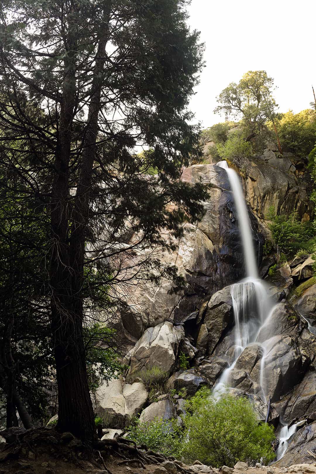
14. Grizzly Falls
Coordinates: 36.8031164,-118.7459739, map
This 75-foot waterfall is a short hike off the Kings Canyon Scenic Byway. The best time to visit is spring when it’s at its full force.
15. Road’s End
Coordinates: 36.8013543,-118.5951105, map
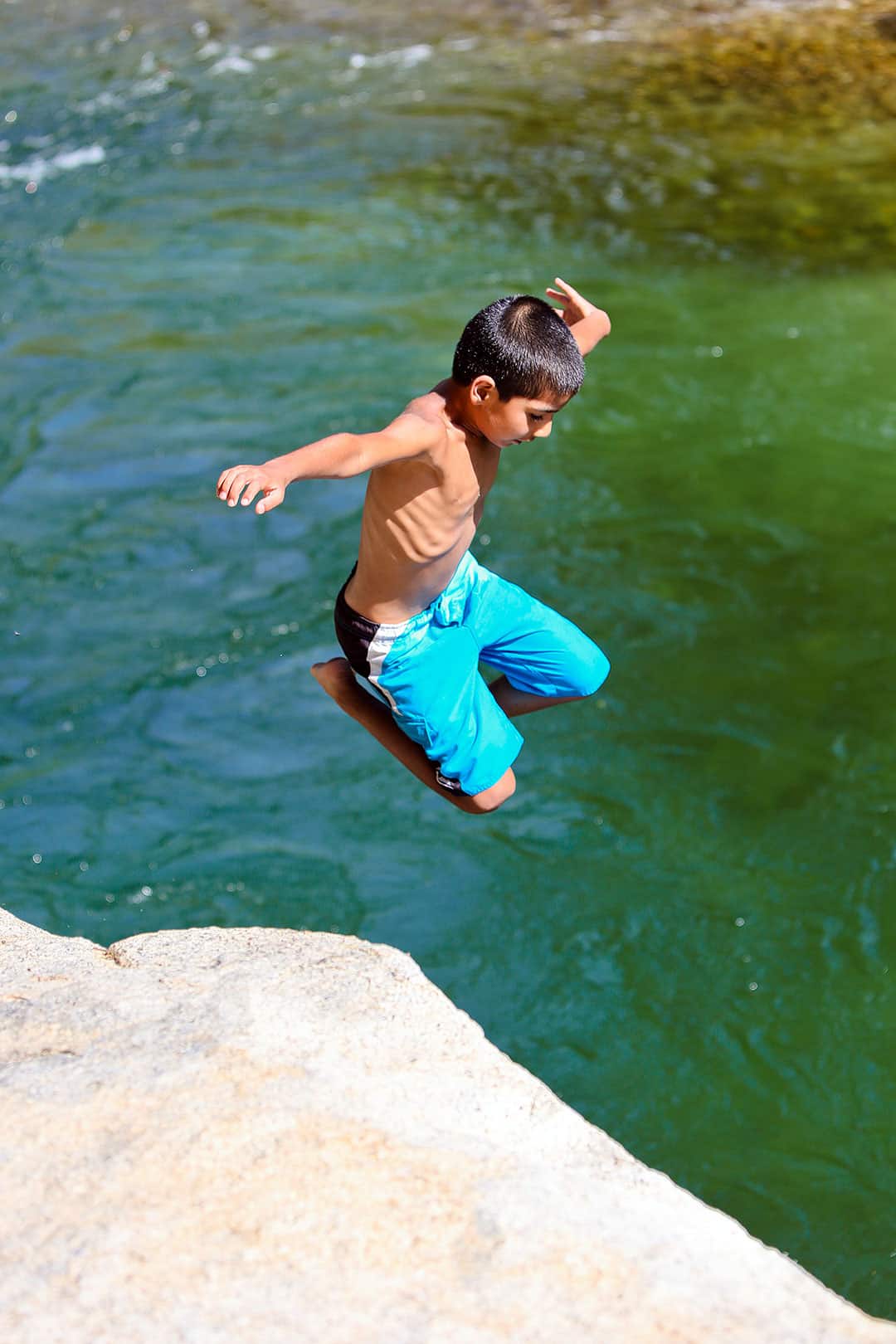
This is the starting point if you’re looking to cross the Sierra and the endpoint if you’re doing the scenic bypass. You can also enjoy the river, and there’s a spot where you can jump in.
Sequoia National Park Map to Help You Get Around
More Things to DO in Sequoia NP + Kings Canyon NP
- Generals Highway
- Junction View, Sequoia
- Muir Grove, Sequoia
- Grant Grove Tree, Kings Canyon
- Zumwalt Meadow, Kings Canyon
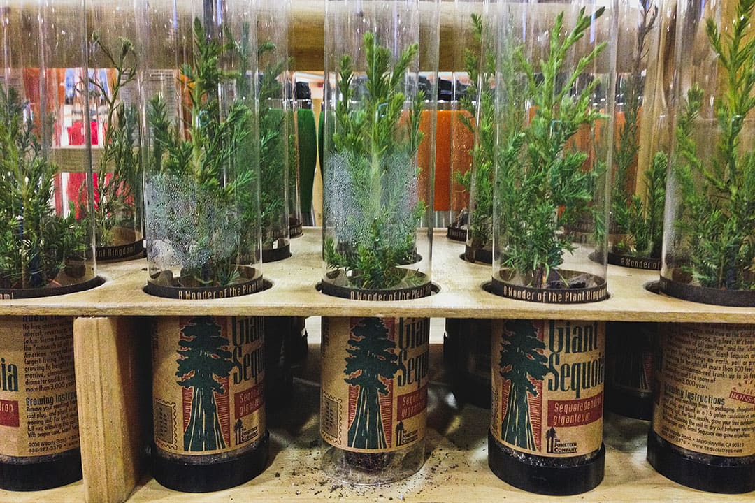
- Buy a baby Sequoia tree to plant somewhere
Sequoia National Park Hikes (From Easy to Difficult)
- Big Trees Trail (1.3 mi loop, 121 ft △, easy)
- Congress Trail (3.2 mi RT, 498 ft △, easy)
- Crescent and Log Meadows (1.8 mi RT, 206 ft △, easy)
- General Sherman Tree (.8 mi RT, 154 ft △, easy)
- Giant Forest Loop Trail (7 mi loop, 1,282 ft △, easy)
- Big Baldy Ridge (5.5 mi loop, 1,391 ft △, moderate)
- Crystal Cave Trail (0.8 mi RT, 291 ft △, moderate)
- Crystal Lake (3.1 mi RT, 833 ft △, moderate)
- Lady Bug Trail (7.2 mi RT, 1,952 ft △, moderate)
- Moro Rock (0.4 mi RT, 187 ft △, moderate)
- Marble Falls Trail (7.4 mi RT, 1,627 ft △, moderate)
- Tokopah Falls (4 mi RT, 639 ft △, moderate)
- Alta Peak Trail (14.9 mi RT, 4,064 ft △, strenuous)
- Eagle and Mosquito Lakes (10.8 mi RT, 3,097 ft △, strenuous)
- Franklin Lakes (11.2 mi RT, 3,458 △, strenuous)
- Garfield Grove Trail (13.6 mi RT, 5,019 ft △, strenuous)
- Heather Lake, Emerald Lake, and Pearl Lake (11.8 mi RT, 2913 ft △, strenuous)
- Lakes Trail Hike (12.2 mi round trip, 2792 ft elevation, moderate to difficult)
- Middle Fork Kaweah Falls (9.1 RT, 1,627 ft △, strenuous)
- Monarch Lakes (8.4 mi RT, 2,650 ft △, strenuous)
- Timber Gap (9.8 mi RT, 4,110 ft △, strenuous)
- Twin Lakes Trail (13.1 mi RT, 3,238 ft △, strenuous)
- White Chief Trail (7.1 mi RT, 2,230 ft △, strenuous)
Kings Canyon National Park Hikes (From Easy to Difficult)
- Big Stump Trail (1.8 mi loop, 236 ft △, easy)
- Buena Vista Peak (2 mi RT, 413 ft △, easy)
- General Grant Tree Trail (0.5 mi loop, 29 ft △, easy)
- Grizzly Falls (0.1 mi loop, 19 ft △, easy)
- North Grove Loop (2.8 mi RT, 449 ft △, easy)
- Road’s End to Bailey Bridge (4.4 mi loop, 209 ft △, easy)
- Roaring River Falls (0.3 mi RT, 26 ft △, easy)
- Zumwalt Meadow (1.5 mi loop, 134 ft △, easy)
- Hart Tree, Fallen Goliath, Redwood Creek (7.1 mi loop, 1,354 ft △, moderate)
- Hotel Creek Trail (3.8 mi RT, 1,614 ft △, moderate)
- Mist Falls (8.1 mi loop, 889 ft △, moderate)
- Paradise Valley (17.1 mi RT, 2,972 ft △, moderate)
- Redwood Canyon (10.9 mi loop, 2,185 ft △, moderate)
- Don Cecil Trail (9.3 mi RT, 3,339 ft △, strenuous)
- Lookout Peak (13 mi RT, 4000 ft △, strenuous)
Sequoia National Park Camping
There are fourteen campgrounds in the two parks, three open year-round. Most of them are first-come, first-served sites, with reservable sites at Potwisha, Buckeye Flat, Lodgepole, Dorst Creek, Sunset, and Sentinel campgrounds.
Campgrounds are usually full on weekends during the summer (Jun – Aug), so arrive early or make reservations where possible. Here is a quick overview of the campsites:
Sequoia National Park
- Lodgepole Campground – 214 sites for tents, RVs, and trailers
- Dorst Creek Campground – 222 sites for tents, RVs, and trailers
- Potwisha Campground (open year-round) – 42 sites for tents, RVs, and trailers
- Buckeye Flat Campground – 27 sites for tents
- South Fork Campground (open year-round) – 10 sites for tents
- Atwell Mill Campground – 21 sites for tents
- Cold Springs Campground – 40 sites for tents
Kings Canyon National Park
- Azalea Campground (open year-round) – 110 sites for tents, RVs, and trailers
- Crystal Springs Campground – 35 sites for tents, RVs, and trailers
- Sunset Campground – 158 sites for tents, RVs, and trailers
- Sentinel Campground – 82 sites for tents, RVs, and trailers
- Sheep Creek Campground – 111 sites for tents, RVs, and trailers
- Moraine Campground – 121 sites for tents, RVs, and trailers
- Canyon View Campground – group sites only
To find more details on campgrounds, visit this page.
Best Places to Stay in Sequoia National Park + Kings Canyon
What’s Nearby
- Yosemite National Park (138 mi NW, 3 h 5 min drive, map)
- Alabama Hills Recreation Area, Lone Pine (251 mi, 4 h 35 min drive, map)
- Manzanar National Historical Site (259 mi, 4 h 40 min drive, map)
- Death Valley National Park (268 mi, 4 h 45 min drive, map)
- Mojave National Preserve (287 mi, 4 h 50 min drive, map)
Planning Checklist
- Get comprehensive insurance for your trip.
- Download these helpful language apps.
- Find great deals on nearby hotels.
- Arrange a rental car for your trip.
- Book a tour for your visit.
- Get airport lounge access.
- Buy a travel charger to keep your devices charged.
- Get a new backpack for your trip.
- Buy a Sequoia travel guide.
- Pack the appropriate shoes for your trip.
- Don’t forget your in-flight essentials.
How many of these things in Sequoia National Park have you done? What is the next National Park that you want to visit?
Did you enjoy this post? Pin it for later
SEE MORE NATIONAL PARK GUIDES
⟡⟡⟡⟡⟡
“Discovery consists not of seeking new lands but in seeing with new eyes” – M. Proust

Esther + Jacob
Esther and Jacob are the founders of Local Adventurer, one of the top 5 travel blogs in the US. They believe that adventure can be found near and far and hope to inspire others to explore locally. They explore a new city in depth every year and currently base themselves in Las Vegas.
Follow on Instagram (E + J), YouTube, TikTok, and Pinterest.
Hi Esther & Jacob, Both Sequoia National Park and Kings Canyon National Park look amazingly beautiful. Though I haven’t been there yet. I am just curious what kind of wildlife did you see there?
All kinds! Here are just a few of them: gray fox, bobcat, black bear, mule deer, mountain lion, marmot, and pika.
When did you visit and where did you camp? Looking to do a camping trip out there in the middle of May and want to make sure these places are open!
Also, your list looks awesome and has motivated me to do this trip even more!
How long would you recommend for a camping/driving trip to see Sequoia, Kings Canyon, and Yosemeti?
Depends on how much you want to see in each place! We could spend a week in Yosemite alone, but you could see the highlights of all of them in a week as well. Hope that helps!
This weekend, we are headed to Mammoth and Sequoia. Your blog was very helpful. Thanks
Thanks for stopping by, Stu. Hope you have a great trip! I still need to visit Mammoth.
Yosemite is definitely a gorgeous place to visit and this list is off the hook. A lot of these places are amazing during the winter as well if you’re willing to put in the effort via a pair of ski. Typically, we visit the National Park right when the gates open from the east side to access some of the best spring skiing on the planet. Great name for your website by the way! :-)
2 Amazing Destinations! Always on the hunt for new exciting camping destinations, these look stunning! Thanks for sharing the beautiful photos and travel inspiration!