
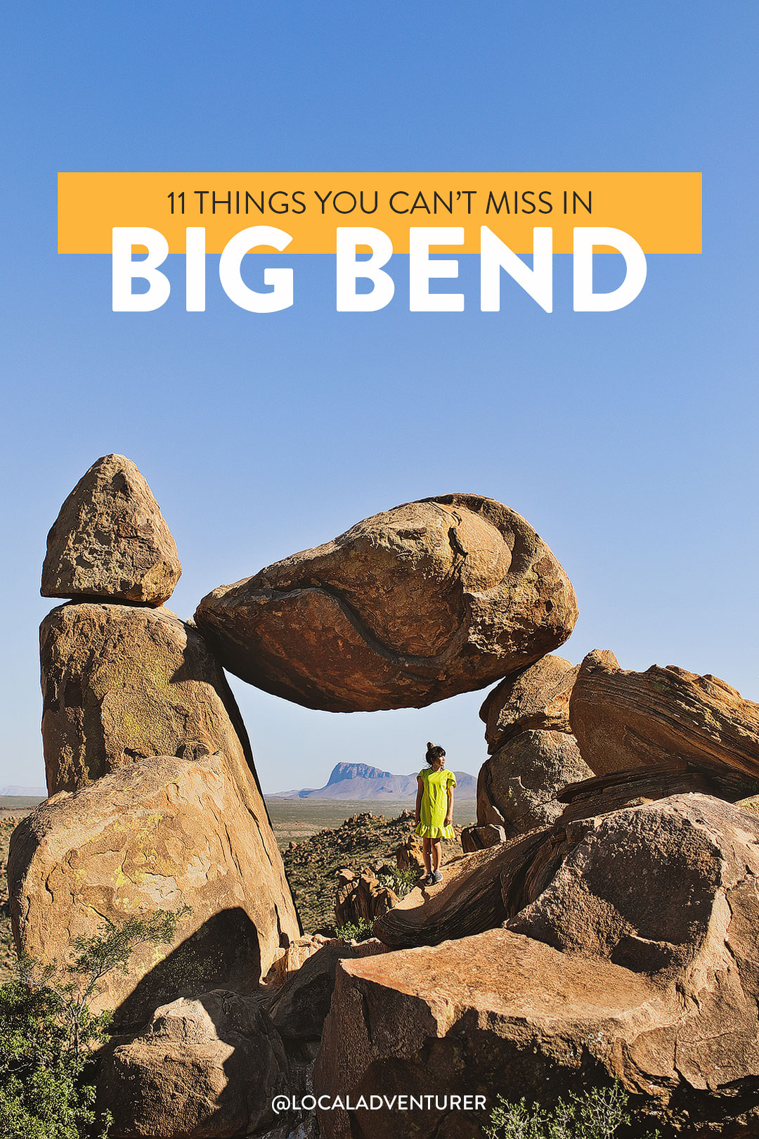
Looking for the best things to do in Big Bend National Park? Here’s where you should start!
As you already know we love our national parks, so Big Bend National Park ended up being the highlight of our West Texas road trip.
Big Bend is one of the lesser-known national parks since it doesn’t have the easiest access to a major airport. It was completely worth the drive, though, to enjoy the beautiful scenery without the insane crowds.
A big thank you to Travel Texas for hosting our trip. All opinions are always our own. This post may contain affiliate links, where we receive a small commission on sales of the products that are linked at no additional cost to you. Read our full disclosure for more info. Thank you for supporting the brands that make Local Adventurer possible.
Last Updated: January 26, 2023
About Big Bend National Park
Big Bend National Park is located in southwest Texas and encompasses the entire Chisos mountain range and most of the Chihuahuan desert that’s within the US.
Within the park, you’ll find deep canyons, endless desert landscape, forested mountains, and of course, the winding river. In case you didn’t know, Big Bend’s name refers to bend on the Rio Grande, the river that separates the US from Mexico.
The park is huge, just like the rest of Texas, and can take a lot of time to get from one end of the park to the other. That’s why we’ve put together the 11 best things to do in Big Bend National Park to help you plan your trip.
What You Need to know Before You Go
- Seasons: Big Bend National Park is open year-round, but your experience can be different depending on when you go.
- Best Time to Visit: Generally, fall and spring have the best weather, winters are mostly mild, and May and June are the hottest. The peak season is between November and April.
- Bring In Your Own Water: If possible, bring your own water because there is a severe drought in the area. Visitors can only have up to 5 gallons of water a day. It’s the desert, so you’ll want to make sure you bring enough water especially on hikes.
- Bring Layers: The temps vary significantly from the mountains and desert floor.
- Fill Up on Gas Before: There are gas stations, but they are far and few between.
- Things Close Early: Have a backup plan for food if you plan on staying in the park all day. In the small surrounding communities, sometimes they close with no mention. There was one night that we had to go on an adventure to find food.
- Entrance Fees: $30 for private, non-commercial vehicles valid for 7 days. Get an annual pass ($80) for the best value if you plan on visiting multiple parks a year. Plus, it saves you time at the gate.
- Stop by the Visitor Center: This is the best place to get the most updated info from rangers. There’s one in Panther Junction, Chisos Basin, Castolon, Persimmon Gap, and Rio Grande. Each has its separate hours of operations.
- If You Need Supplies: You can find convenience stores are at Rio Grande Village, Chisos Basin, and Castolon.
- Cell Service is Spotty. Download the area on your google maps ahead of time and pick up a map. You can get one at a pay station or visitor center.
11 Amazing Things to Do in Big Bend national Park
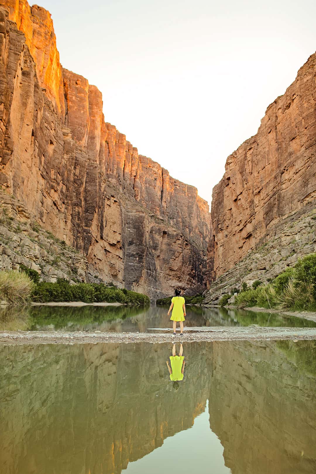
1. Santa Elena Canyon Hike →
29.1727689,-103.6187929, map
1.7 miles round trip, moderate
We sprinted down to the mouth of the canyon to catch the sunset and stayed until the moonrise. We witnessed a handful of other photoshoots, including a wedding shoot.
You don’t have to do the entire hike to enjoy the beautiful views.
If you continue along the trail, you’ll find paved steps that lead to a vista. The trail continues to take you deeper into the canyon. The hike can get muddy since it follows along the water.
If the Terlingua Creek floods, then the trail is impassable.
Local Tip: Keep an eye out for critters. We saw a snake while trying to cross a shallow part of the water.
Photo Tip: Sunset gives you prime conditions for reflection shots at the edge of the water.
See More: 11 Breathtaking Canyons in USA You Can’t Miss
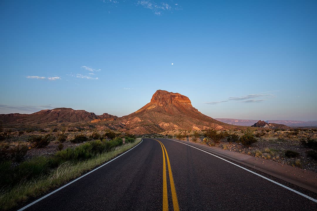
2. Ross Maxwell Scenic Drive
Ross Maxwell Scenic Dr, Texas 79834, map
This 30-mile drive takes half a day and has plenty of scenic overlooks and exhibits. Here are some notable ones you shouldn’t miss:
- Santa Elena Canyon (photo above)
- Sotol Vista Overlook – one of the best 360° views inside the park.
- Mule Ears Overlook – a great view of Mule Ears Peaks.
- Tuff Canyon Overlook – great viewpoint above the canyon. There’s a separate hike you can go through the canyon (see a full list of hikes below).
- Castolon Historic Compound – Get a look into the history of the area. You can also stop by the visitor center and camp store.
3. Window Trail →
29.2756021,-103.3133939, map
5.6 miles round trip, moderate
This is a popular sunset hike in the Chisos Basin Area. It takes you to a V-shaped canyon that frames the desert beautifully. Since most of the hike is descending on the way there, save energy for your hike back since you’ll be going uphill.
Local Tip: If it has been raining, Oak Creek may be flowing which will require you to cross the water a few times.
See More: 15 Best Day Hikes in the US to Put On Your Bucket List
4. Lost Mine Traiil →
29.2735794,-103.2889748, map
4.8 miles round trip, moderate
The Lost Mine Trail is in the Chisos Basin Area and the most popular longer hike. Along the hike, you’ll get great views of Casa Grande and Juniper Canyon, see a bunch of local flora and fauna, and end at a ridge where you can see Pine Canyon and the Sierra del Carmen in Mexico.
Since it is popular, the parking lot fills up quickly, so get an early start.
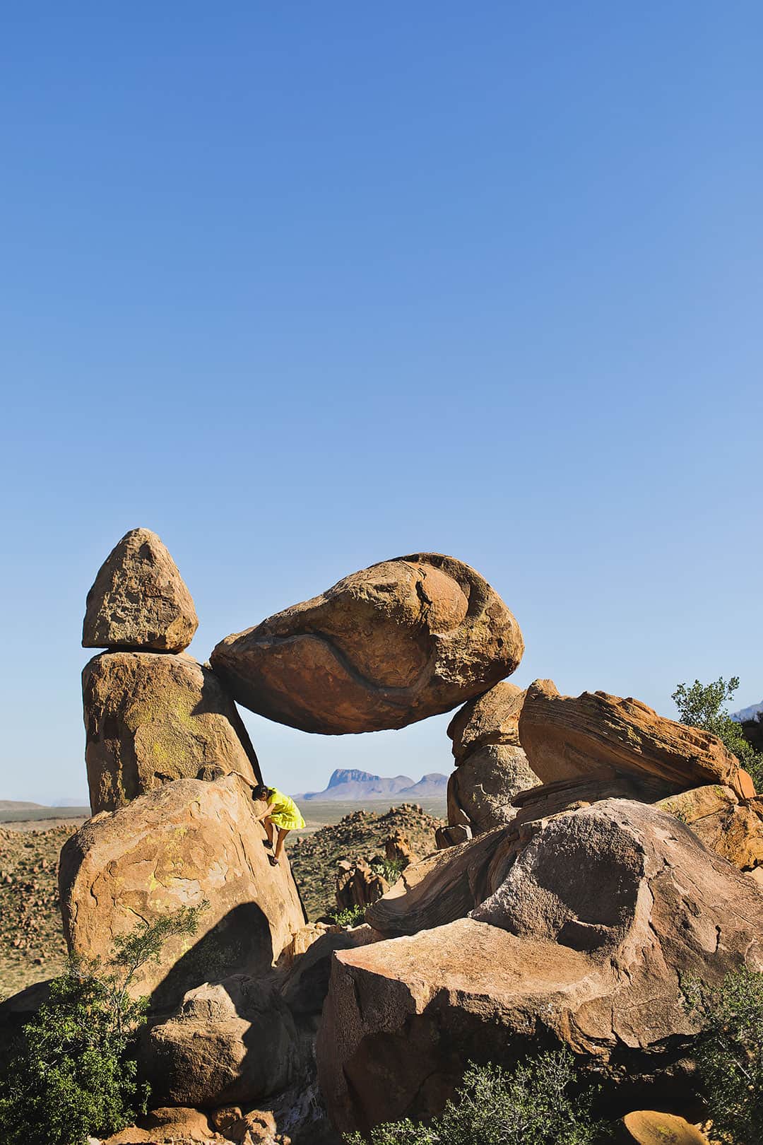
5. Balanced Rock Hike →
29.403018,-103.214373, map
2.2 miles round trip, easy
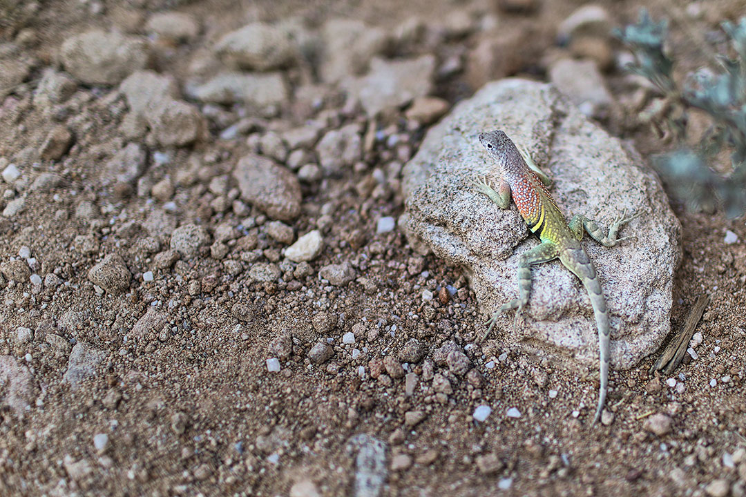
This was our favorite area of the park, but we particularly love our rocks and boulders. The hike is rated easy, but most of our group considered it moderate. The majority of the hike follows a gravel wash, making it flat and easy to follow. The last quarter mile gets steep until you find yourself at Balanced Rock.
We spent a lot of time here scrambling the rocks and saw a bunch of small rainbow-colored lizards on our way back. We didn’t see any here, but you should watch out for snakes.
Local Tip: You have to drive 6 miles down an improved dirt road to get to the parking lot. We saw some cars that weren’t high clearance, but there were some sketchy spots you should take very slow in a regular car. Road conditions can change based on weather as well so it’s always good to check-in at the visitor center.
See More: 25 Best Hikes in the World to Put on Your Bucket List
6. Lower Burro Mesa Pouroff Hike →
29.2361475,-103.4072679, map
1-mile round trip, easy
This hike is just off of Ross Maxwell Drive. At the end, you’ll find yourself at the base of a 100-foot dry waterfall. During the summer, there can be flash floods. The waterfall is no longer dry, but you shouldn’t hike it in the case of a flash flood. Check the weather before starting your hike.
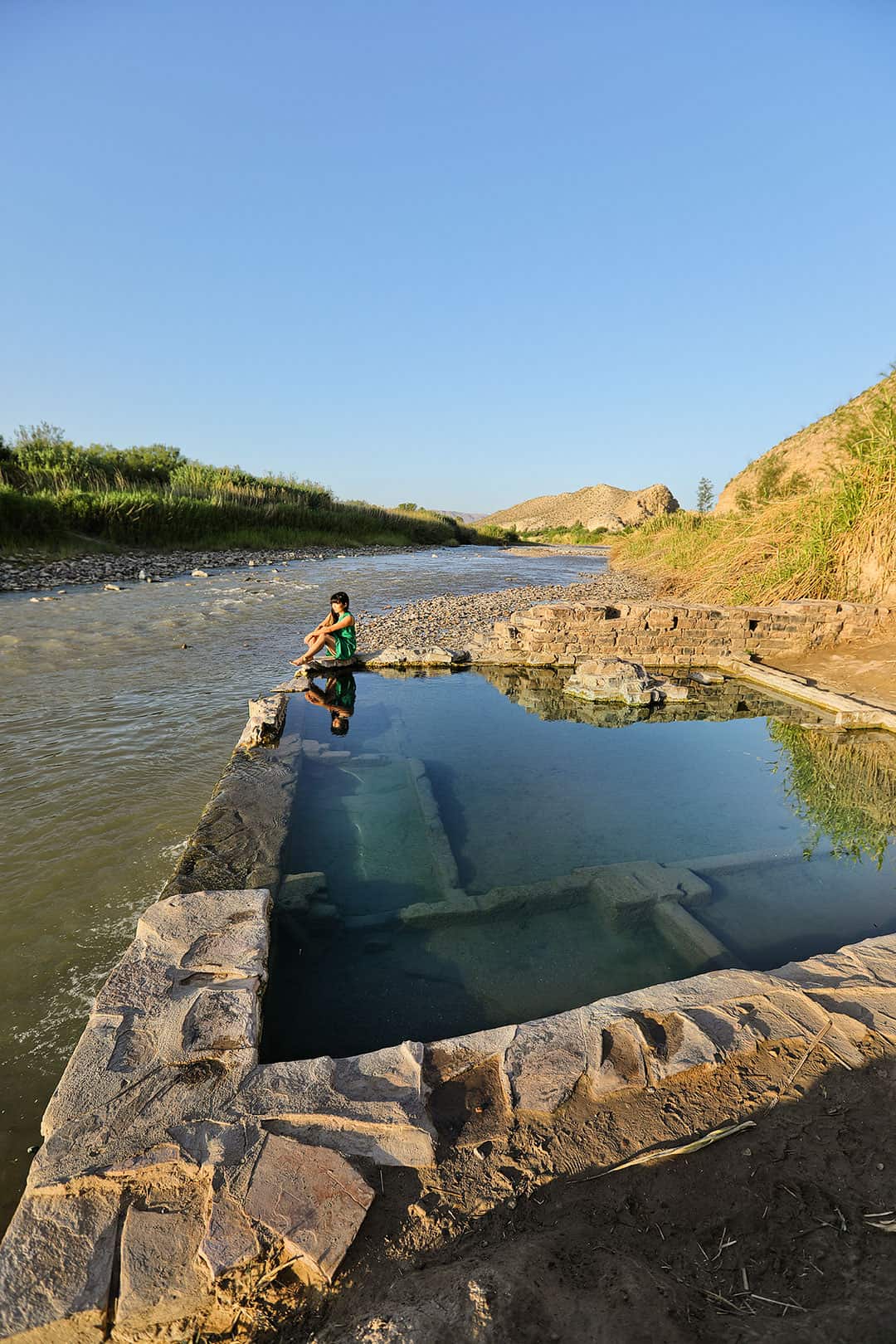
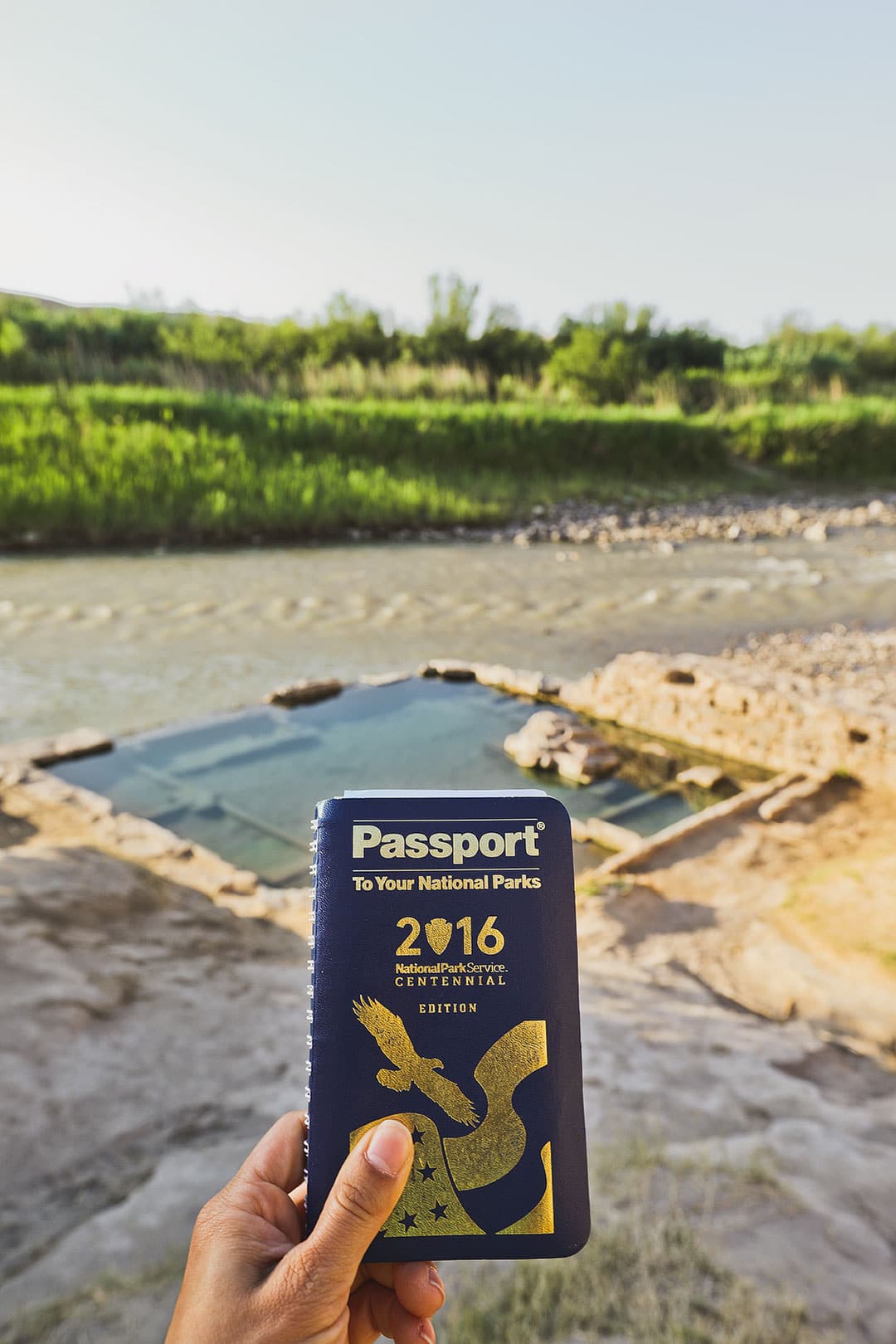
7. Langford Hot Springs →
29.1795088,-102.9999457, map
1.2-mile loop, 144 ft elevation, easy
The Hot Springs Historic Trail is an easy walk to hot springs. Along the way, you’ll pass by remains of a resort and homestead and pictographs to check out as well.
If you plan on taking a dip, there are no facilities to change there, so change before your hike. It also gets crowded. We woke up before sunrise to beat the crowds and still ran into a few people. The water stays around 105°F throughout the year.
Local Tip: When you’re about 0.6 miles from the trailhead, there is a large pull-out where you can park your car. There is parking right near the trailhead, but the road gets narrow and rough so be sure you’re comfortable with handling that drive before continuing.
See More: 25 Amazing Hot Springs in the US to Soak In
8. Fossil DIscovery Exhibit
Fossil Bone Exhibit, Big Bend National Park, TX 79834, map
Travel through 130 million years of geologic time at the Fossil Discovery Exhibit. You’ll get to see specimens from Big Bend’s fossil records and check out the artwork that shows you what life was like in ancient times.
This is a great stop in the middle of the day when it’s really hot. You can get some shade and kids can play on the fossil-themed climbing structures.
Local Tip: Keep in mind that there is no water available at this location and there is only a vault toilet.
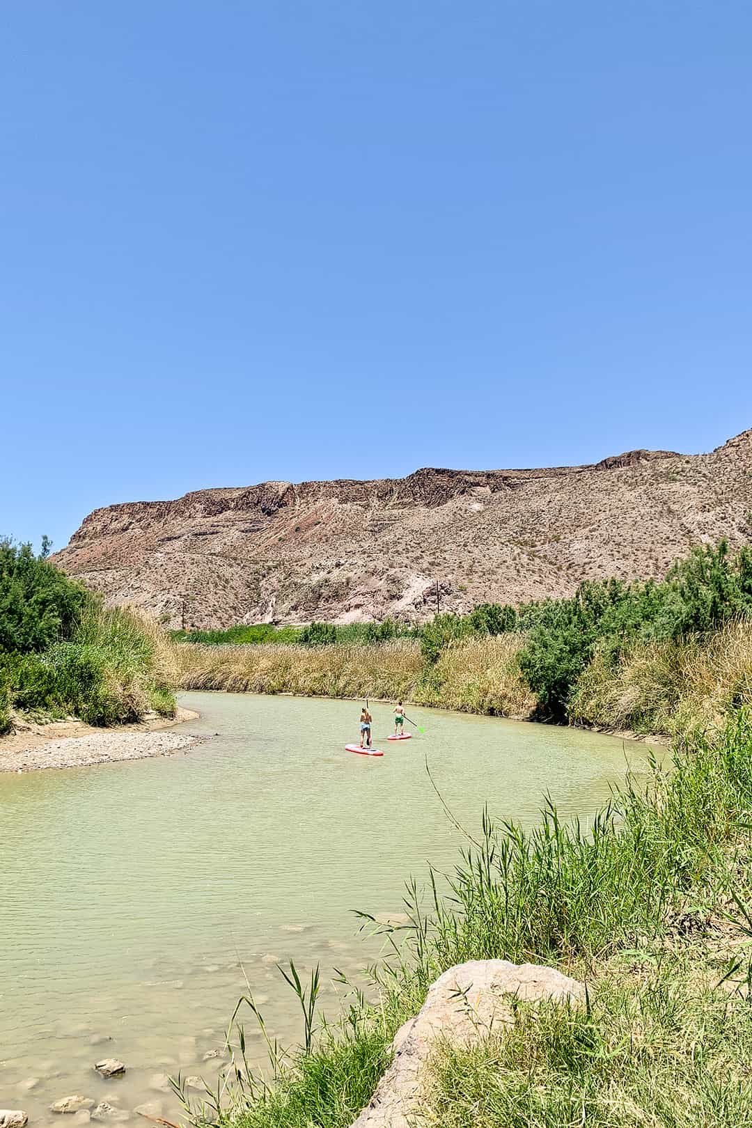
9. Raft, Canoe, oR SUP Down the Rio Grande River
Terlingua, TX 79852, map
Crazy to think we were straddling two countries on our SUPs.
There are 5 river canyons to explore in Big Bend. There are a handful of nearby outfitters that offer raft rentals and guides.
During our visit, we headed to the Lajitas Golf Resort where we met our SUP guides. From there, we hopped into their truck and they drove us to our launching point on the Rio Grande.
You can also head to the Boquillas Canyon rapids where you can do a 33 mile trip down the Rio Grande.
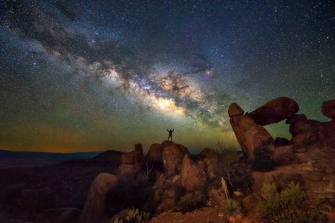
10. Stargazing
There aren’t many dark sky areas left in the world, and Big Bend National Park is a dark sky certified park. It has the least light pollution of any national park in the lower 48, which means it has an exceptional quality of starry nights.
If you’re there to shoot the milky way, make sure you time it around the new moon. You can also shoot it before the moon rises, but it’s a trickier time window.
Local Tip: If the timing works, join a ranger star party. We’ve only been to one star party, and it was pretty cool!
See More: The Stargazing Events You Don’t Want to Miss This Year
11. Terlingua
32.3545255,-118.2868744, map
Terlingua is one of the closest communities to Big Bend National Park and was our home base during our visit.
This small, eclectic town is known for its annual chili festival, which we’ll have to come back for. During our downtime, we enjoyed live music at the Starlight Theatre, wandered through the historic Terlingua cemetery, and tucked ourselves in at the haunted Perry Mansion. I don’t know if you believe in ghosts, but it got pretty weird.

Map of Big Bend National Park
More Things to Do in Big Bend National Park
- More Scenic Drives
- Paved Roads (Chisos Basin Road – 6 mi, Panther Junction to Rio Grande Village – 21 mi, Persimmon Gap to Panther Junction – 28 mi, Maverick Entrance Station to Panther Junction – 23 mi)
- Improved Dirt Roads (Dagger Flat Auto Trail – 14 mi RT, Grapevine Hills Road – 6.4 mi, Hot Springs Road – 2 mi, Old Maverick Road)
- Primitive Roads (Old Ore Road – 26 mi, The River Road – 51 mi, Glenn Springs Road – 16 mi, Black Gap Road – 8.5 mi)
- Sam Nail Ranch, Ross Maxwell Drive (RMD) – an old homestead where you’ll find historic remnants. It’s a great spot for birding.
- Homer Wilson Ranch, RMD – Aka Blue Creek Ranch, this was one of the largest ranches in the early 20th century. You can see the overlook or if you’re into history, walk down to learn more about the area.
- Castolon Historic District, RMD – Learn more about the human history of the area.
- Mariscal Mine – This was once the center of quicksilver mining in Big Bend. You’ll find the abandoned buildings and it’s the best-preserved mercury mining site in the state of Texas.
- Boquillas Overlook, Rio Grande Village – Boquillas Canyon is the longest and deepest canyon in the park. It’s hard to see it from the overlook but look for signs to help you spot it.
- Camino del Rio or River Road – Texas Highway 170 made NatGeo’s list of the most scenic drives in the US. The 30-mile drive follows the Rio Grande with amazing views of mountains and canyons.
- Boquillas, Mexico – You can take the opportunity to cross the border to the town of Boquillas. Don’t forget your passport and check the guidelines. The Port of Entry has limited hours.
Download Free Big Bend Itinerary
Big Bend national Park Hikes
There are 201 miles of hiking trails, and these are the Big Bend hikes in the order of easy to difficult. See our Big Bend hiking map to search by area. Also, don’t forget to get Alltrails+ so you have access to the maps when you’re offline.
- Panther Path (0.1 mi loop, 3 ft, easy, map)
- Window View Trail (0.3 mi RT, 13 ft, easy, map)
- Sam Nail Ranch Trail (0.3 mi loop, 29 ft, map)
- Chihuahuan Desert Nature Trail (0.5 mi loop, 36 ft, easy, map)
- Rio Grande Nature Trail (1.0 mi loop, 121 ft, easy, map)
- Tuff Canyon Trail (1.0 mi RT, 98 ft, easy, map)
- Hot Springs Historic Trail (1.4 mi loop, 154 ft, easy, map)
- Santa Elena Canyon Trail (1.5 mi RT, 610 ft, map)
- Grapevine Hills Trail (2.2 mi RT, 232 ft, easy, map)
- Chisos Basin Loop Trail (2.4 mi loop, 465 ft, easy, map)
- Boquilas Canyon Trail (1.3 mi RT, 230 ft, moderate, map)
- Closed Canyon Trail (1.8 mi RT, 396 ft, moderate, map)
- Upper Burro Mesa Pour-off Trail (3.8 mi RT, 501 ft, moderate, map)
- Mule Ear Spring Trail (3.9 mi RT, 410 ft, moderate, map)
- Dog Canyon Trail (4.3 mi RT, 272 ft, easy, map)
- Chimneys Trail (4.6 mi RT, 364 ft, moderate, map)
- Lost Mine Trail, Chisos Basin Area (4.8 mi RT, 1099 ft, moderate, map)
- Hot Springs Canyon Trail (5.5 mi loop, 921 ft, moderate, map)
- Window Trail (5.6 mi RT, 948 ft, moderate, map)
- Cattail Falls, Rio Grande (5.7 mi RT, 685 ft, moderate, map)
- Mariscal Canyon Rim Trail (12 mi RT, 2417 ft, moderate, map)
- Pinnacles Trail (8.0 mi RT, 1965 ft, hard, map)
- Emory Peak Trail (10.4 mi RT, 2529 ft, hard, map)
- Marufo Vega Trail (13.4 mi loop, 2660 ft, hard, map)
More Tips for Big Bend
- Watch for rattlesnakes (there are four rattlesnake species and one copperhead), mountain lions, and bears. Read this crazy encounter story.
- Get Alltrails+ so you have access to trail maps when you’re offline.
- Birding is great in the park with over 450 species spotted. The Colima warbler can be seen here and nowhere else in the world between April and September.
- Follow the Leave no Trace principles.
- The Rio Grande marks the international border, and more specifically, the middle of the deepest channel. Landing on the Mexican bank is considered an illegal crossing. There are exceptions made when safety is concerned (to scout rapids, to repack a boat, to seek shade when overheating, etc).
- Arroyos and washes can become rivers while you sleep. Never sleep in them or in lower spots.
- Do not swim or wade in the Rio Grande. It has strong currents and extreme drop-offs.
- Store food and toiletries in approved bear-proof containers.
- Fishing in the park requires a free permit available at ranger stations.
- Pets are allowed only on roads, developed campgrounds, and primitive roadside campsites. They must be on a leash at all times. Do not take them on trails, public buildings, or in the backcountry.
- Wood and ground fires are prohibited in the park.
- All boats require a float permit that you can get at ranger stations.
Where is Big Bend National park
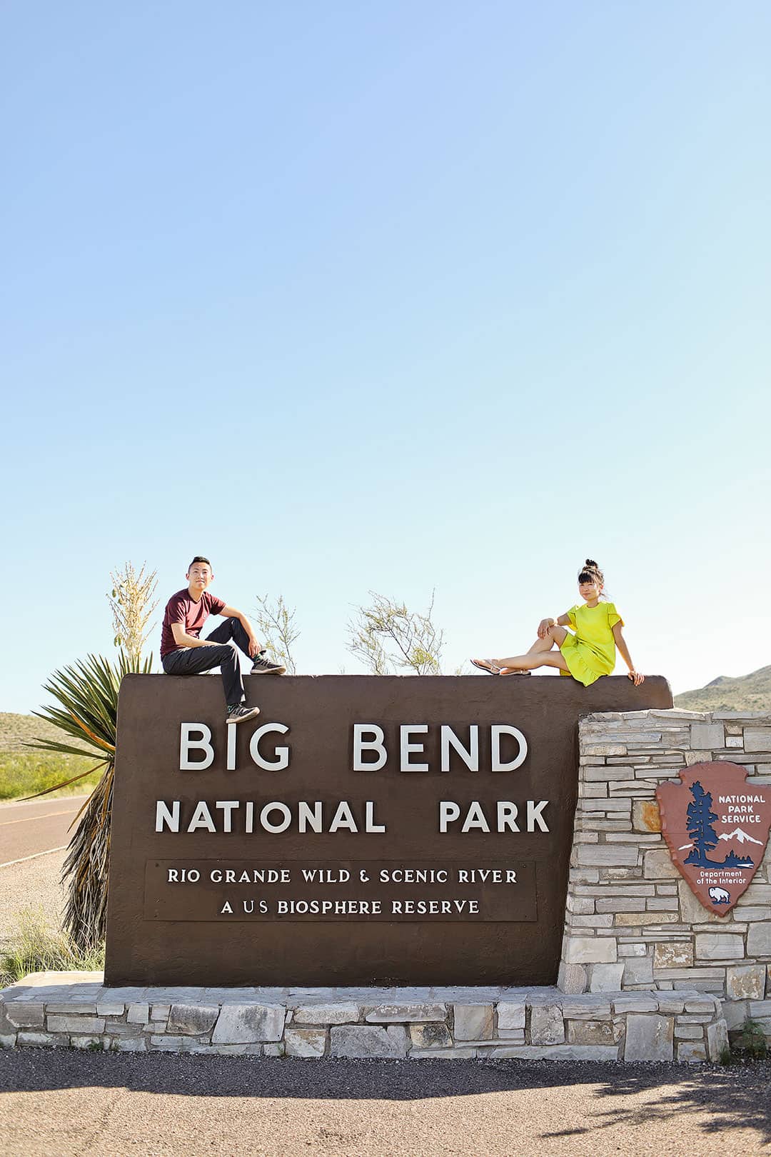
Big Bend National Park is located in Southwest Texas. Because of its remote location, you must purposefully plan your trip. We visited the park while checking out other parts of West Texas, including El Paso, Fort Davis, and Marfa.
Directions to Big Bend National park
There is no public transportation near or in the park. The easiest way to get to Big Bend is to fly into one of the major airports, rent a car, and then drive to the park. Although Midland/Odessa is closer to the park, we recommend flying into El Paso because there is more to see along the drive. The other locations are good if you want to visit those spots, but there won’t be many stops along the way.
Fly Into:
- El Paso, TX (ELP) – 288 miles away (what we did)
- Odessa Midland, TX (MAF) – 195 miles away
- San Antonio, TX (SAT) – 374 miles away
- Austin, TX (AUS) – 441 miles away
Train or Bus:
- Alpine, TX – 72 miles away.
- There is an Amtrak station in Alpine where you can rent a car.
- You can also take a Greyhound to Alpine and rent a car there.
Car and RV Rentals
No matter how you get to the Big Bend, you’ll need to rent a car since there is no public transportation in the park. Click here to search for the best prices.
If you want to explore Big Bend in an RV but don’t have one, check out Outdoorsy. They are the largest and most trusted RV rental marketplace, and we rented one for our road trip to Bishop, CA.
We spent a ton of time looking through their site since they have so many different options! Plus, they include liability insurance with each rental. Here are links to search in specific cities:
Where to Eat – Big Bend Restaurants
The only dining available inside the park is at Chisos Mountain Lodge. You can also pick up packaged food at Castolon, the Chisos Basin, Panther Junction, and Rio Grande Village. Otherwise, you can find food in nearby communities of Terlingua, Marathon, and Study Butte. Can go grocery shopping at the French Grocer in Marathon
- Taqueria El Milagro, Terlingua (Mexican, $) – So glad we randomly stumbled across this gem. Nothing else was open and we pulled up right as they were closing up shop. They graciously decided to stay open and feed us seeing how desperate we were, and it turned out to be the best food we had in the area.
- Starlight Theatre, Terlingua (Mexican, $) – Local favorite with live music. Met some characters here.
- 12 Gage Restaurant, Marathon (American, $)
- Expresso Y Poco Mas (Breakfast & Brunch, $$) – Another local favorite that’s packed for breakfast.
- White Buffalo Bar, Marathon (Bar, $)

Best Places to Stay
- Chisos Mountain Lodge is only hotel inside park and each room has great views. You can make reservations from Nov 15 to April 15.
- Perry Mansion is where we stayed. It was newly renovated, and each room was unique. The home is supposedly haunted.
- Lajita Golf Resort is where we met our SUP guides and had lunch. The resort looked nice and there’s an 18-hole championship course.
- Camping in one of the 3 campgrounds. You can stay up to 14 consecutive nights (with the exception of the busy season from Jan 1 to Apr 15) with a total of 27 nights per year.
- Chisos Basin Campground (60 sites, 40 reservable)
- Cottonwood Campground (24 sites, no reservations) – quieter campground since there are fewer sites.
- Rio Grande Village Campground (100 sites, 60 reservable)
- Backpacking to primitive campsites. Get permits here.
- RV at the Rio Grand Village RV Campground. There are 25 sites will full hook ups. Based on reviews we’ve read, the RV sites are very close together.
Facts about Big Bend
- Established as National Park in June 12, 1944
- Highest Point Emory Peak 7,832 ft
- Lowest Point Rio Grande Village 1,850 ft
- Park covers 801,163 Acres (15th largest in the national park system)
- 3 Canyons in Big Bend
- Santa Elena – 20 mi
- Mariscal – 10 mi
- Boquillas – 33 mi
- 118 miles of shared International Border
- Flora and Fauna
- 1,295 species of plants
- 75 species of mammals
- 450+ species of birds
- 3,600 species of insects
- 56 species of reptiles
- 11 species of amphibians
- 38 species of fish
What’s Nearby
- Smallest Target (57 mi north, 55 min, map)
- Marathon Post Park Pool (72 mi north, 1 hr 20 min, map)
- Museum of the Big Bend, Sul Ross University (98 mi north, 1 hr 40 min, map)
- Bolmorhea State Park (155 mi north, 2 h 40 min, map) – world’s largest spring-fed swimming pool
- Fort Davis (122 mi north, 2 hr, map)
- Boquillas Crossing Port of Entry / Boquillas del Carmen (21 mi southeast, 30 min, map) – small Mexican village nearby across the Rio Grande from Big Bend
- El Paso (330 mi NW, 5 hr 50 min, map)
Planning Checklist
- Get comprehensive insurance for your trip.
- Find a great deal on Big Bend lodging.
- Arrange a rental car for your trip.
- Book a tour for your visit.
- Get airport lounge access.
- Buy a travel charger to keep your devices charged.
- Get a new backpack for your trip.
- Buy a Texas travel guide.
- Pack the appropriate shoes for your trip.
- Don’t forget your in-flight essentials.
Can you think of any other things to do in Big Bend National Park that you can’t miss?
Did you enjoy this post? Pin it for later
SEE MORE NATIONAL PARK GUIDES
⟡⟡⟡⟡⟡
“Discovery consists not of seeking new lands but in seeing with new eyes” – M. Proust

Esther + Jacob
Esther and Jacob are the founders of Local Adventurer, one of the top 5 travel blogs in the US. They believe that adventure can be found near and far and hope to inspire others to explore locally. They explore a new city in depth every year and currently base themselves in Las Vegas.
Follow on Instagram (E + J), YouTube, TikTok, and Pinterest.