
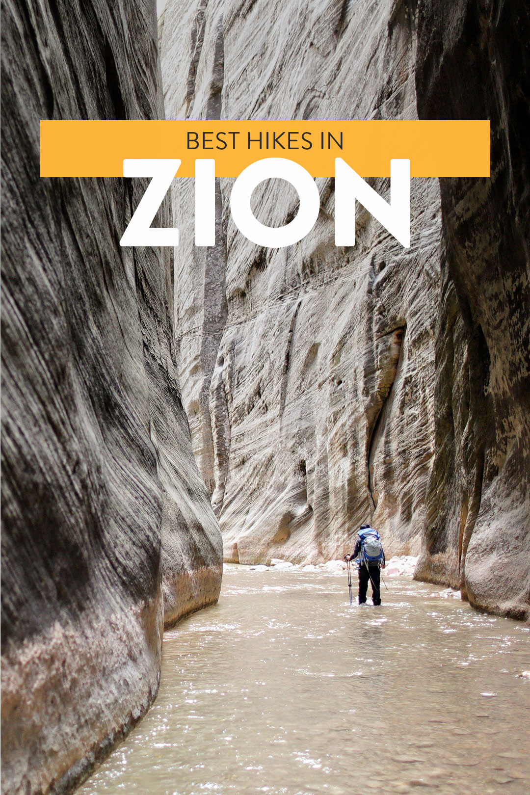
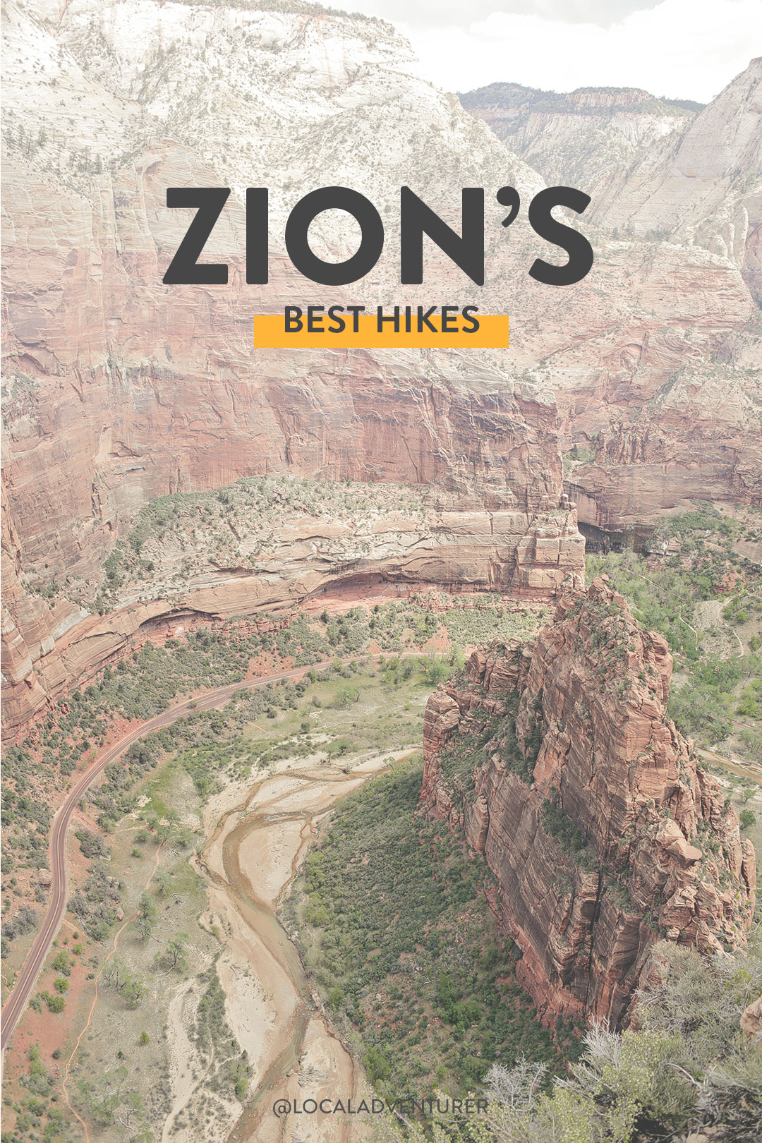
Looking for the best hikes in Zion National Park? These are the hikes you should do first.
Zion National Park is a great destination because there is so much packed into a small area, whether you’re a hardcore hiker or soft adventurer. We don’t consider ourselves hardcore hikers, and our fitness level is average, but we’re slowly getting our feet wet with backpacking.
We love that Zion is also a great place to find longer strenuous hikes and multi-day backpacking trips if you want to venture further into the park. It also has iconic hikes like the Zion Narrows and Angels Landing.
If you’re unsure what to do during your trip there, we’ve listed the best of Zion National Park hikes, from easy to challenging.
This post may contain affiliate links, where we receive a small commission on sales of the products that are linked at no additional cost to you. All opinions are always our own. Read our full disclosure for more info. Thank you for supporting the brands that make Local Adventurer possible.
Last Updated: June 15, 2026
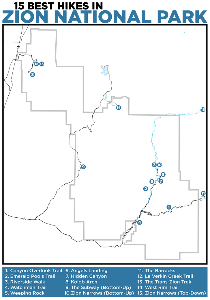
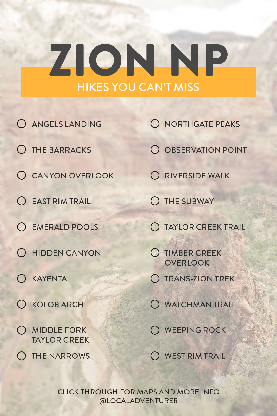
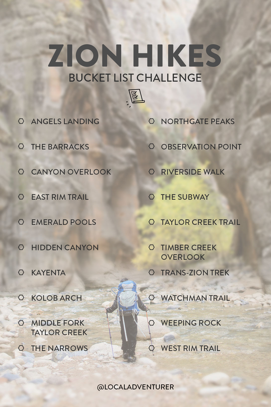
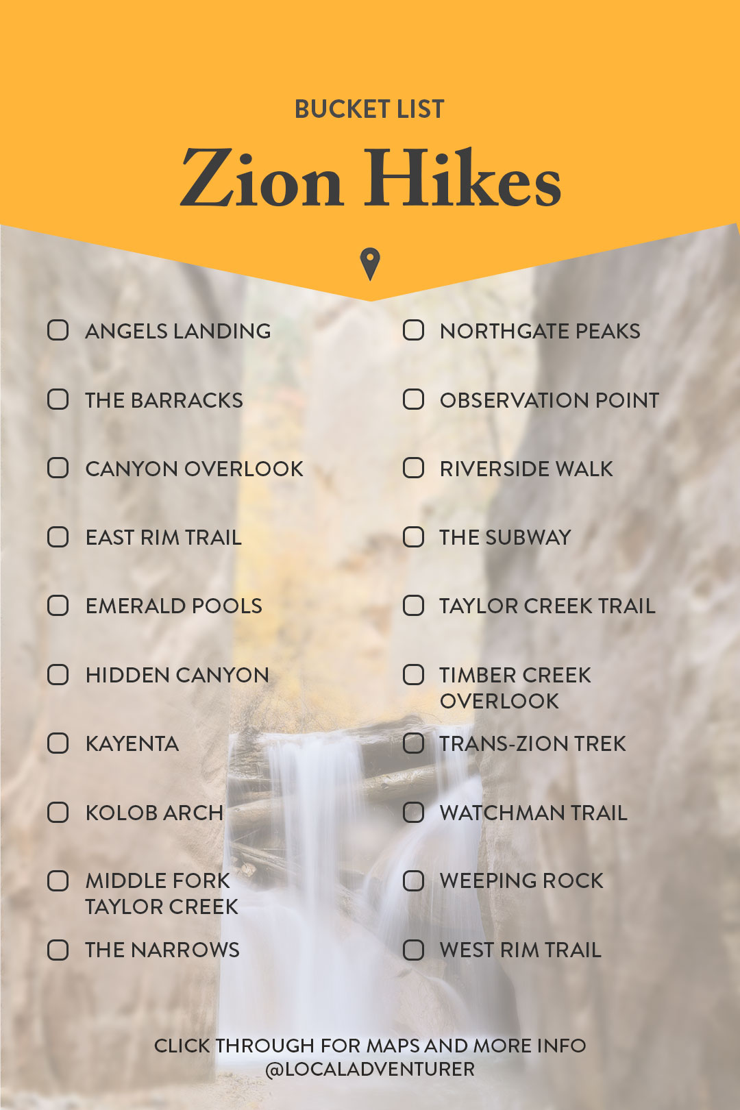
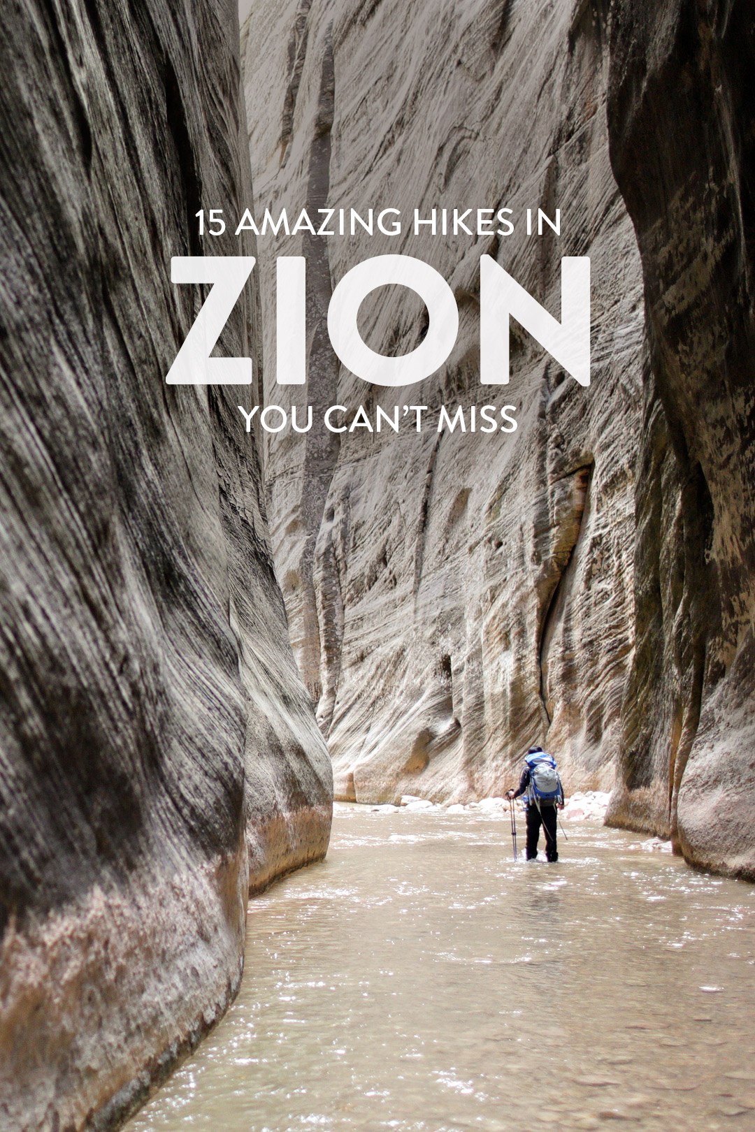
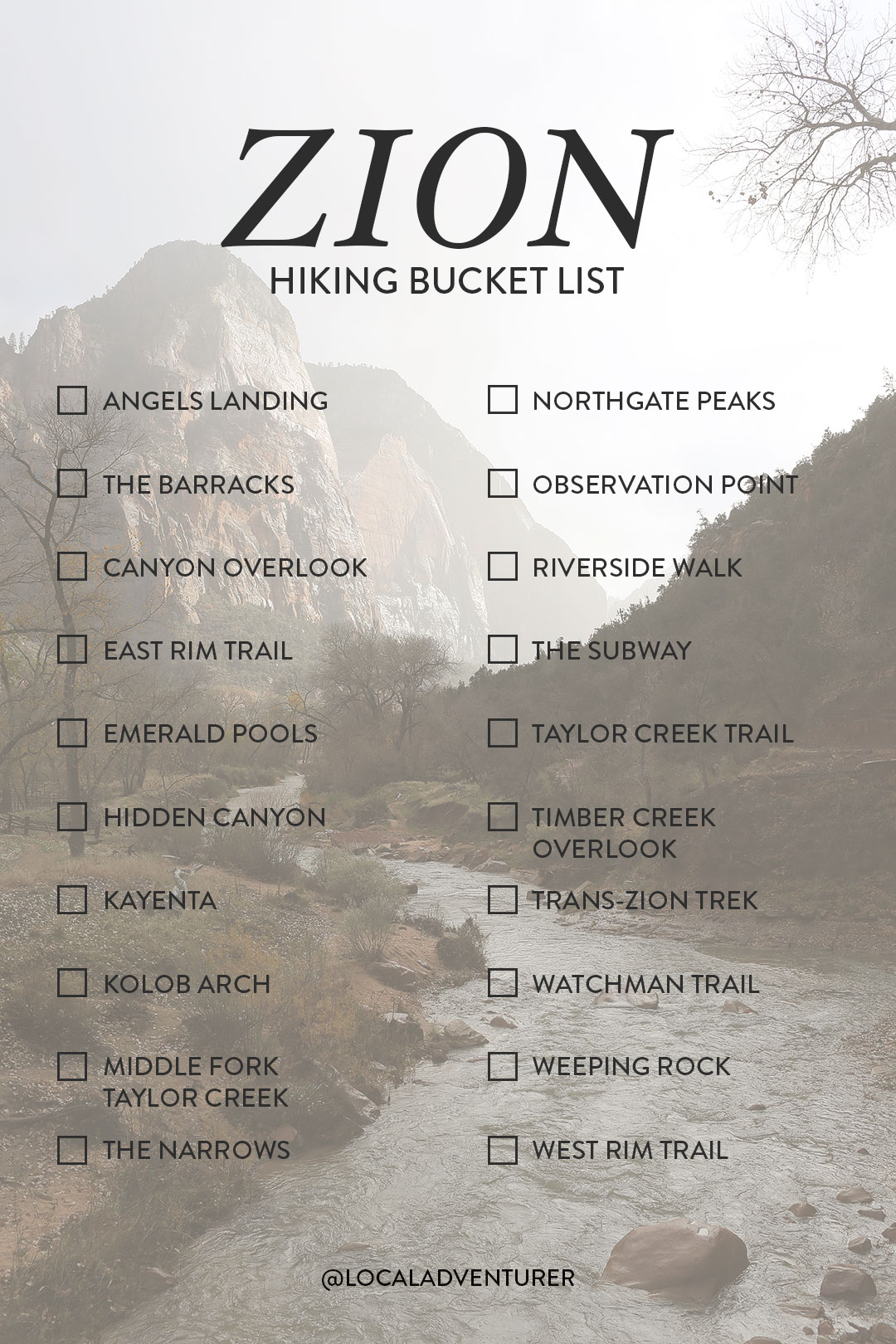
15 Best Hikes in Zion National Park
5 Best Easy Hikes in Zion
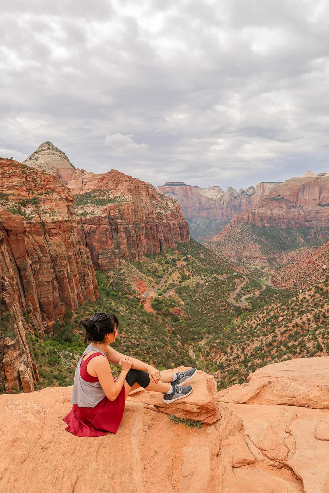
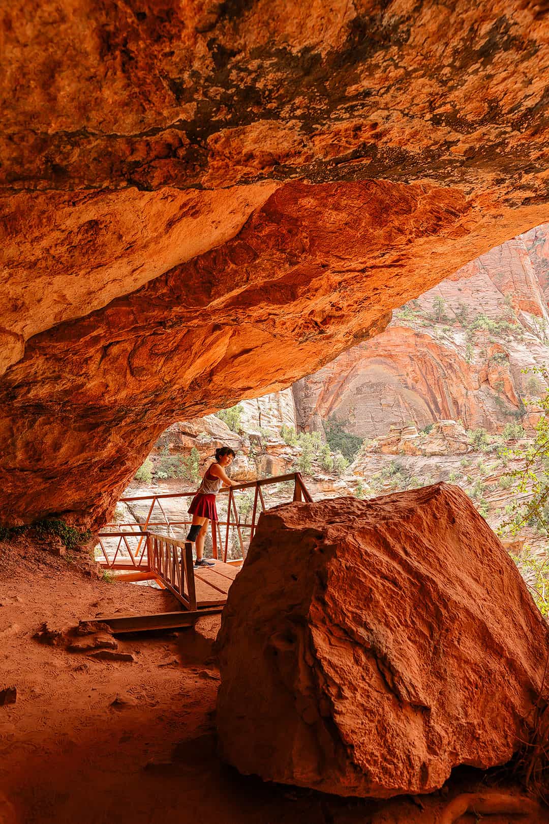
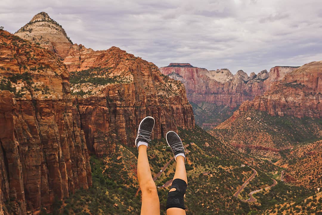
1. Canyon Overlook Trail →
Trailhead Coordinates: 37.213341, -112.940680, map
Distance: 1 mile roundtrip, 213 ft elevation gain
Time: < 1 Hour
Difficulty: Easy
Traffic: Crowded
This trail leads you to one of the best photography spots in the park. The trailhead is near the East entrance just before the Zion-Mt. Carmel Tunnel. After a short hike up from the street, you go through a large natural cave and are rewarded with an extraordinary view of Zion Canyon below.
More: How to Hike the Canyon Overlook Trail
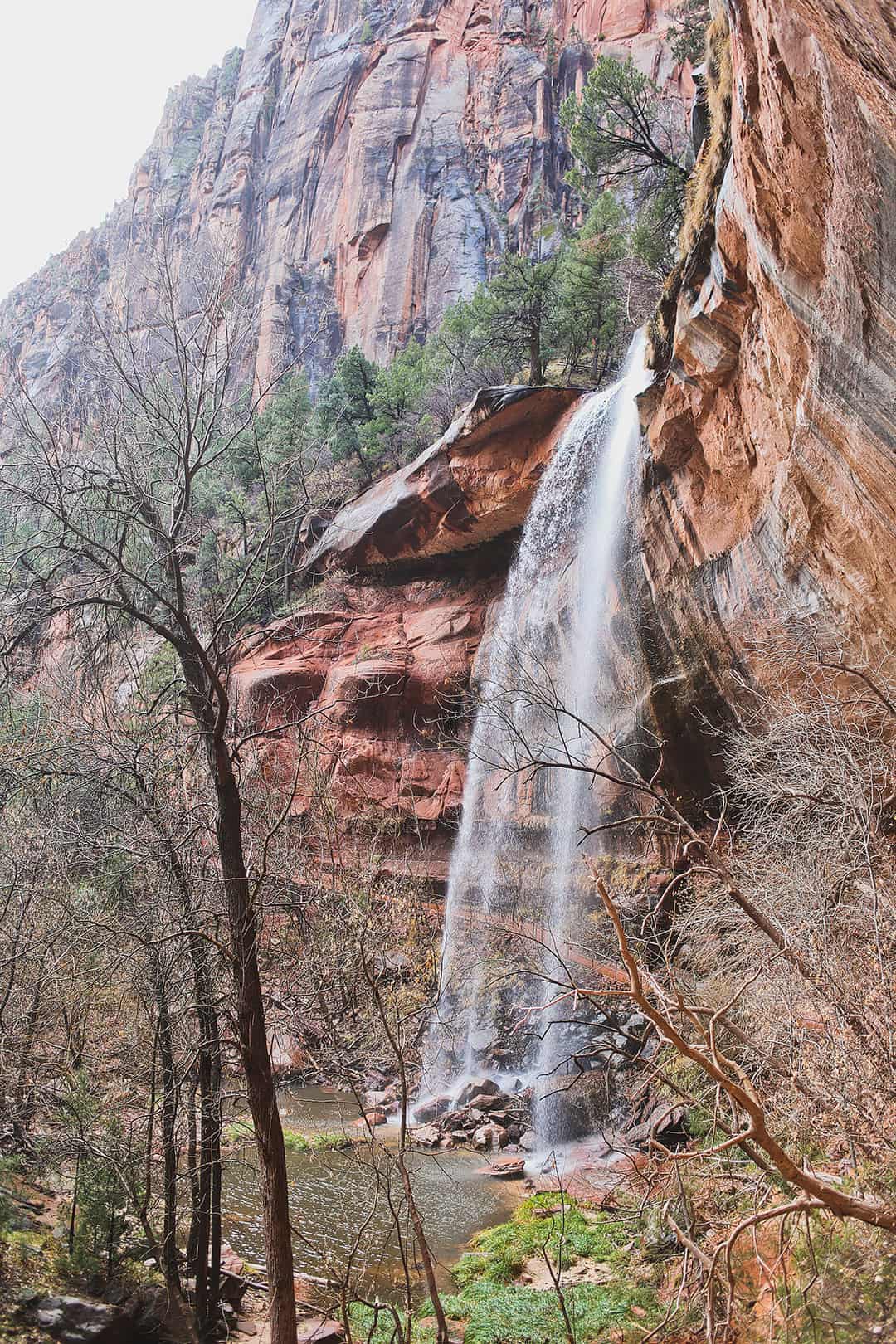
2. Emerald Pools Trail →
Shuttle Stop 5 or 6 (6 takes slightly longer)
Distance: 1.2-3 Miles, 552 ft elevation gain
Time: 1-3 Hours
Difficulty: Easy
Traffic: Crowded
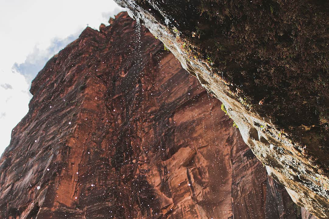
This collection of trails gives you a few different options, with spectacular views of greenery, Pools, and waterfalls. The Lower and Middles Pools can be reached from the same trailhead, while the Upper Pool has a different starting point. This trail also allows you to walk under a waterfall.
See More: 15 Incredible Things to Do in Zion National Park
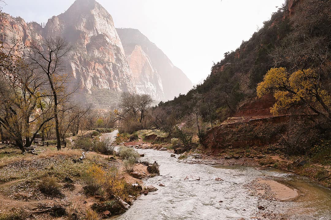
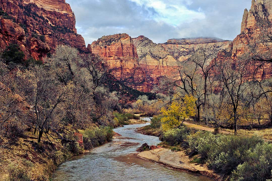
3. Riverside Walk →
Shuttle Stop 9
Distance: 1.8 mi miles roundtrip, 206 ft elevation gain
Time: 1-2 Hours
Difficulty: Easy
Traffic: Crowded
Also known as the Gateway to the Narrows, this paved path takes you from the Temple of Sinawava to the Virgin River. You can then enjoy the entrance of the Narrows and even wade around in the river before making your way back.
4. Watchman Trail →
Shuttle Stop 1 (Visitor Center)
Distance: 3.1 mile loop, 646 ft elevation gain
Time: 1-3 Hours
Difficulty: Easy to Moderate
Traffic: Crowded
Visitors often overlook this trail, but it offers a stunning view of the valley. Although it doesn’t climb the heights of the Watchman itself, it’s a great introduction to the park’s beauty.
5. Weeping Rock →
Shuttle Stop 7
Distance: 0.4 Miles
Time: < 1 Hour
Difficulty: Easy
Traffic: Very Crowded
This short stroll takes you to the famous weeping wall, where you see trickling streams of water and hanging gardens of fern and moss. It’s not our favorite “hike” in Zion, but it takes you to one of the most iconic parts of the park. The trail is narrow, so it is not recommended for wheelchairs or strollers.
5 Best Moderate to Strenuous Day Hikes
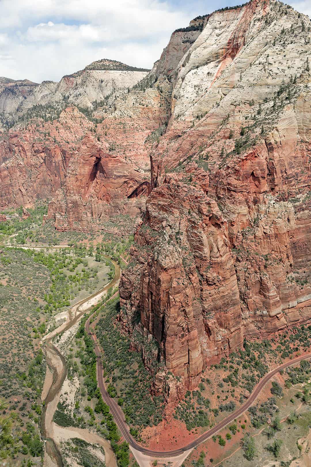
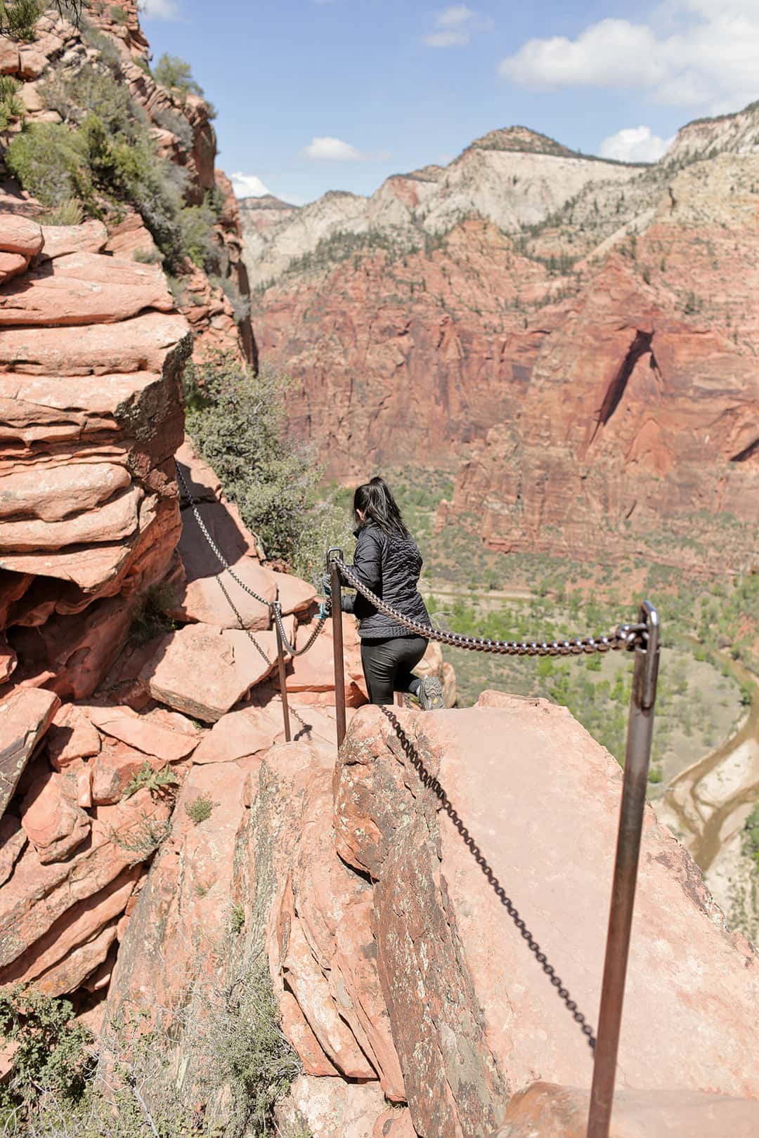
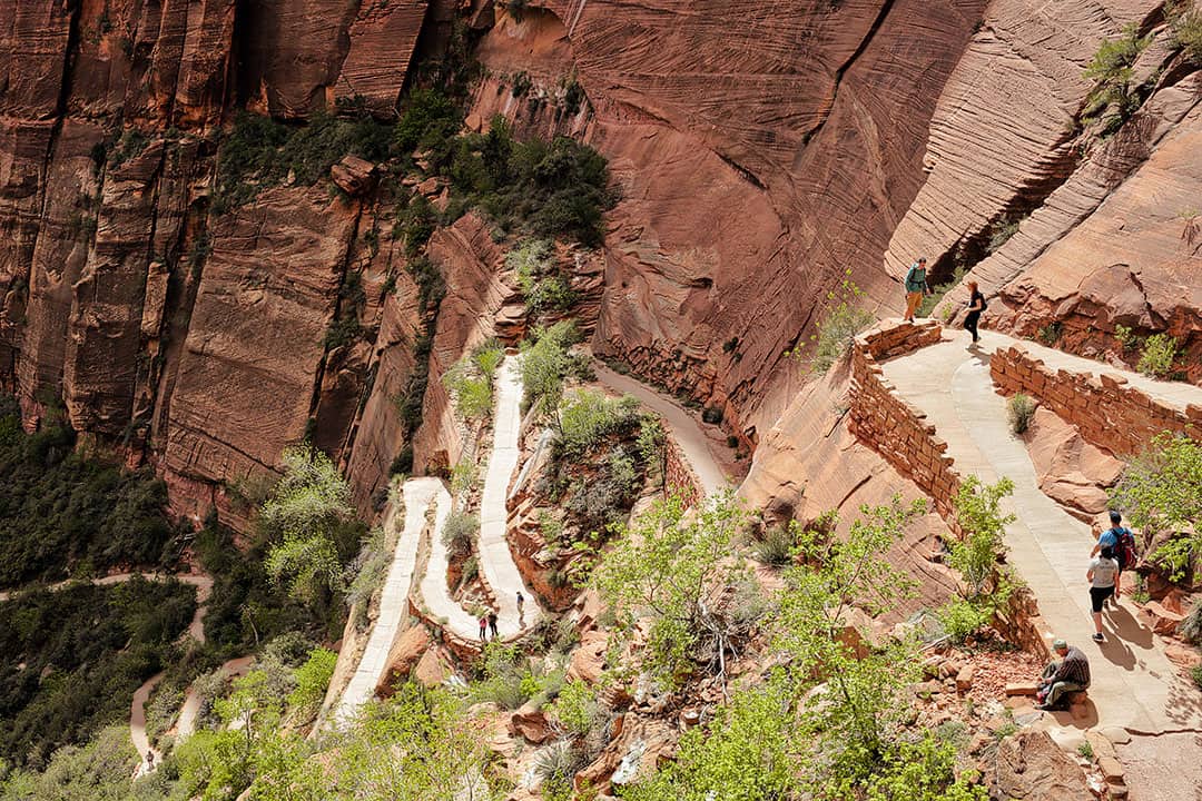
6. Angels Landing →
Shuttle Stop 6
Distance: 4.1 Miles, 1617 ft elevation gain
Time: 2-4 Hours
Difficulty: Strenuous
Traffic: Very Crowded
One of the iconic hikes in Zion National Park, Angels Landing is not for the faint of heart (or anyone with a fear of heights). Sections of the trail offer chains to help steady yourself as you navigate the part with drop-offs on both sides. The views at the top are truly stunning!
Local Tip: Angels Landing requires a permit to hike. Find details about the lottery system here.
More: 15 Most Dangerous and Scariest Hikes in the World
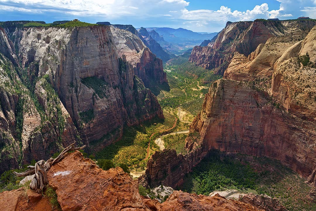
7. Observation Point →
Shuttle Stop 7
Distance: 6.7 Miles out and back, 2131 ft elevation gain
Time: 4-6 Hours
Difficulty: Strenuous
Traffic: Moderate to Crowded
Observation Point is a Zion classic giving you glimpses of Echo Canyon and rewarding you with a fantastic view of the park. This 8-mile round trip hike has a more than 2,100 feet elevation gain. The sharp ridge you see in the center is Angel’s Landing.
8. Kolob Arch →
Trailhead Coordinates: 37.4378783, -113.1920637, map
Distance: 15.1 Miles roundtrip, 1781 ft elevation gain
Time: Full Day
Difficulty: Moderate
Traffic: Moderate
Kolob Arch is the second longest arch in the world, although many still argue that it’s larger than Landscape Arch. You can reach the arch from Kolob Canyons Road at Lee Pass or the Hop Valley Trailhead, but both are 7-mile treks.

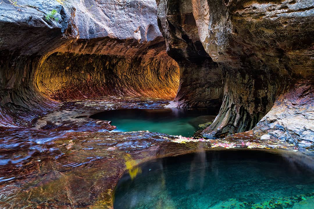
9. The Subway (Bottom-Up) →
Trailhead Coordinates: 37.2908319, -113.0968386, map
Distance: 7.0 Miles round trip, 1305 elevation gain
Time: Half Day
Difficulty: Strenuous
Traffic: Low
The subway is a gorge that looks like a subway tunnel. Although the bottom-up hike doesn’t require rappels or swims, you still hike through water and need a permit to hike. For more technical hikers, the Top to Bottom hike is also spectacular!
More: 11 Most Difficult Hiking Permits to Get in the US
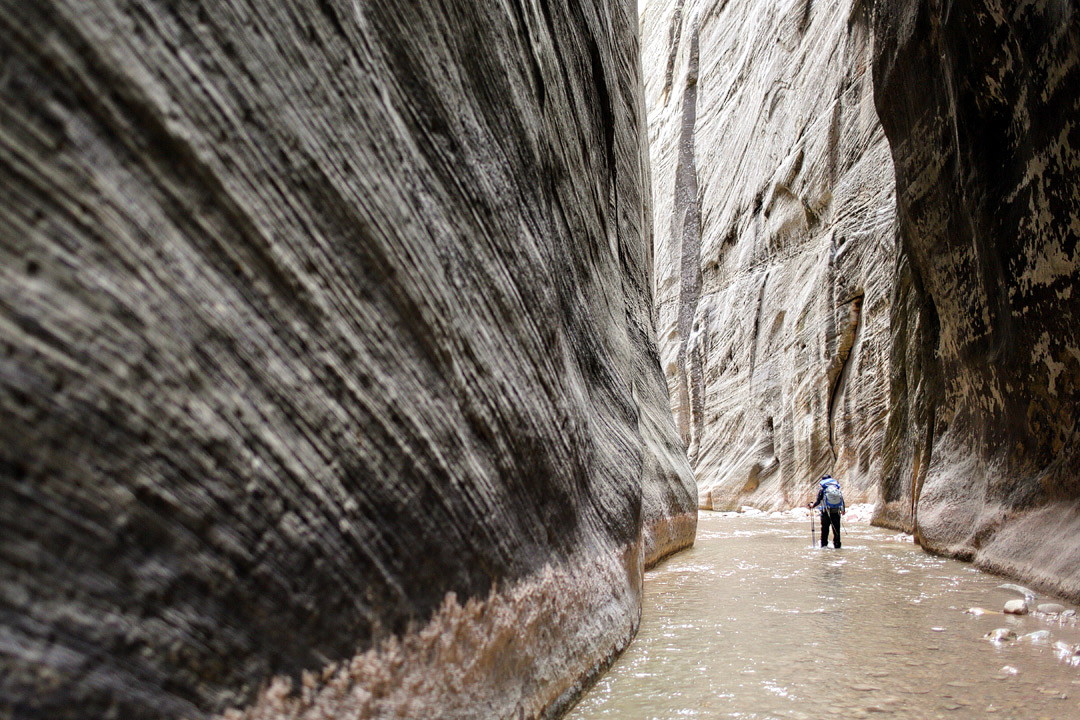
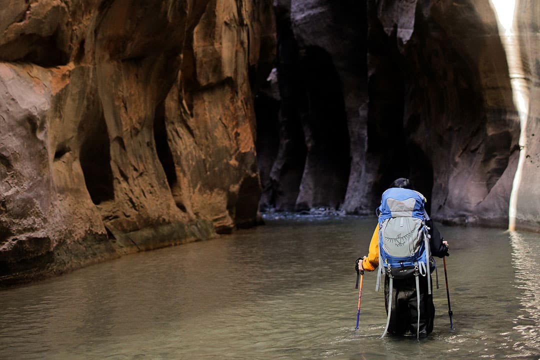
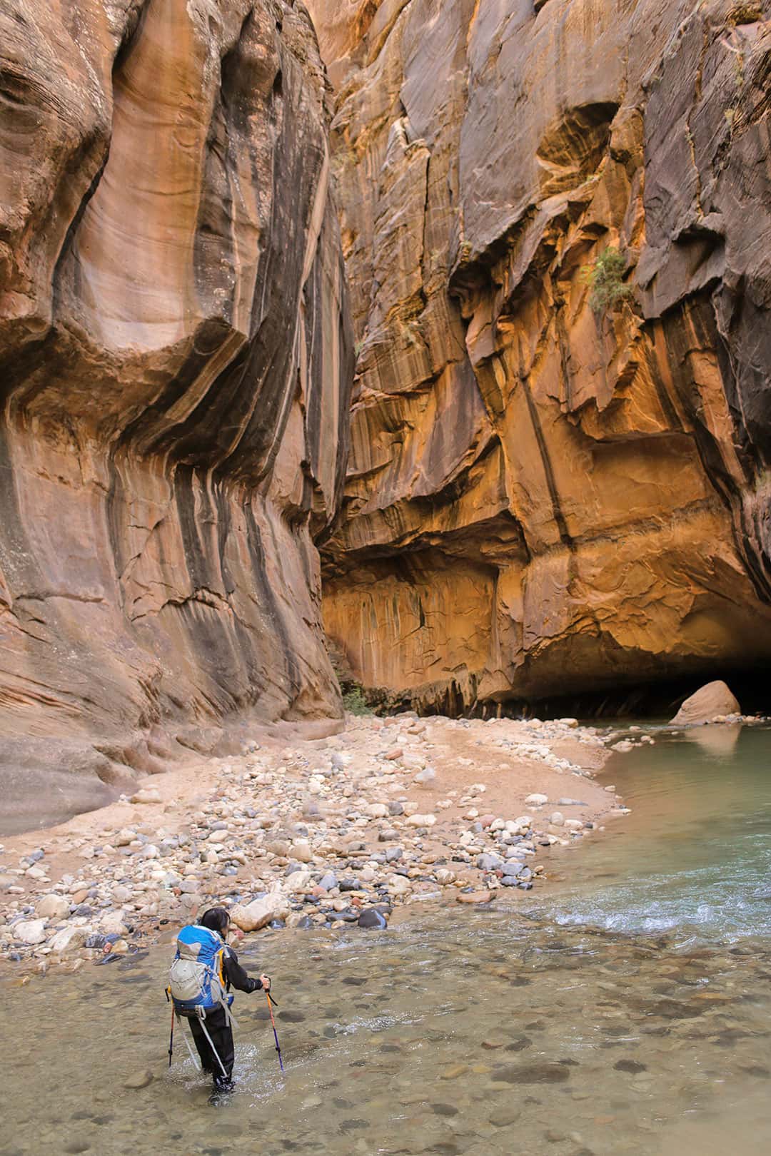
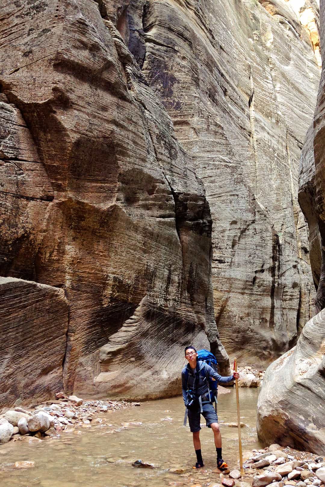
10. Zion Narrows (Bottom-Up) →
Shuttle Stop 9
Distance: 3-8 Miles
Time: 2-6 Hours
Difficulty: Moderate
Traffic: Very Crowded
Best Time to Go: April until Oct
This hike is perfect for a hot summer day. You can go as far up the river as you want before you turn around, but try to make it up to the most iconic portion called Wall Street. The brochure says this one is careful and moderate, but in our opinion, sometimes it’s easier to climb stairs for hours than tread through the water.
Local Tip: Hiking the Narrows depends on the water levels. Check the National Parks site for any trail closures.
More: Our 2-Day Narrows Backpacking Trip
5 Best Backpacking Trails
11. The Barracks →
Distance: 20 Miles
Time: 2-3 Days
Difficulty: Strenuous
Traffic: Low
The Virgin River has two main forks. The North Fork is most frequented because of The Narrows, but the East Fork offers equally beautiful canyons in much more solitude. There are also many side canyons to explore as you hike through the Parunaweap Canyon. The majority of this hike lies outside of Zion in its neighboring BLM.
12. La Verkin Creek Trail →
Distance: 18.6 miles round trip, 2326 ft elevation gain
Time: 2 Days
Difficulty: Moderate
Traffic: Low
When to Go: Year Round
Most people use this trail to visit Kolob Arch, but you can make it an overnight trip to take your time and soak in all the beauty. The campsites along the trail are superb, and you can tack on an additional 5 miles round trip hike to Beartrap Canyon falls.
13. The Trans-Zion Trek or Zion Traverse →
Distance: 48 Miles point to point
Time: 3-5 Days
Difficulty: Strenuous
Traffic: Low
This hike takes you through several trails in the park, bringing you from one corner of Zion to the other. You will need to get all the appropriate permits, but it’s well worth it as you will see portions of the park that most people don’t get a chance to experience.
14. West Rim Trail →
Distance: 16-18 Miles
Time: 2 Days
Difficulty: Strenuous
Traffic: Moderate
Best Time to Go: April to Oct
Starting at Lava Point, this trail has some of the best views in Zion, including canyons, springs, trees, and flowers. And you can add on a side trip to Angels Landing too!
15. Zion Narrows (Top-Down) →
Distance: 16 Miles
Time: 2 Days
Difficulty: Strenuous
Traffic: Moderate
Although you technically can do the entire hike as a day hike if you’re fast, but taking time to camp halfway through was really nice. The hike requires a permit, and you are in the water for a large portion of the hike. Check out our guide to the Narrows hike for more details.
More: Backpacking Gear List for the Zion Narrows Hike + Tips
Map of Zion National Park Hiking Trails
More Zion Hikes
Don’t forget to download the area on google maps or AllTrails+ to have lesser-known trails available offline.
- Archaeology Trail (0.3 mi RT, 52 ft, easy, shuttle stop #1)
- Lower Emerald Pool Trail (1.2 mi RT, 69 ft, east, shuttle stop #5)
- Grotto Trail (1 mi RT, 35 ft, easy, shuttle stop #5)
- Weeping Rock Trail (0.4 mi RT, 98 ft, easy, shuttle stop #7)
- Timber Creek Overlook (1.2 mi loop, 255 ft, easy)
- Riverside Walk (2.2 mi RT, 57 ft, easy, shuttle stop #9)
- Watchman Trail (3.3 mi RT, 368 ft, moderate, shuttle stop #1)
- Pa’rus Trail (3.5 mile RT, 147 ft, easy, shuttle stop #1)
- Middle Fork Taylor Creek Trail (4.9 mi RT, 715 ft, moderate)
- Northgate Peaks Trail (6.0 mi loop, 1118 ft elevation gain, moderate)
- Sand Bench Trail (7.6 mi RT, 466 ft, moderate, shuttle stop #5)
- Upper Emerald Pool Trail (1 mi RT, 200 ft, moderate, shuttle stop #6)
- Kayenta Trail (2 mi RT, 150 ft, moderate, shuttle stop #6)
- Canyon Overlook Trail (1 mi RT, 163 ft, moderate, no shuttle)
- Angels Landing (5.4 mi RT, 1,488 ft, difficult, shuttle stop #6)
- Hidden Canyon Trail (3 mi roundtrip, 931 ft elevation gain, difficult, shuttle stop 7) – closed due to large rockfall
- Observation Point (8 mi RT, 2148 ft, difficult, shuttle stop #7)
- The Narrows Bottom-Up (9.4 mi RT, 334 ft, difficult, shuttle stop #9)
- East Rim Trail (9.9 mi point to point, 1354 ft elevation gain, difficult)
- The Narrows Top Down (16 mi point to point, difficult)
- West Rim Trail (14.7 mi point to point, 1253 ft, difficult)
- Zion Traverse (48.7 point to point, 3110 ft, difficult)
Best Places to Stay in Zion
What’s Nearby
- St George (46.6 mi SW / 45 min, map)
- Kanab (41.7 mi SE / 1 hr, map)
- Bryce Canyon National Park (72.4 mi NE / 1 h 21 min, map)
- Glen Canyon National Recreation Area (89.4 mi E, 1 h 28 min, map)
- Antelope Canyon (113 mi, 1 h 58 min, map)
Planning Checklist
- Get comprehensive insurance for your trip.
- Download these helpful language apps.
- Find a great deal on Zion hotels.
- Arrange a rental car for your trip.
- Book a tour for your visit.
- Get airport lounge access.
- Buy a travel charger to keep your devices charged.
- Get a new backpack for your trip.
- Buy a Zion travel guide.
- Pack the appropriate shoes for your trip.
- Don’t forget your in-flight essentials.
What types of hikes do you typically like to do? Which of these Zion hikes above have you done or would you like to do?
DID YOU ENJOY THIS POST? PIN IT FOR LATER
SEE MORE NATIONAL PARK GUIDES
⟡⟡⟡⟡⟡
“Discovery consists not of seeking new lands but in seeing with new eyes” – M. Proust

Esther + Jacob
Esther and Jacob are the founders of Local Adventurer, one of the top 5 travel blogs in the US. They believe that adventure can be found near and far and hope to inspire others to explore locally. They explore a new city in depth every year and currently base themselves in Las Vegas.
Follow on Instagram (E + J), YouTube, TikTok, and Pinterest.