
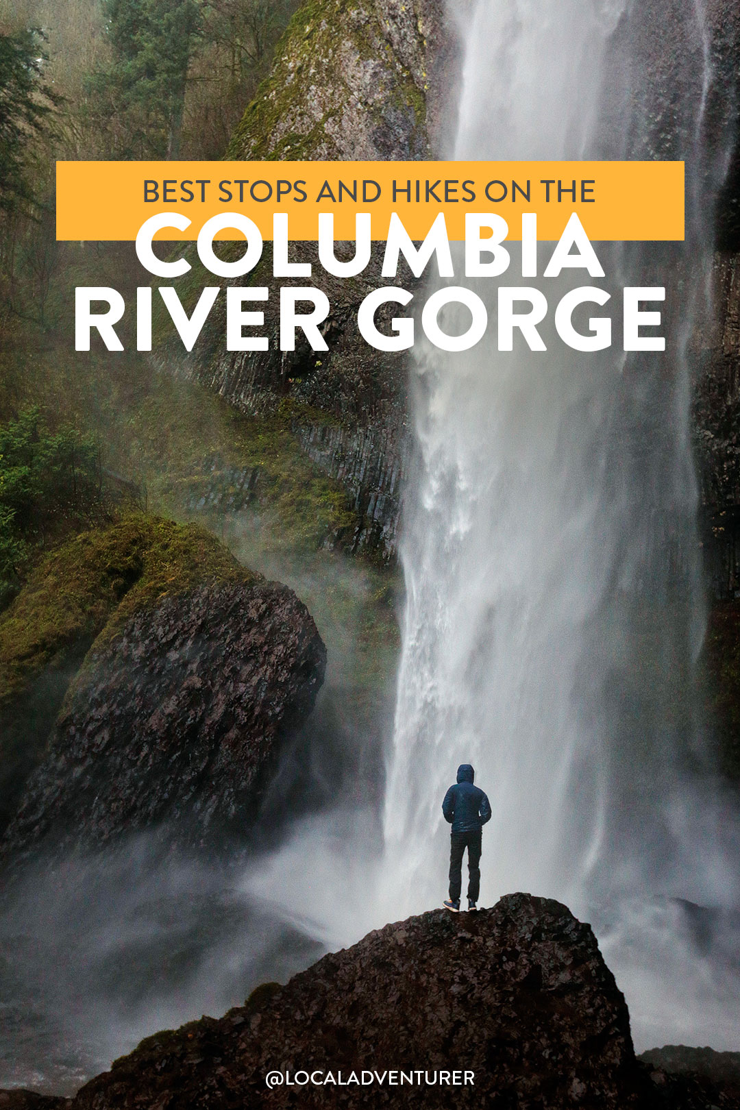
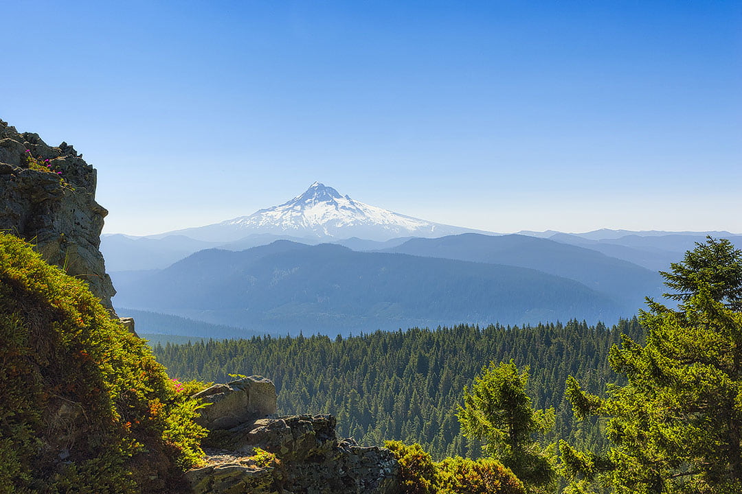
Plan on Hiking in the Columbia River Gorge? Don’t miss these amazing hikes!
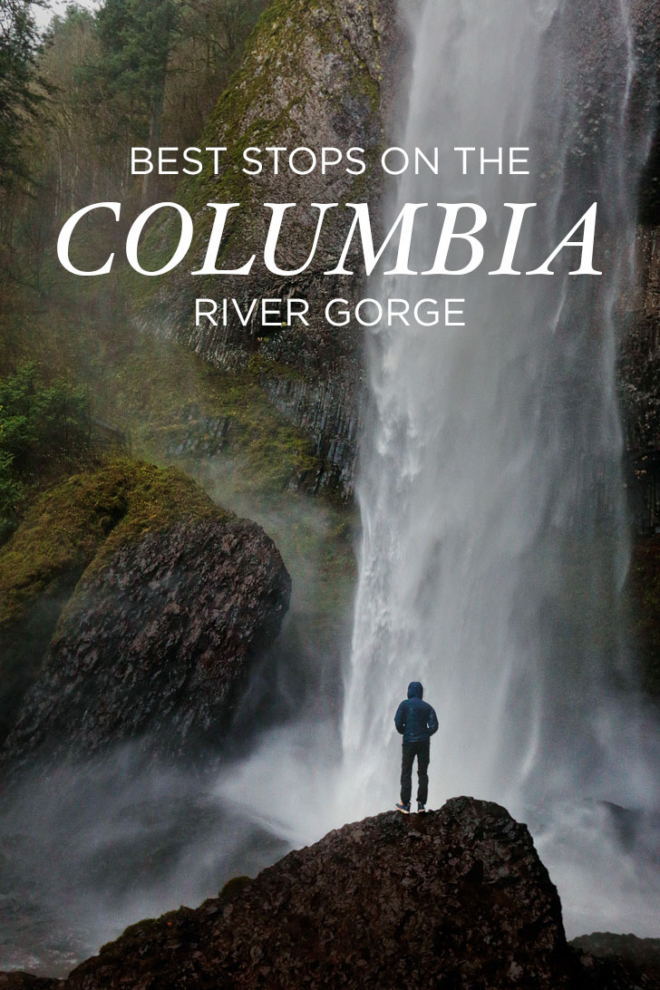
The Columbia River Gorge is full of amazing hikes, waterfalls, and views. When we have any free time, we tend to head out to the Gorge. It’s our favorite area to explore in Oregon since it’s such an easy and scenic drive from Portland. If you’re trying to figure out your next hike to do, here’s a list of the best stops and why they made our list.
Note: Due to fires and natural disasters, it’s always a good idea to check the USDA site to see which trails are currently open.
This post may contain affiliate links, where we receive a small commission on sales of the products that are linked at no additional cost to you. All opinions are always our own. Read our full disclosure for more info. Thank you for supporting the brands that make Local Adventurer possible.
Last Updated: February 16, 2026
TLDR
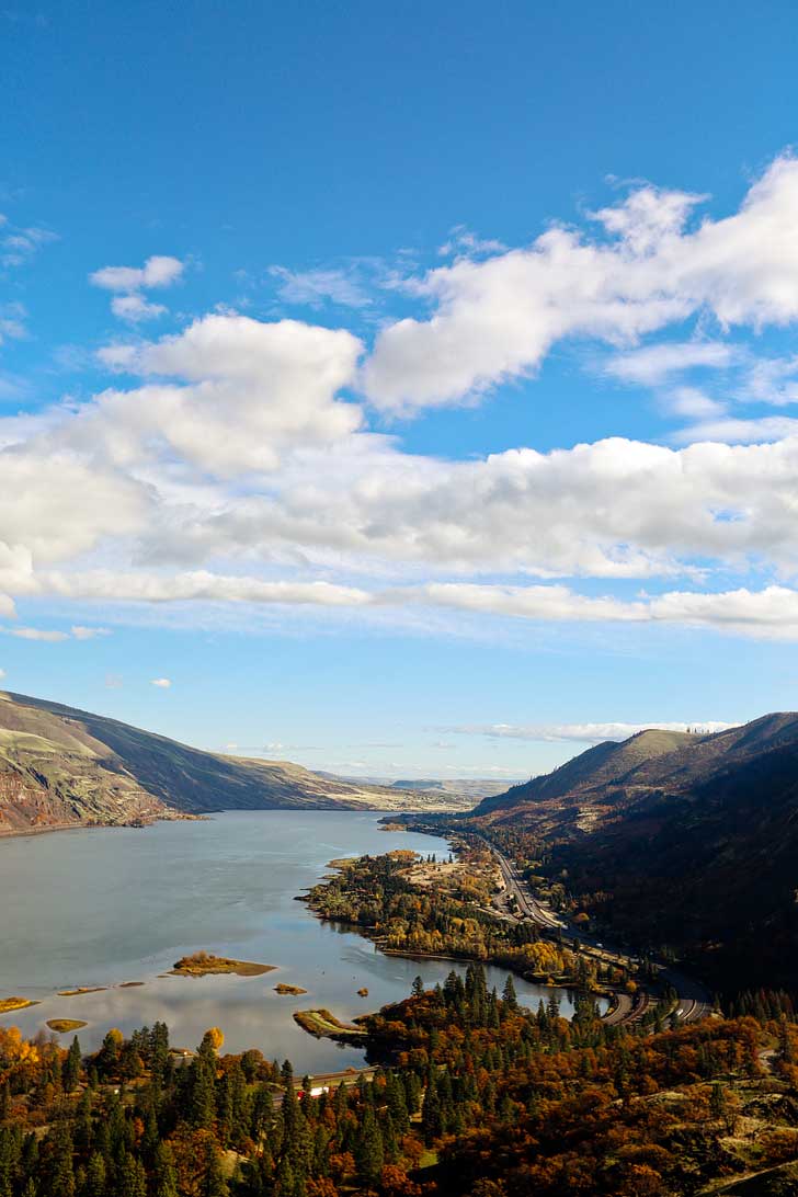
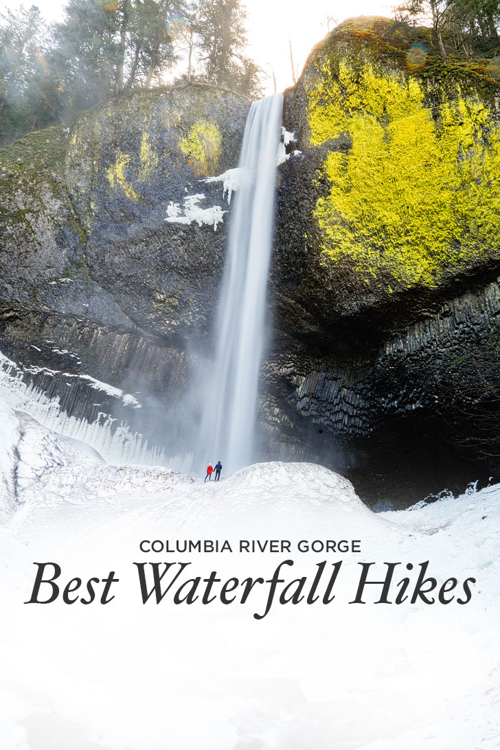
📍 Location – The Columbia River Gorge is located on the border between Oregon and Washington, stretching east from the Portland metro area along the Columbia River. It’s a hiker’s paradise with lush forests, dramatic cliffs, and over 90 waterfalls, including the iconic Multnomah Falls.
🥾 Our Fave Hikes – Latourell Falls, Wachlella Falls, Rowena Crest Viewpoint, Oneonta Gorge, Dog Mountain
🦬 Wildlife – deer, black bears, bald eagles, ospreys, river otters, beavers, and a variety of songbirds and waterfowl
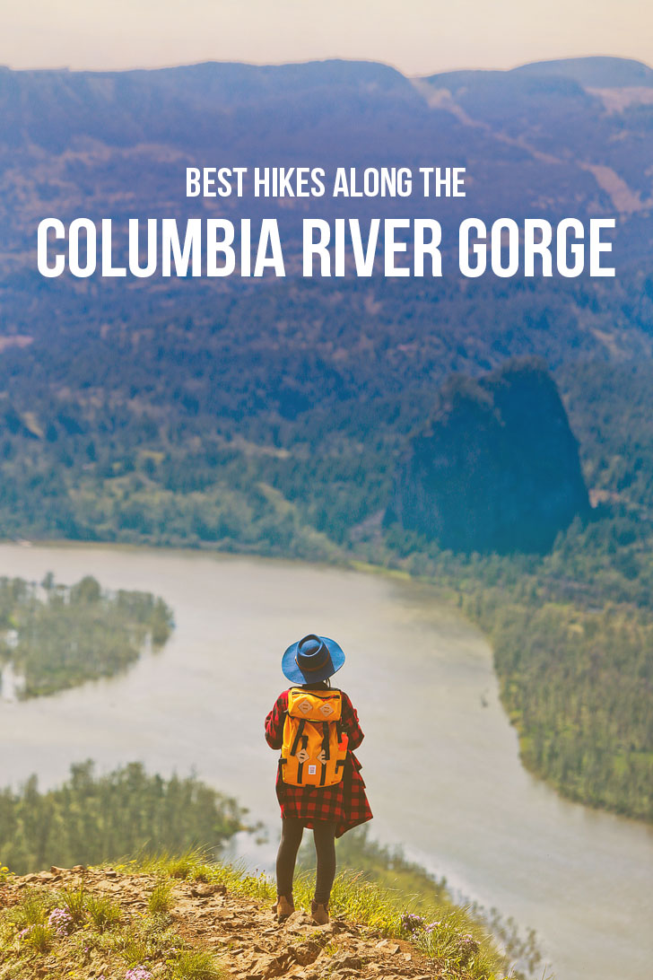
21 Best Hikes in the Columbia River Gorge
We’ve broken down the hikes into three categories: Easy, Moderate, and Difficult. You can click on the links in the content menu above to skip to each section.
Best Easy Hikes in the Columbia River Gorge
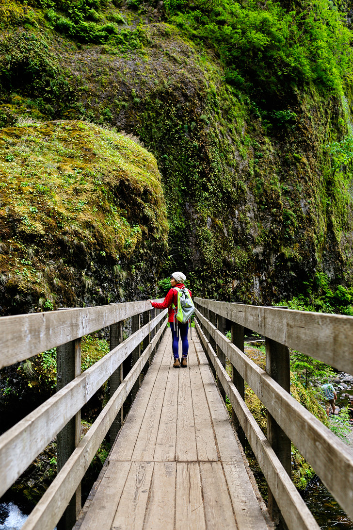
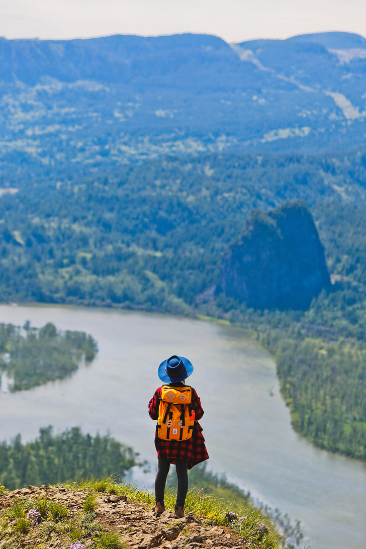
1. Latourell Falls – CLosest to the city (pictured above) →
Trailhead Coordinates: 45.538804, -122.217923, map
Distance: 2.4 mile loop
Elevation Gain: 520 ft
Difficulty: Easy
Seasons: Year Round (except during winter storms)
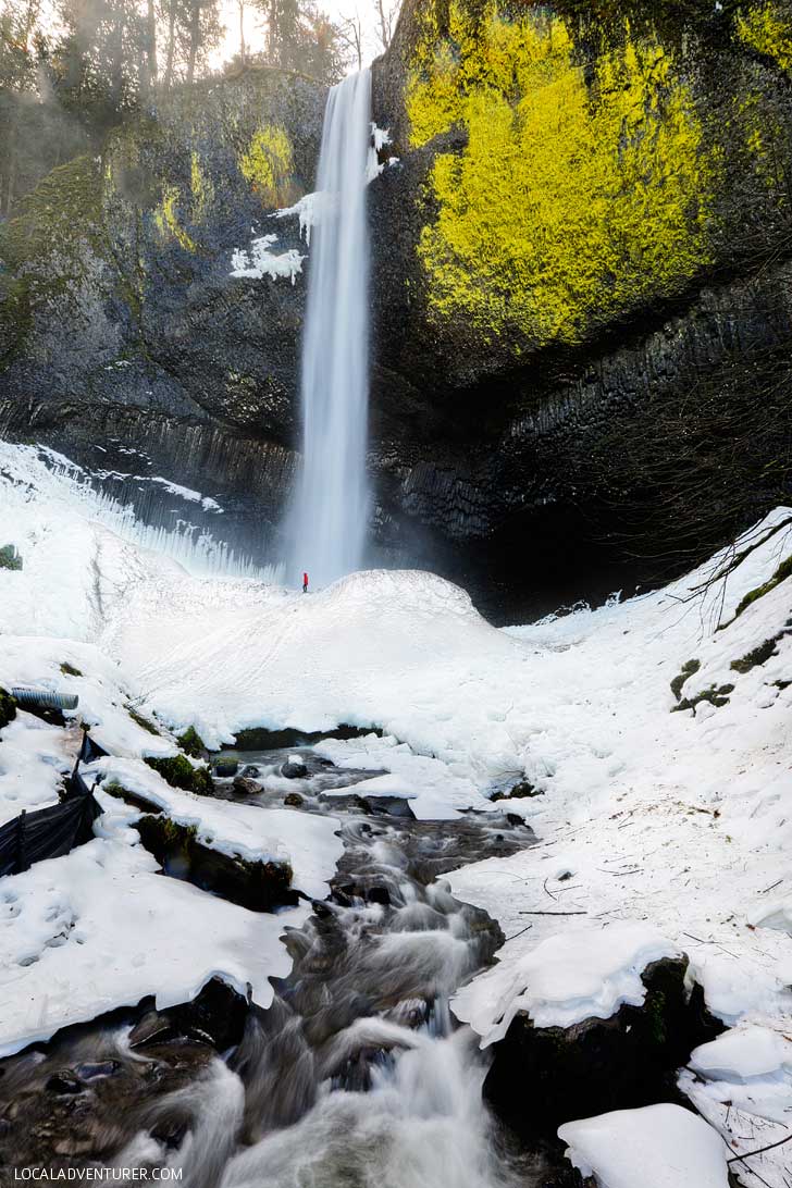
What You’ll See: You’ll find two waterfalls here. The first is just a short walk from the parking lot, the second can be found up the trail. Since this one was so close to the city, we visited different times of the year to see it in different seasons. If you go during the winter, be sure you have crampons.
See More: How to Hike to Latourell Falls

2. Wahclella Falls – Best Photo Ops →
Trailhead Coordinates: 45.63060, -121.95382, map
Distance: 2 mile loop
Elevation Gain: 250 ft
Difficulty: Easy
Seasons: Year Round
What You’ll See: This is one of our favorite hikes in the Columbia River Gorge. You’ll see two waterfalls, including multiple viewpoints of Wahclella Falls. We love how many different photo ops there are.
See More: Your Guide to the Wahclella Falls Hike
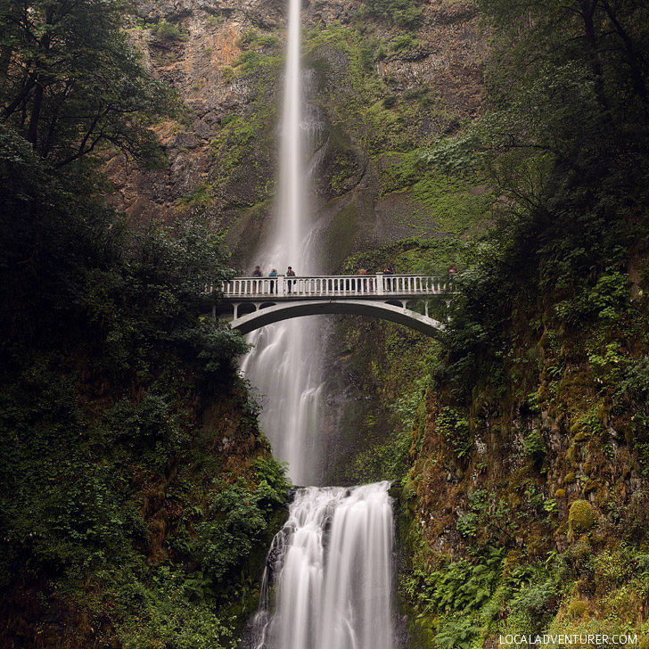
3. Multnomah Falls Hike – Touristy but Can’t Miss
Trailhead Coordinates: 45.577617, -122.117242, map
Distance: 2.4 miles round trip
Elevation Gain: 870 ft
Difficulty: Easy to Moderate
Seasons: Year Round
What You’ll See: Oregon’s most recognizable waterfall. It is the tallest in the state and often crowded. You can see the falls with no effort from the bottom, or do the hike to see more of the waterfall. During the summer, timed use permits are required.
4. Ponytail Falls – A Waterfall You Can Go Behind
Trailhead Coordinates: 45.590247, -122.068229, map
Distance: 0.8 mile round trip
Elevation Gain: 360 ft
Difficulty: Easy
Seasons: Year Round
What You’ll See: This nice and easy hike takes you to a waterfall that has a trail leading behind it, which makes it unique from the others in the gorge.
See More: 15 Best Day Trips from Portland
5. St Cloud Trail – Beach with a View
Trailhead Coordinates: 45.600294, -122.111986, map
Distance: .5 mile loop
Elevation Gain: 50 ft
Difficulty: Easy
Seasons: Year Round
What You’ll See: Hike to orchards, enjoy a beach along the gorge, and even get a glimpse of Multnomah Falls from across the water.
See More: The Ultimate Portland Bucket List
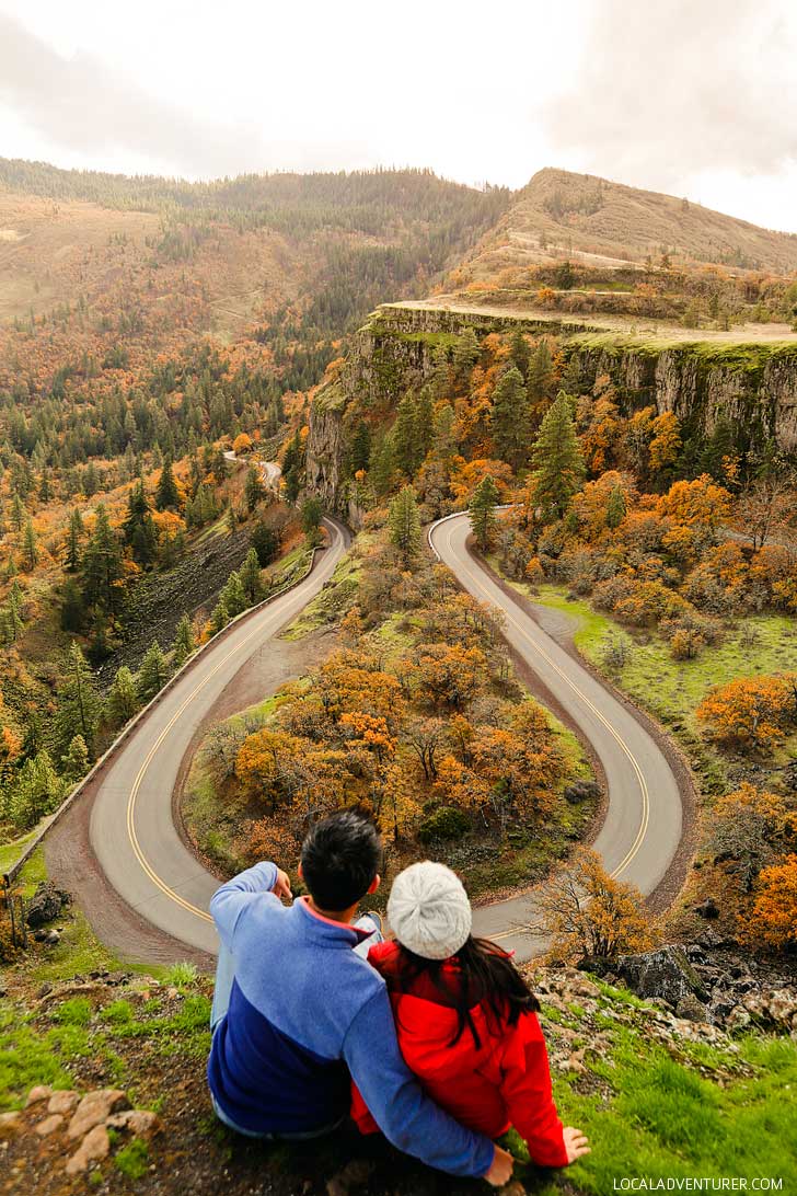
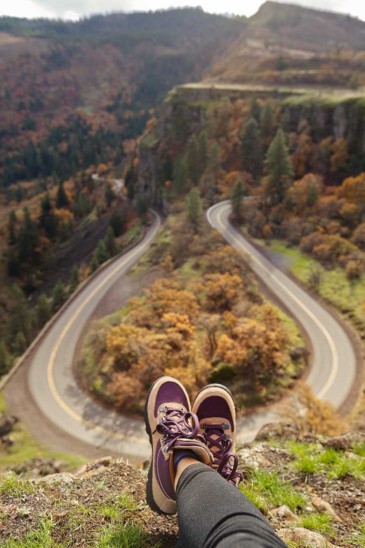
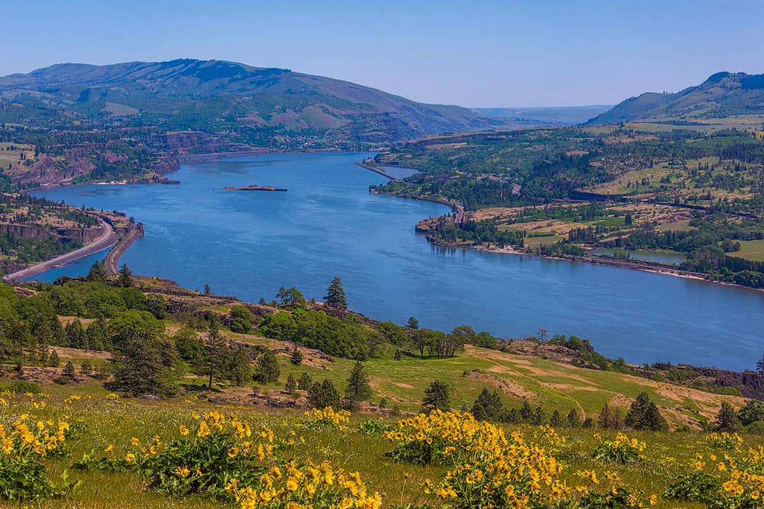
6. Rowena Crest Viewpoint – for the Gram →
Trailhead Coordinates: 45.600294, -122.111986, map
Distance: 1 mile
Elevation Gain: 100 ft
Difficulty: Easy
Seasons: Year Round
What You’ll See: Very picturesque road and great views of the gorge. During the season, it’s also a great spot to see wildflowers. Plus it has an iconic shot of the hairpin turn in the road.
See More: Your Photo Guide to the Rowena Crest Viewpoint
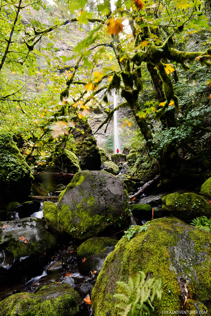
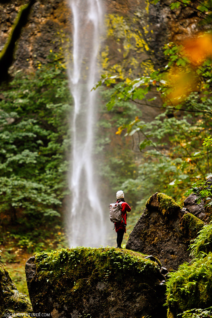
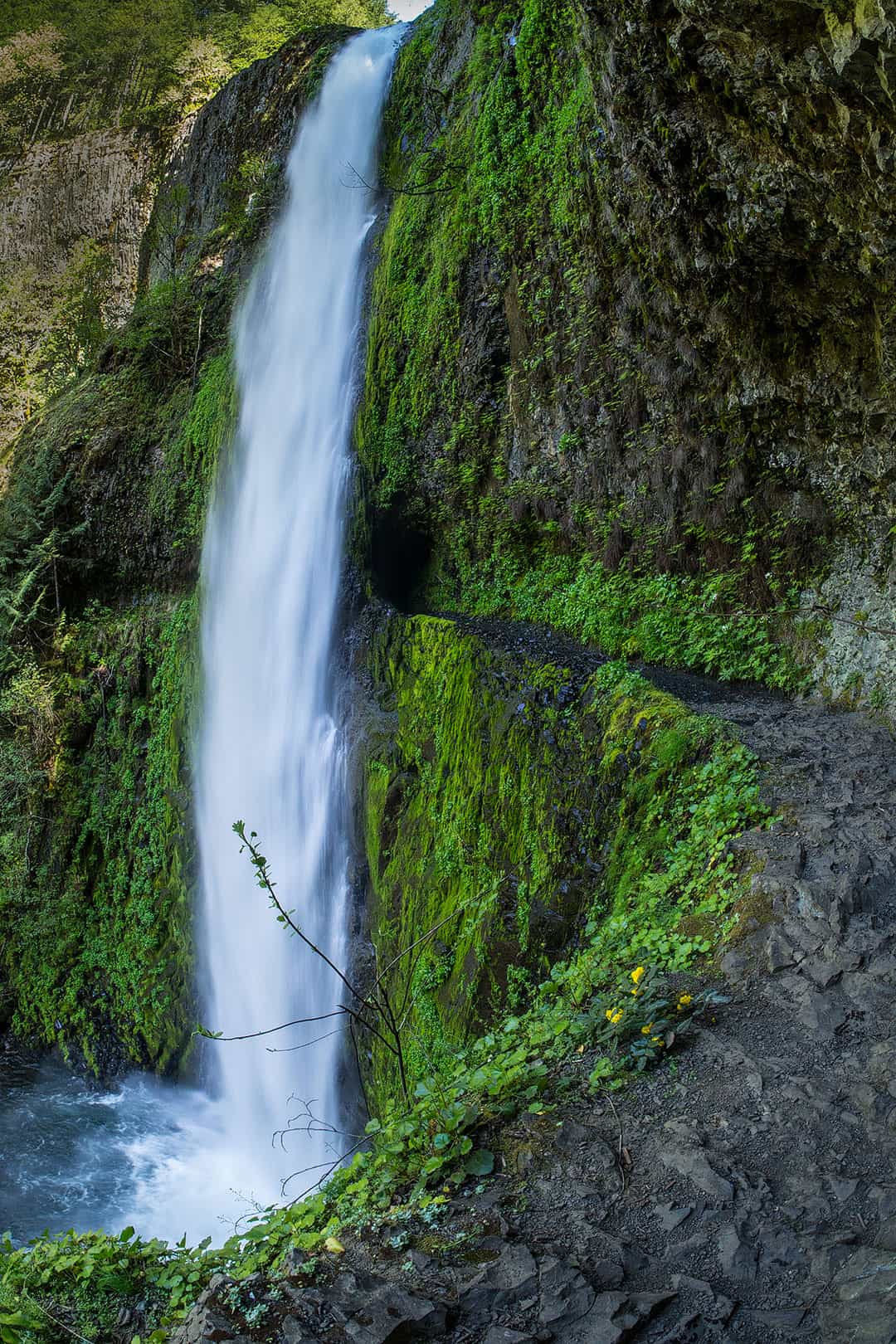
7. Elowah Falls – Short but Sweet →
Trailhead Coordinates: 45.612425, -122.004528, map
Distance: 1.4 mile round trip
Elevation Gain: 280 ft
Difficulty: Easy
Seasons: Year Round
What You’ll See: Moss, fern, and a beautiful waterfall in an amphitheater.
See More: How to Hike to Elowah Falls
Best Moderate Hikes in the Columbia River Gorge
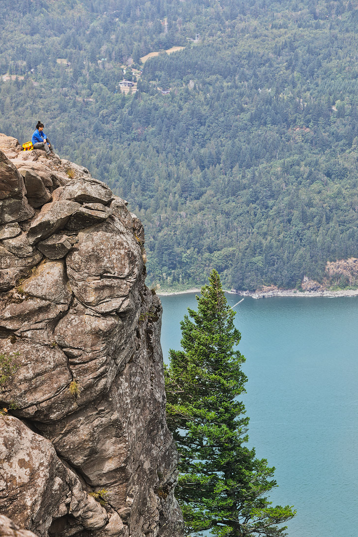
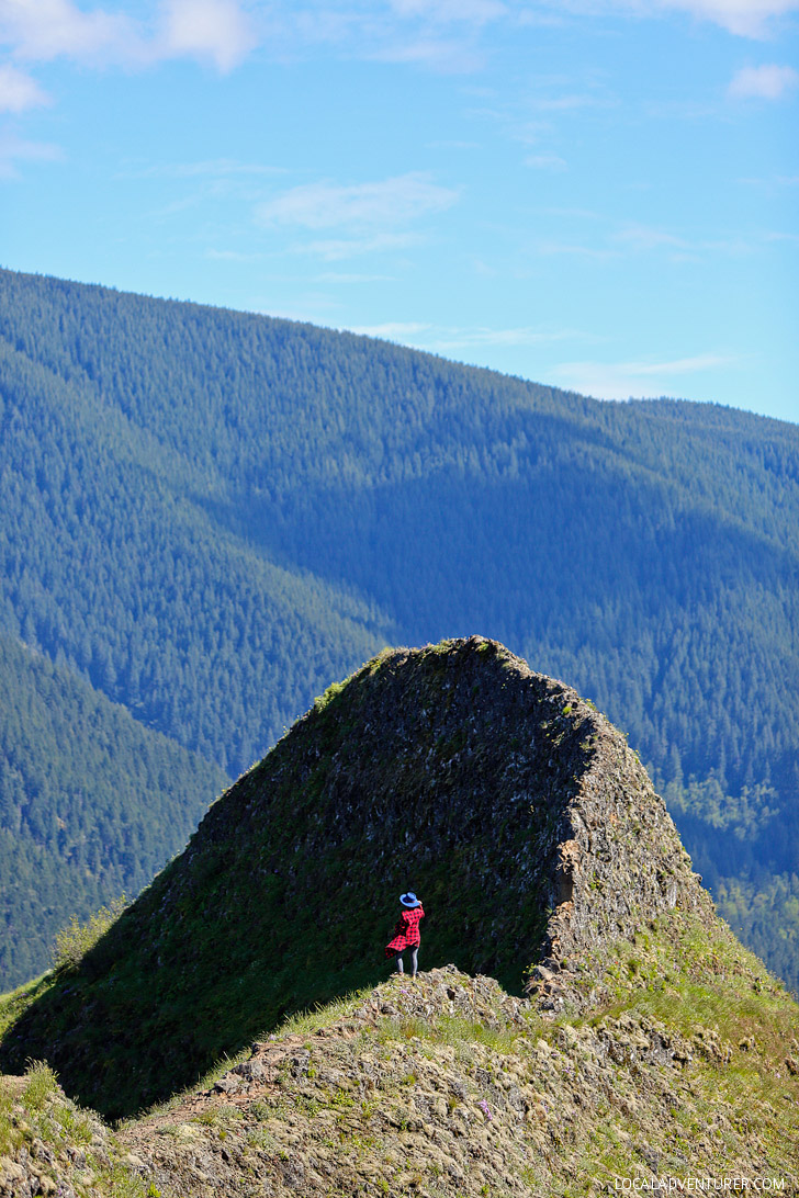
8. Angel’s Rest – Best View of the Gorge →
Trailhead Coordinates: 45.5602273, -122.1748379, map
Distance: 4.8 miles round trip
Elevation Gain: 1450 ft
Difficulty: Moderate
Seasons: Year Round
What You’ll See: An exposed bluff that gives you 270-degree panoramic views.
See More: How to Do the Angels Rest Hike

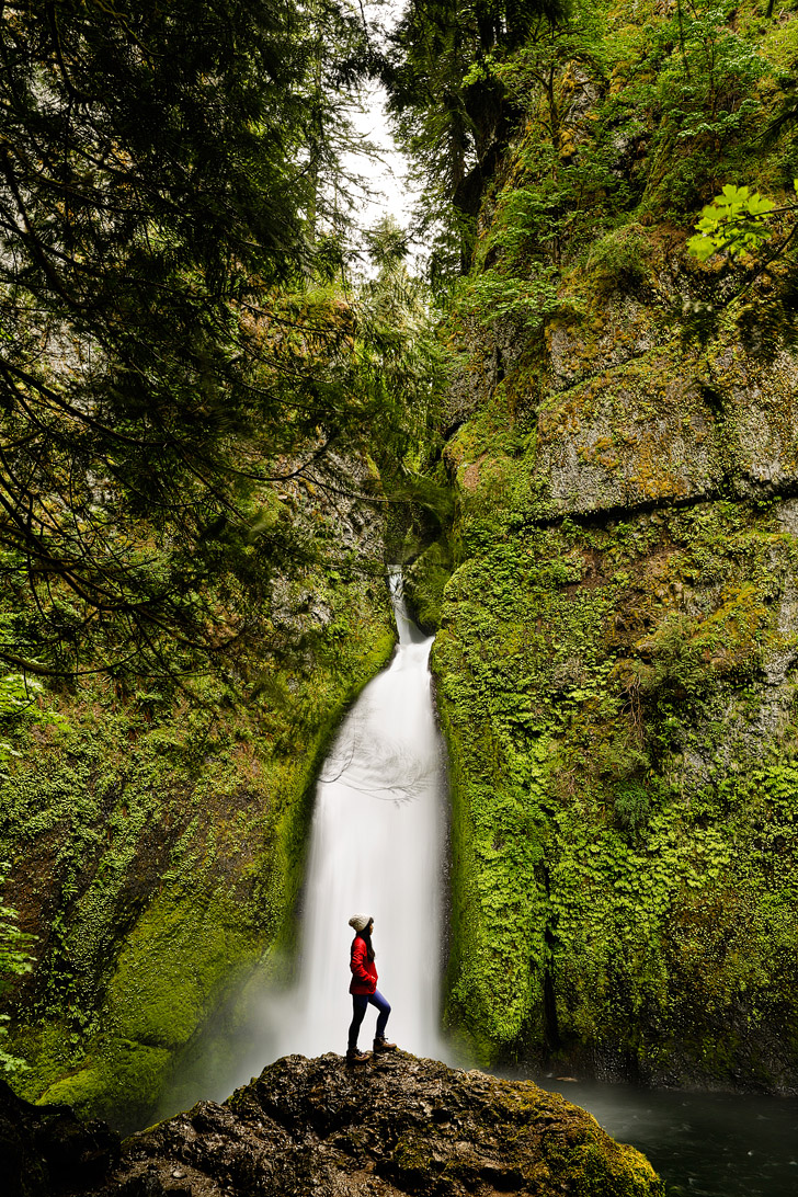
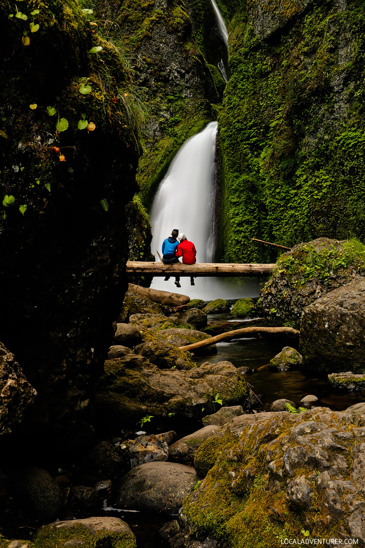
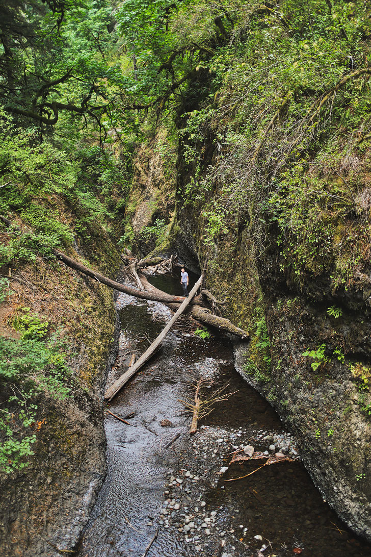
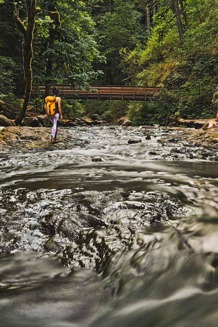
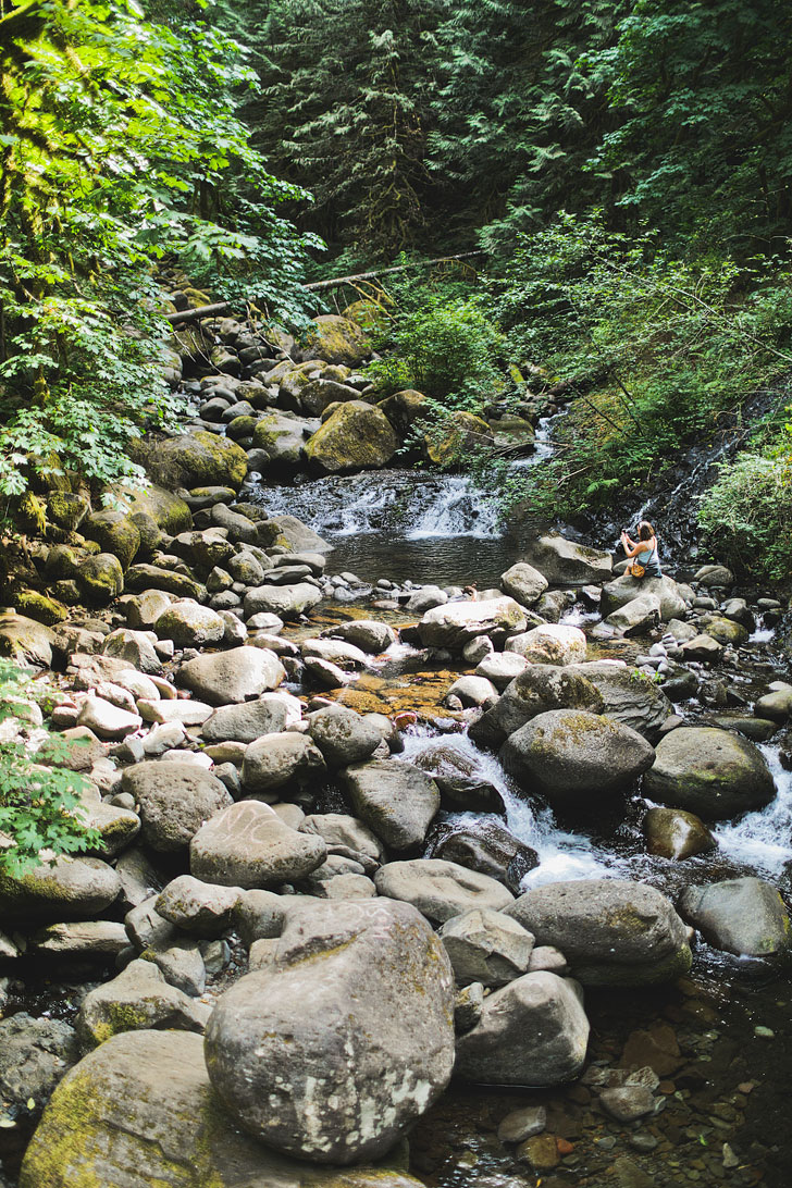
9. Oneonta Gorge Hike – For Some Adventure →
Trailhead Coordinates: 45.5889484, -122.0768179, map
Distance: 1 mile round trip
Elevation Gain: 0 ft
Difficulty: Moderate
Seasons: August to October
What You’ll See: A very popular hike where you climb over a log jam and wade (or swim) through water to reach this waterfall. Great on hot days!
See More: How to Hike to Oneonta Gorge

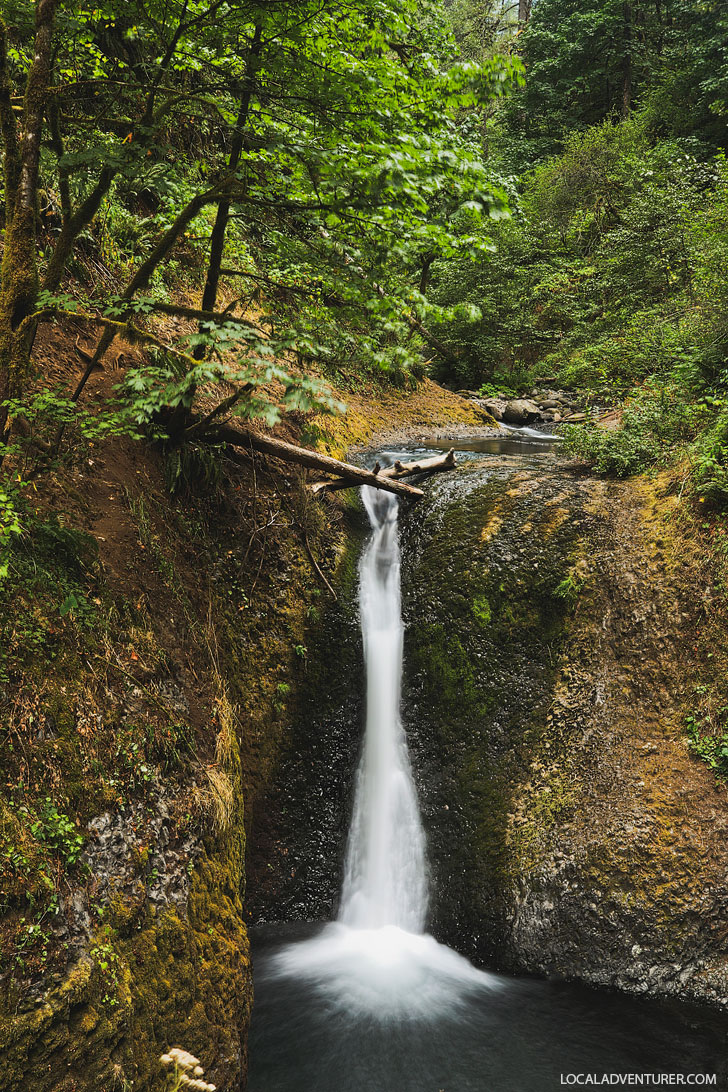
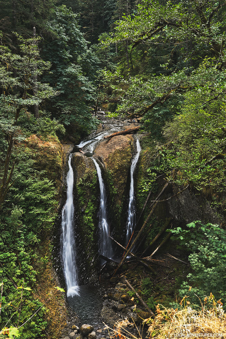
10. Triple Falls Hike – Because 3 is Better Than 1 →
Trailhead Coordinates: 45.58849, -122.0806787, map
Distance: 3.2 miles round trip
Elevation Gain: 610 ft
Difficulty: Moderate
Seasons: Year Round
What You’ll See: Much less crowded and you get to see a triple waterfall. You can also see Middle Oneonta and Upper Oneonta Falls along the way.
See More: How to Hike the Stunning Triple Falls Trail in Oregon
11. Beacon Rock Hike – Climb a Monolith (WA Side)
Trailhead Coordinates: 45.628520, -122.022228, map
Distance: 1.8 mile round trip
Elevation Gain: 680 ft
Difficulty: Moderate
Seasons: Year Round
What You’ll See: This is one of the most prominent geological features in te gorge. The 848-foot monolith was once the core of a volcano.
See More: 25 Free Things to Do in Portland Oregon
12. Cape Horn – Close to Portland
Trailhead Coordinates: 45.58852,-122.1809287, map
Distance: 7.1 mi loop
Elevation Gain: 1350 ft
Difficulty: Moderate
Seasons: Year Round but Lower Part of the loop is closed Feb 1 to July 15
What You’ll See: Gorgeous views, rocky crags, steams and two waterfalls.
See More: Your Ultimate Oregon Coast Road Trip
13. Coyote Wall – Walk the CLiffs (WA Side)
Trailhead Coordinates: 45.6999519,-121.4055847, map
Distance: 7.8 miles lollipop loop
Elevation Gain: 1,640 ft
Difficulty: Moderate
Seasons: Year Round
What You’ll See: See expansive views, wildflowers in the spring, and steep walls and drop-offs.
See More: 15 Amazing Weekend Trips from Portland Oregon
14. Eagle Creek to Tunnel Falls Hike – Waterfalls Around Every Corner
Trailhead Coordinates: 45.636729, -121.919665, map
Distance: 12 miles round trip
Elevation Gain: 1,775 ft
Difficulty: Moderate
Seasons: Year Round
What You’ll See: Multiple waterfalls, tall basalt cliffs, bridges over beautiful streams, and unique geological formations.
See More: 25 Most Popular Spots to Instagram Portland Oregon
Difficult Hikes + Backpacking in the Gorge
15. Munra Point – FOr the THrills →
Trailhead Coordinates: 45.636729, -121.919665, map
Distance: 6 miles round trip
Elevation Gain: 2,270 ft
Difficulty: Difficult, Unmaintained Trail
Seasons: Year Round but hazardous when wet
What You’ll See: A dramatic ridge and beautiful views of the gorge. There was quite a bit of scrambling on this hike and I can see why it would be dangerous if it’s raining.
See More: How to Do the Munra Point Hike
16. Eagle Creek to Wahtum Lake Hike – Go Backpacking
Trailhead Coordinates: 45.6367682, -121.9217929, map
Update: The trail is currently closed.
Distance: 26.5 mile loop
Elevation Gain: 5,310 ft
Difficulty: Difficult
Seasons: Year Round
What You’ll See: See waterfalls, basalt columns, streams, and a beautiful lake. There are campgrounds in Eagle Creek but they are currently closed for the season.
17. Table Mountain – A Taste of the PCT
Trailhead Coordinates: 45.65032, -121.9360787, map
Distance: 15.5 miles round trip
Elevation Gain: 4,320 ft
Difficulty: Difficult
Seasons: April to October
What You’ll See: Dip your feet in Gilette Lake, enjoy Greenleaf Falls, see Wauna Point, and hike a portion of the PCT.
See More: The Ultimate Portland Food Bucket List
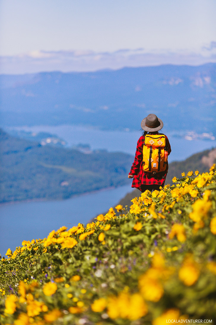
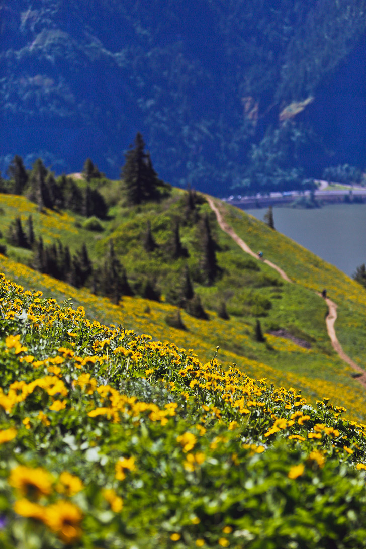
18. Dog Mountain – Wildflower Heaven (WA Side) →
Trailhead Coordinates: 45.6992035,-121.7101839, map
Distance: 6.9 mi
Elevation Gain: 2800 ft
Difficulty: Difficult
Seasons: Year Round but Mid-May to Early June for Wildflowers
What You’ll See: Northwest Balsamroot and other Wildflowers, Views of the Gorge
See More: Dog Mountain Hike Washington – Best Wildflowers Near Portland

19. Waucoma Lakes Loop Hike – For the Lake Lovers
Trailhead Coordinates: 45.6260037, -121.7610187, map
Distance: 16.5 miles loop
Elevation Gain: 4,737 ft
Difficulty: Difficult
Seasons: Summer and Fall
What You’ll See: Visit four lakes along the Waucoma Ridge and enjoy the amazing views.
20. Rock of Ages Loop Hike – All About the Rocks
Trailhead Coordinates: 45.5902456, -122.0703989, map
Update: The trail is currently closed.
Distance: 10 miles loop
Elevation Gain: 3,000 ft
Difficulty: Difficult
Seasons: April to October
What You’ll See: Amazing rock structures, including an arch, a beautiful backbone, and more.
See More: Where to Find the Best Views in Portland
21. Larch Mountain Hike – Iconic Falls and Amazing Views
Trailhead Coordinates: 45.5789337, -122.1205987, map
Distance: 14.4 miles round trip
Elevation Gain: 4,055 ft
Difficulty: Difficult
Seasons: April to November
What You’ll See: See iconic waterfalls then end with an amazing 360-degree view.
Map of the Columbia River Gorge
More Easy Hikes You Can Add On
- Catherine Creek State Park, Washington – 90 species of wildflowers between Feb and July
- She Who Watches – guided tours to see petroglyph/pictograph that is run twice a week in April to October (Fri and Sat 10 AM)
- Bridal Veil Falls – 120 ft cascading falls – not our favorite waterfall/hike, but it’s close to many of the others
- The Hood River Spit – popular beach for windsurfers
- Women’s Forum State Scenic Viewpoint – see Vista House and Beacon Rock from here
- Gibbons Creek Wildlife Art Trail, Steigerwald Lake National Wildlife Refuge – easy, kid-friendly, lots of wildlife
- Horsetail Falls – a waterfall right along the road
- Little Beacon Rock Loop Hike – see Beacon Rock’s much smaller and older neighbor
- Pool of the Winds Hike – easy hike to see two waterfalls
- Eagle Creek Overlook Hike – get views of the Bonneville Dam
Essential Tips for Hiking in Oregon
- Download AllTrails+ to have access to trail maps offline.
- Waterfalls are fuller during winter, but the weather is also rainier. Early summer or fall is best since you might get decent weather and the waterfalls aren’t a trickle, otherwise, don’t forget your rain jackets!
- Solid hiking shoes are really helpful. These waterproof ones are our go-to year-round.
- In the winter, the trails can be iced over, so hike with crampons.
- There are commonly landslides or fires and sometimes trails are closed. Check this site for current closures.
- This is our go-to adventure camera backpack. It’s water-resistant so it’s good for light rain and mist from the waterfalls, but you can easily throw on a rainfly when you head more protection.
- If you’re taking photos, don’t forget a waterproof casing or cover to protect your camera. Even if it’s not raining, many of the waterfalls have a ton of mist. It also helps to have a tripod and ND filters if you’re hoping to shoot waterfalls.
Best Places to Stay in the COlumbia River Gorge
Planning Checklist
- Get comprehensive insurance for your trip.
- Download these helpful language apps.
- Find a great deal on Portland hotels.
- Arrange a rental car for your trip.
- Book a tour for your visit.
- Get airport lounge access.
- Buy a travel charger to keep your devices charged.
- Get a new backpack for your trip.
- Buy a PNW travel guide.
- Pack the appropriate shoes for your trip.
- Don’t forget your in-flight essentials.
Which of these Oregon hikes have you done? Any hikes we should add?
Did you enjoy this post? Pin it for later

SEE MORE Portland GUIDES
⟡⟡⟡⟡⟡
“Discovery consists not of seeking new lands but in seeing with new eyes” – M. Proust

Esther + Jacob
Esther and Jacob are the founders of Local Adventurer, one of the top 5 travel blogs in the US. They believe that adventure can be found near and far and hope to inspire others to explore locally. They explore a new city in depth every year and currently base themselves in Las Vegas.
Follow on Instagram (E + J), YouTube, TikTok, and Pinterest.
21 hiking trails in one area! Damn, that’s a lot! Oregan is as great for hikers as people say! I have hiked my way in many places in the world but I have never been to the US due to its visa process but it’s good to know great places to hike when I finally make it there. :)
I hope you get a visa to make it here. Oregon is one of the best states for people who love the outdoors.
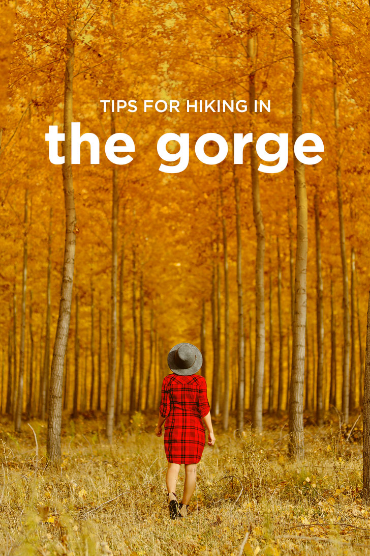
Can you tell me where you took the pictyre of the orange trees and The red dress.. Gorgeous!
It’s in Boardman, Oregon. Thank you, Destiny. :)
River, mountains, falls … Such a Beautiful palace. Awesome.
The hyperlink for the coordinates to Ponytrail Falls isn’t right. If I copy-paste the coordinates into google maps (45.59044,-122.0707587), that works fine, but the hyperlink (https://www.google.com/maps/place/4°00'00.0“N+5°35’25.6″E/@4,5.5882557,17z) takes me to a point off the coast of Nigeria. Great reference article overall. Cheers!
Thanks Caleb for pointing that out!! Will have that changed right away. :)
Nice post. This was really helpful post, thanks!
Amazing post! Thanks for sharing!
Thanks, Anna! :)
I love this list.
So usefull!
AMAZING PHOTOS….
Thank you!