
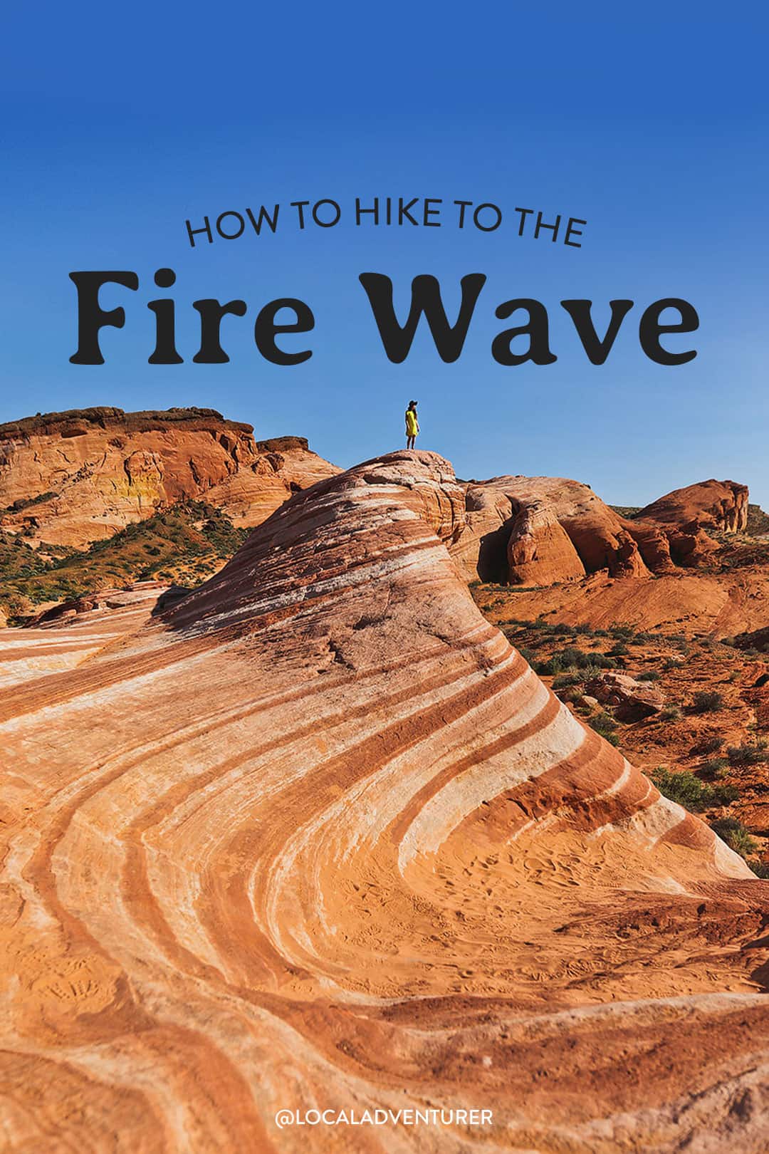
Want to know how to hike the Fire Wave at Valley of Fire State Park?
Most people who visit Las Vegas know about Red Rock Canyon, which offers some great hikes within half an hour of the Strip. But if you’re willing to drive an hour away, you’ll find yourself in the magical Valley of Fire State Park, which includes one of the unique landmarks in the Southwest, the Fire Wave.
This post may contain affiliate links, where we receive a small commission on sales of the products that are linked at no additional cost to you. All opinions are always our own. Read our full disclosure for more info. Thank you for supporting the brands that make Local Adventurer possible.
Last Updated: May 26, 2026
About Valley of Fire and the Fire Wave
Valley of Fire is Nevada’s oldest and largest state park. Besides Red Rock, which is part of Vegas, it’s our go-to spot to take our out-of-towners. We’ve been a lot since it’s so convenient, and we’re still surprised when we find new spots to explore in the park.
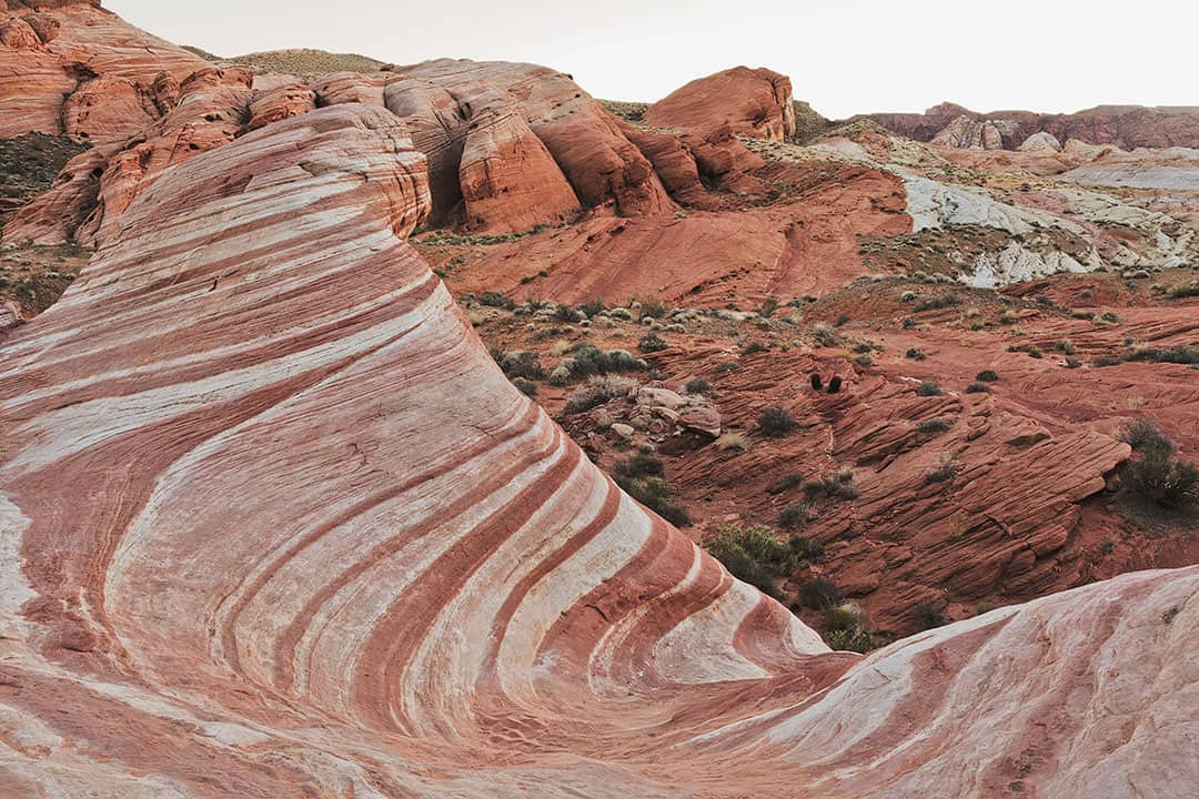
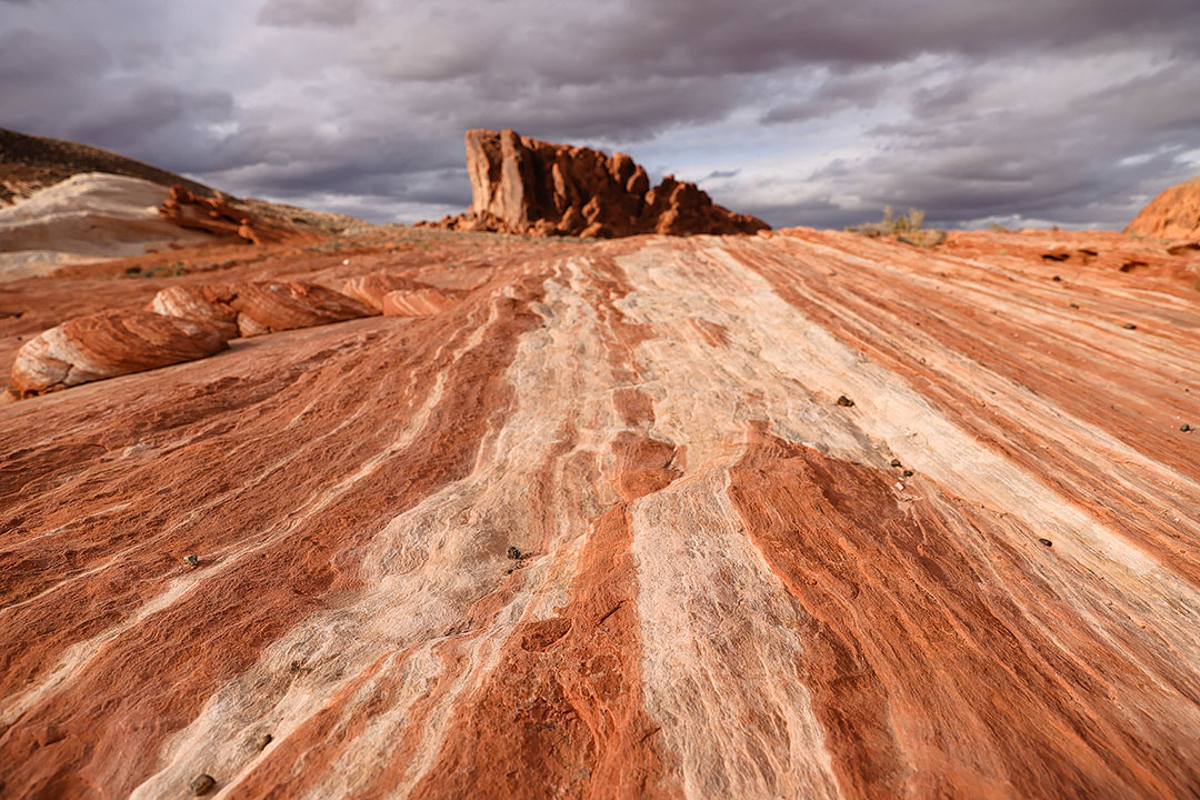
The first major sites people see are rock structures like the Fire Wave, the White Domes, Arch Rock, and Elephant Rock.
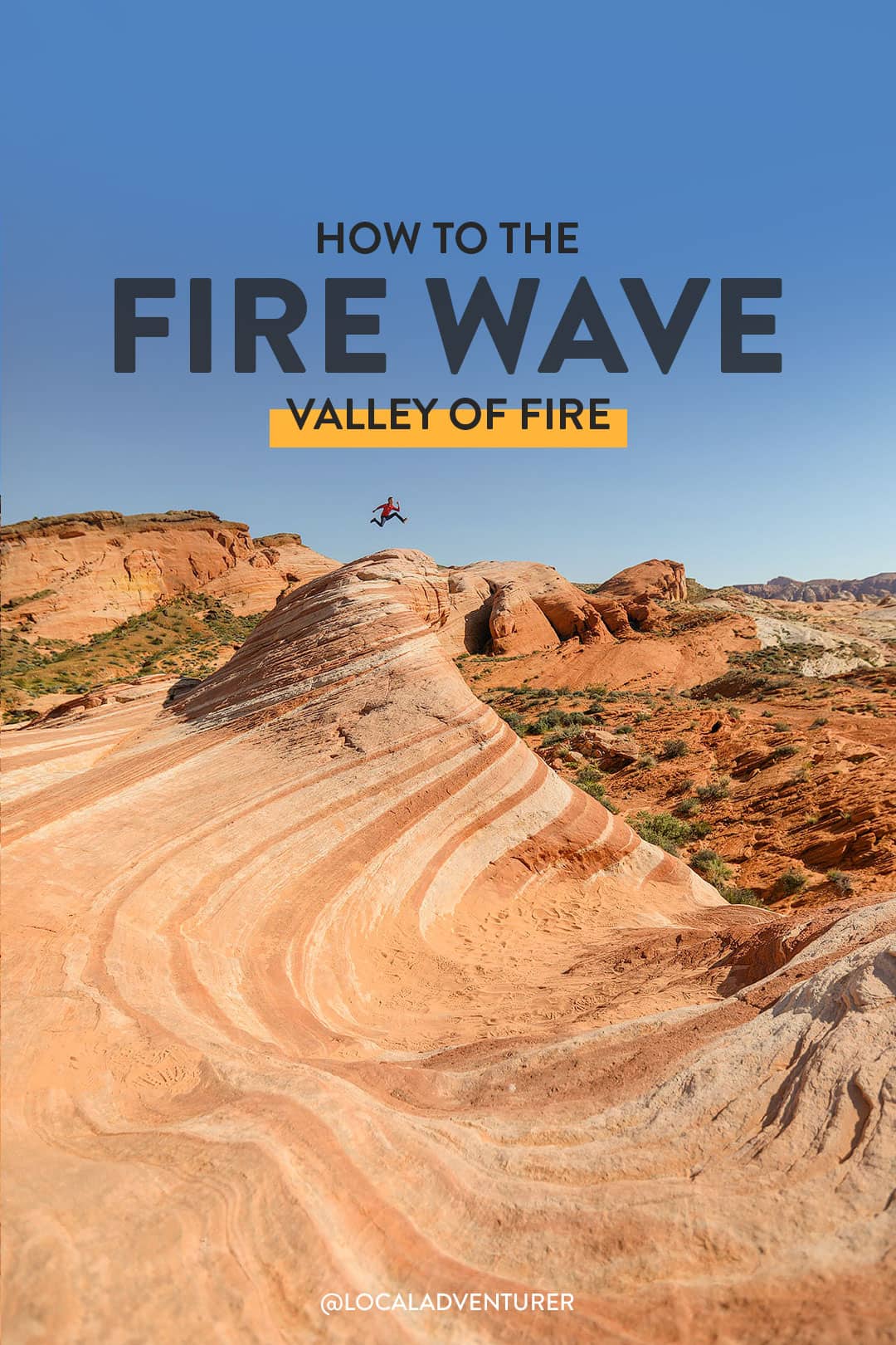
On our very first visit to Valley of Fire back in 2015, we did the Fire Wave hike. At the time, it was not on the official brochure, but now the secret’s out, and it’s the most popular landmark in the park. Many people say it looks like the elusive Wave in Arizona, except that it’s so much more accessible.
See More: 15 Incredible Things to Do in Valley of Fire State Park
Valley of Fire Address and Fees
Valley of Fire State Park
29450 Valley of Fire Road
Overton, Nevada 89040 (map)
702.397.2088
Open year-round from dawn to dusk.
Entrance: $15 per vehicle ($10 per vehicle Nevada resident)
Camping: $25 per night ($20 per vehicle Nevada resident) + $10 for sites with utility hookups
Annual Entrance Permit: $100
Local Tip: If you want to buy an annual pass, just mention this at the gate, and they will direct you to the Visitor Center, where you can purchase the pass.
See More: 15+ Best Day Trips from Las Vegas You Can’t Miss
How to Hike the Fire Wave
Distance: 1.5-miles roundtrip
Difficulty: Easy
Trail Map: click here for trail map
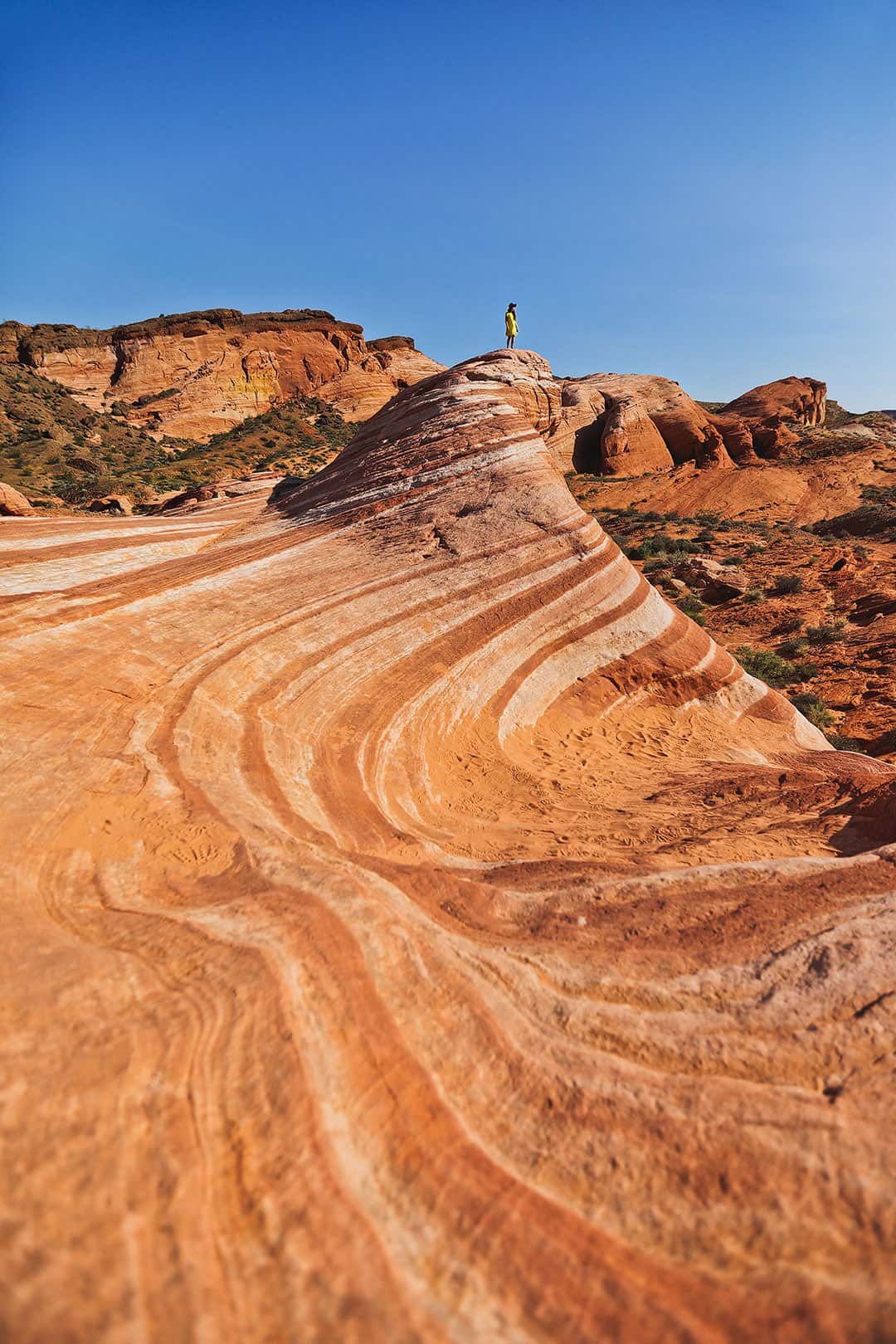
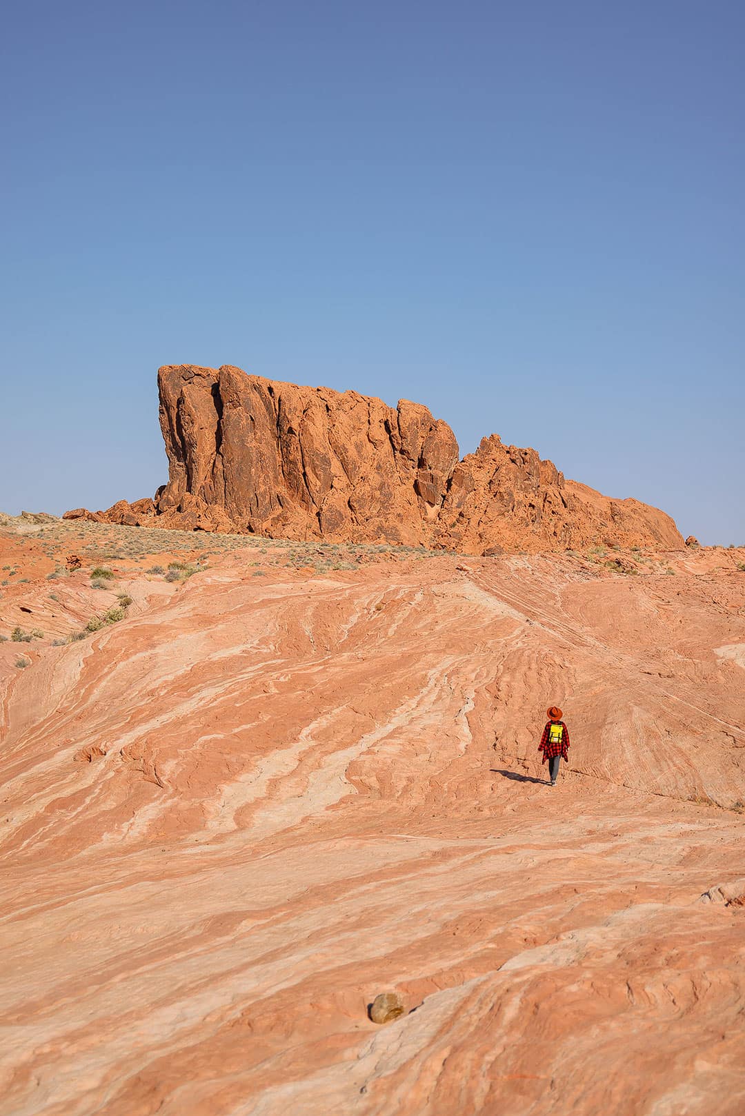
The Fire Wave is a popular 1.5-mile out-and-back hike at Valley of Fire. Starting in Parking Lot #3 (the final parking area on White Dome Road before it ends by White Domes Trail), head to the west side of the road at a well-marked trailhead for the Fire Wave Trail.
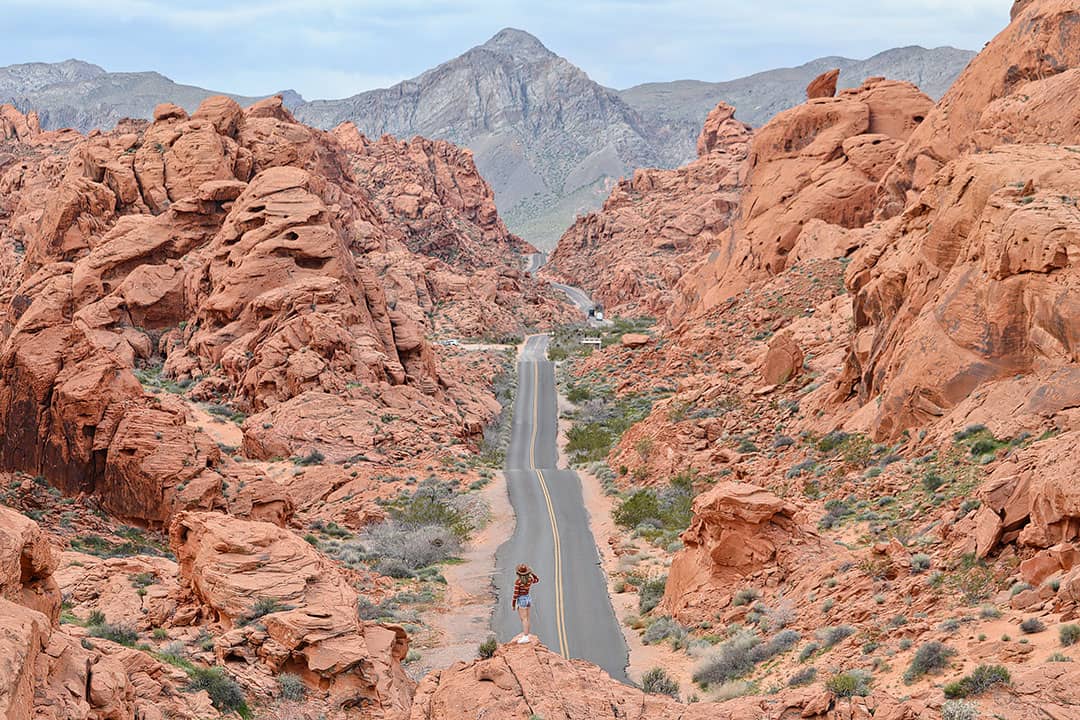
Follow the sandy trail towards the cliffs, then turn right. This area has the most elevation change with a few small hills. As you skirt around Gibraltar Rock, the trail will become rockier. Continue to follow trail markers with Gibraltar Rock to your back now. When you’re on the rock, the trail might not be as clear, but keep an eye out for markers along the way. After you get over the hill, you’ll see the Fire Wave in the distance.
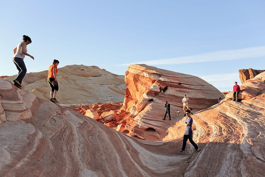
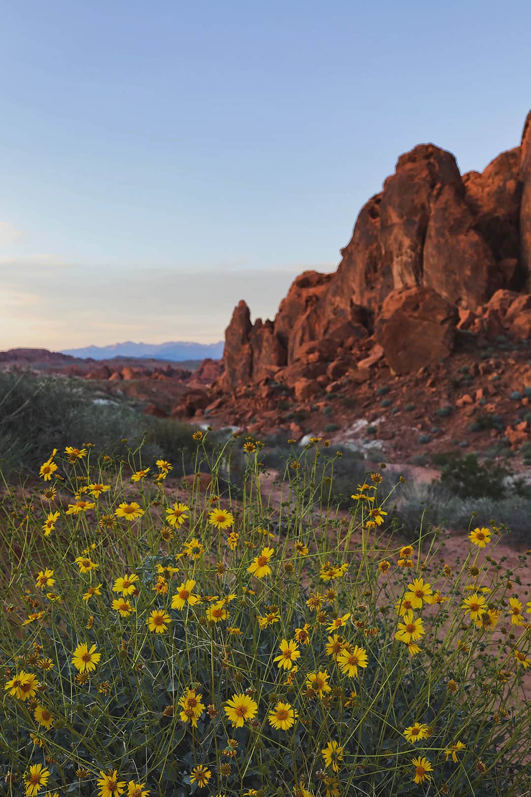
Along the way, you’ll find other rock formations and photo opps.
Trail CLosure
Because of the extreme heat during the summer, the park closes certain hikes including the Fire Wave. For the 2026 season, the closure starts on May 15, 2026 and ends at the end of September.
Fire Wave Hike Trailhead Coordinates
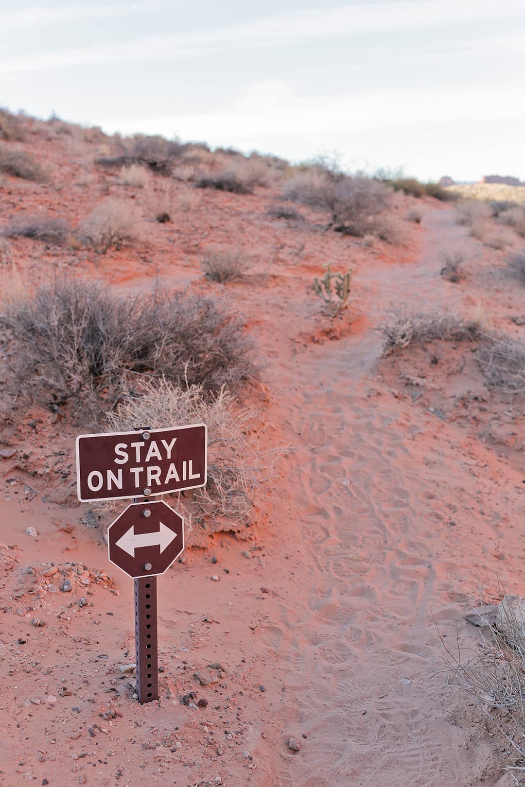
Local Tip: To help preserve the area, please stay on the established trails.
See More: 15 Best Day Hikes in the US to Put On Your Bucket List

Where to Stay
Essential Tips for Hiking to the Fire Wave in Valley of Fire State Park
- Stop by the Visitor Center to find out the most up-to-date info.
- Check the current weather here.
- Stay on the trail and pack out what you pack in.
- See the trail map here (if you want to use offline trail maps, upgrade to AllTrails+)
- The trail is closed May 15 to September 30, 2026 due to the extreme heat.
- Wear sturdy shoes – these are our go-to hiking boots. The rock is uneven, and the hike is sandy, so you’ll get sand in your shoes if they are porous.
- Wear sunblock – the hikes in Valley of Fire do not have much shade.
- Carry plenty of water. Even though it’s a short hike, it can get extremely hot in the summer. Avoid hiking in the middle of the day.
- Photo Tip – If you’re hoping to catch some golden light on the wave, the sun dips below the horizon well before sunset, so give yourself plenty of time. Otherwise, the colors get dull.
- Drones – The use of drones or any remote-controlled aircraft is not allowed.
- Unfortunately, this park road is closed when it’s dark, so don’t get stuck inside.
- If you don’t have a car and plan on taking Uber or Lyft there, you may get stranded since cell service is unreliable.
- Pets are welcome but must be kept on a leash or not more than six feet in length.
See More: 7 Breathtaking National Parks Near Las Vegas
Planning Checklist
- Get comprehensive insurance for your trip.
- Download these helpful language apps.
- Find a great deal on Las Vegas hotels.
- Arrange a rental car for your trip.
- Book a tour for your visit.
- Get airport lounge access.
- Buy a travel charger to keep your devices charged.
- Get a new backpack for your trip.
- Buy a Las Vegas travel guide.
- Pack the appropriate shoes for your trip.
- Don’t forget your in-flight essentials.
- Save money on attractions with Go City.
Have you been to Valley of Fire? What is your favorite hike?
DID YOU ENJOY THIS POST? PIN IT FOR LATER
SEE MORE LAS VEGAS GUIDES
⟡⟡⟡⟡⟡
“Discovery consists not of seeking new lands but in seeing with new eyes” – M. Proust

Esther + Jacob
Esther and Jacob are the founders of Local Adventurer, one of the top 5 travel blogs in the US. They believe that adventure can be found near and far and hope to inspire others to explore locally. They explore a new city in depth every year and currently base themselves in Las Vegas.
Follow on Instagram (E + J), YouTube, TikTok, and Pinterest.