
We looked up towards the pass in front of us and grew silent, partly in awe and partly in fear of the steep climb. Moments later, we were on our way up. Even though each step was carefully placed, our feet kept sliding back down on the loose rock. We weren’t sure how we were going to make it up.
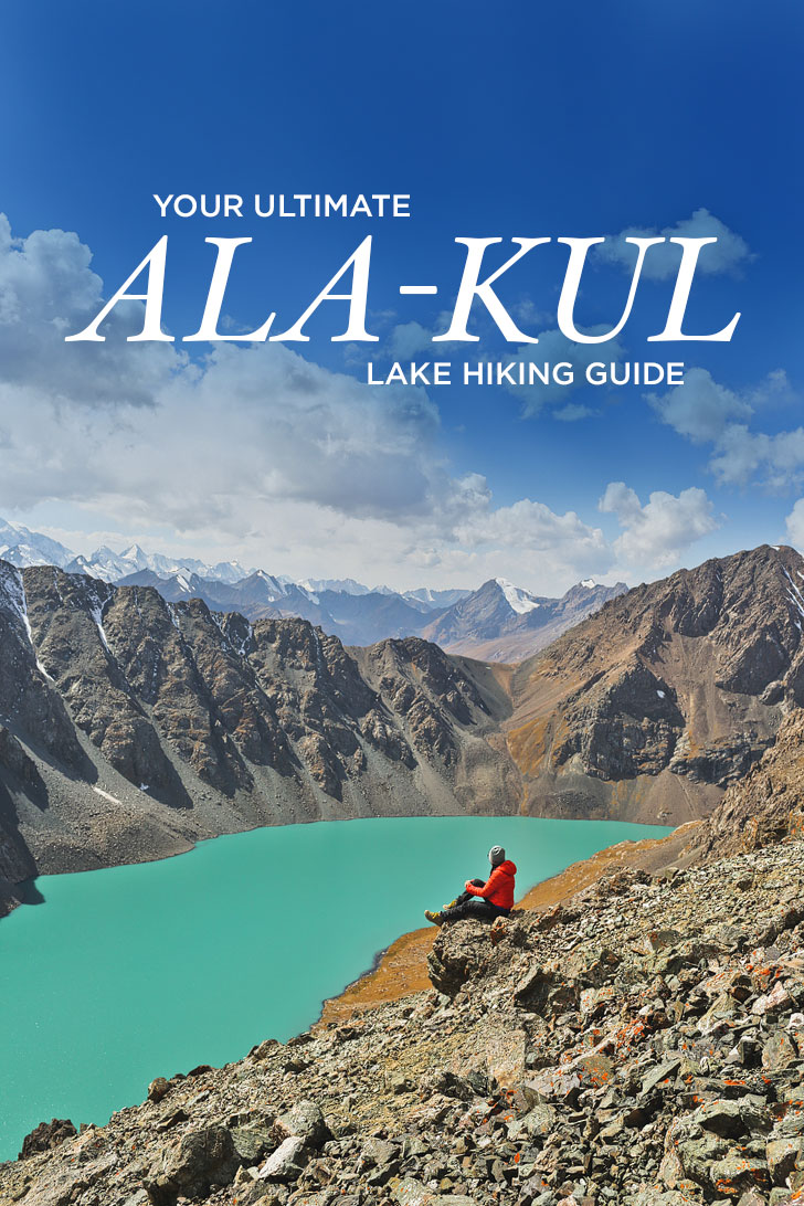
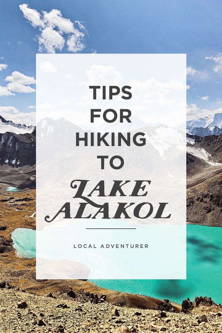
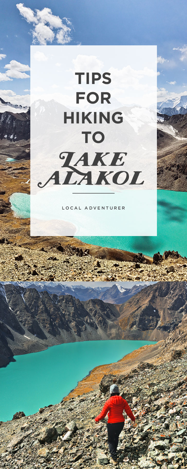
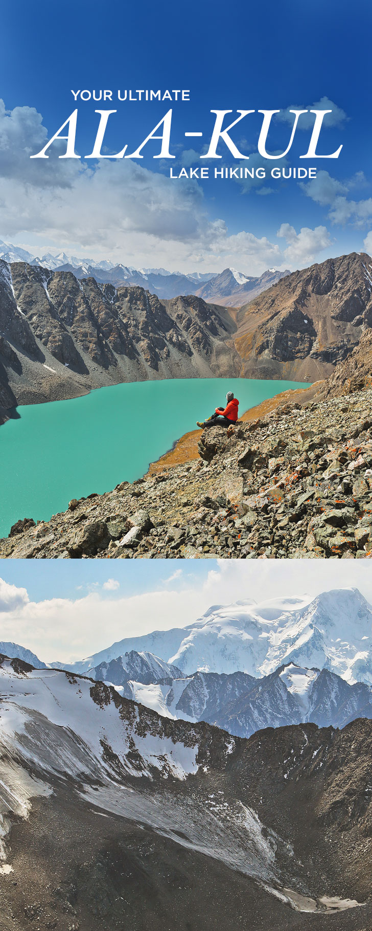
YOUR COMPLETE GUIDE TO HIKING TO LAKE ALAKOL
This post and trip were made possible by Discover Kyrgyzstan and the support of the American people through USAID (United States Agency for International Development). As always, all opinions are our own and do not reflect the views of USAID or the United States Government. Thank you for supporting the brands that make Local Adventurer possible.
WHAT WE COVER [ CLICK LINKS TO SKIP AHEAD ]
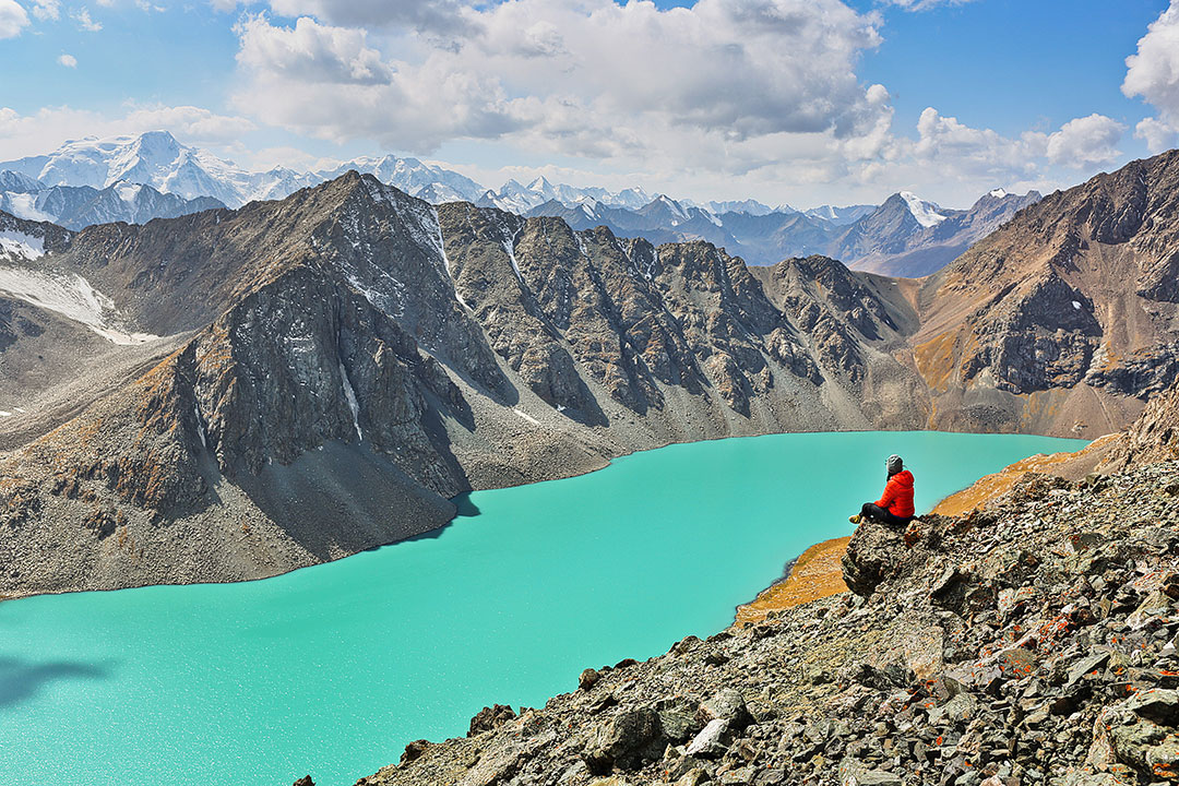
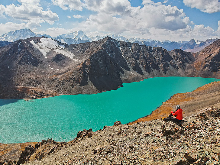
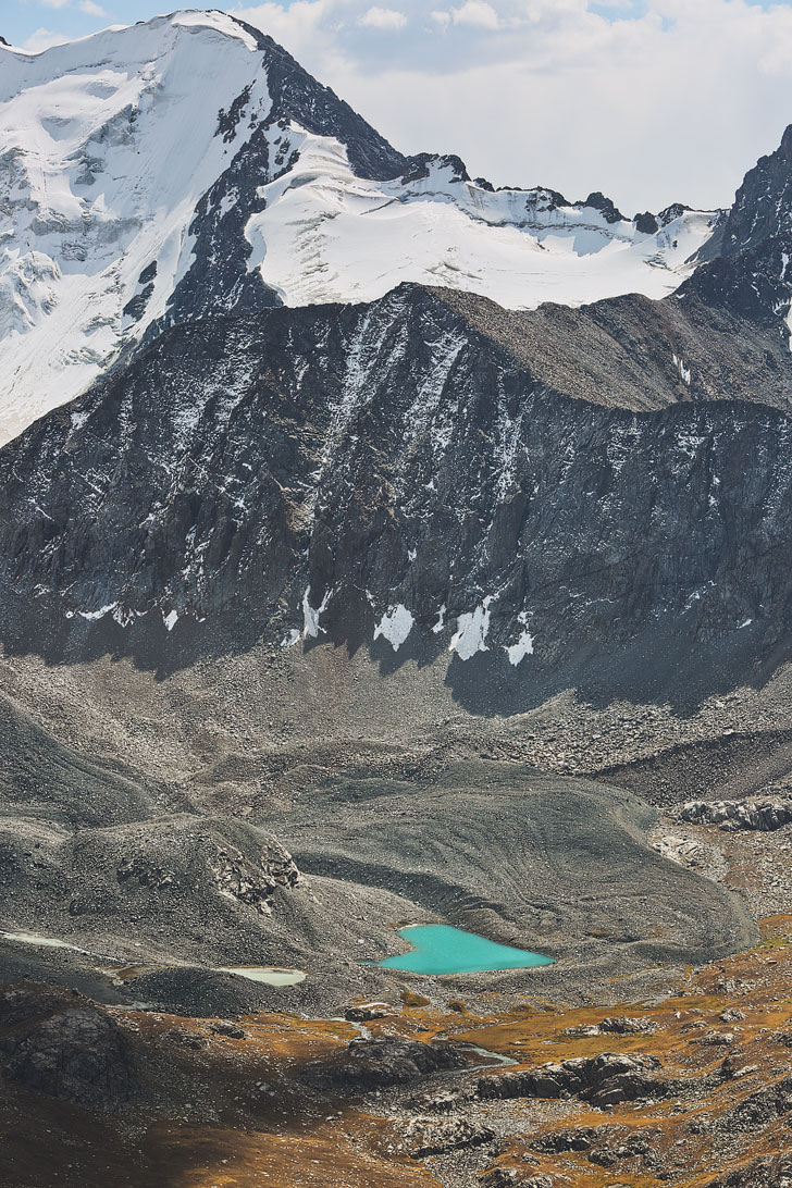
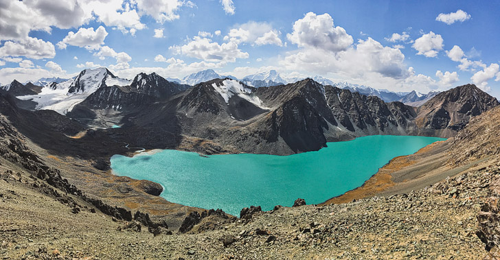
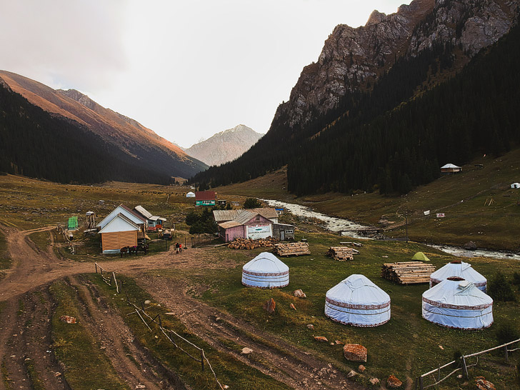
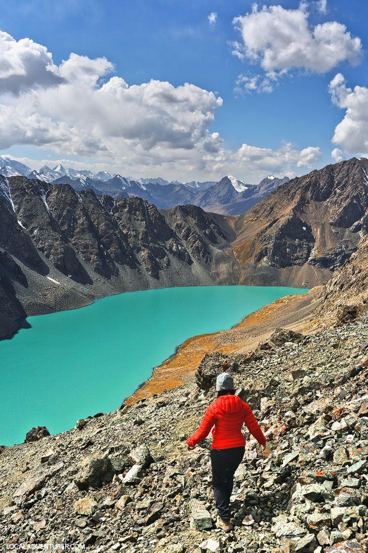
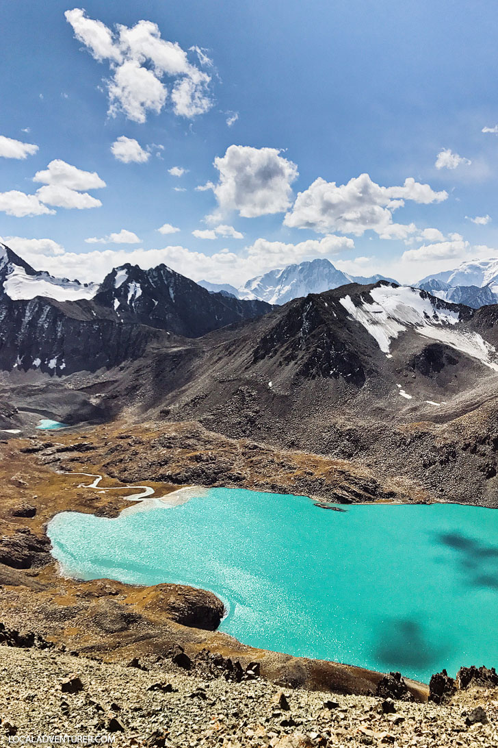
Lake Alakol is one of the most popular destinations in Kyrgyzstan. I’ve never seen a turquoise lake quite like this before. It reminded me of the glacial lakes in the Pacific Northwest, but it was somehow even more vibrant. The lake is nestled amongst the jagged peaks of the Ala-Too Mountain Range, and it almost feels like you’ve discovered a secret spot.
IS IT ALAKOL, ALAKUL, ALA-KOL, OR ALA-KUL?
We’ve seen it spelled Alakol online, but when we were there, maps had it written as Ala-Kul. We’ve seen locals use any and all of these spellings interchangeably with spaces, no spaces, and dashes. This is pretty common in Kyrgyzstan and what makes traveling here confusing. Spellings aren’t always consistent and sometimes there are places named the same or similar names. We met another traveler who ended up at Jyrgalan (a building in another city), and then Jergalan (pretty much the same pronunciation), before making it to his correct destination, Jyrgalan (the village).
Since Alakol Lake is one of the most popular landmarks, you shouldn’t have any issues when referencing it.
WAYS TO GET THERE
There are multiple ways to get to Lake Alakol, but all of them take some effort.
- The most popular route is a 3-4 day trek starting in Karakol and ending in Aksu, where you can get a cab back to Karakol.
- The alternative is to start in Aksu and head to Altyn Arashan first, then hike to Lake Alakol (generally 2 days) or go on horseback for a day trip.
We came in from the other side since we hiked to Boz-Uchuk Lakes. After arriving in Altyn Arashan, we rode to the bottom of the Alakol pass on horseback, then finished the last climb on foot.
OUR EXPERIENCE & THE EASIEST WAY TO GET THERE
During our visit to Kyrgyzstan, we had the chance to do a more undiscovered hike to Boz-Uchuk Lakes and then on to Altyn Arashan. From Altyn Arashan, it’s easy to add a day trip to Alakol on horseback, or add a couple days to hike to Alakol. If you’re very quick, you might be able to hike it in a day if you wake up really early and during the summer when the days are longer.
For those of you looking for the least amount of effort to get to Alakol, you can hire an off-road vehicle to take you from Aksu to Altyn Arashan. It’s extremely bumpy off-road terrain, so a regular cab won’t take you. We asked the Destination Karakol folks how much it normally is, and they said it can cost between 10,000-13,000 som for a car to drop you off and pick you up when you’re done.
Total Distance: 10.4 km by horse + 2 km walk
Pass: Ala-Kul North Pass (3900 m)
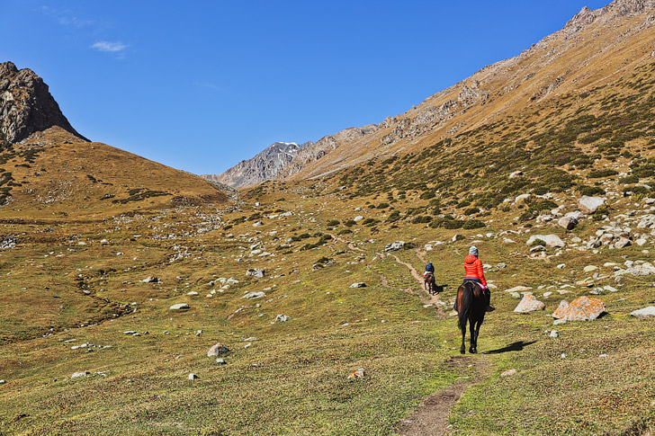
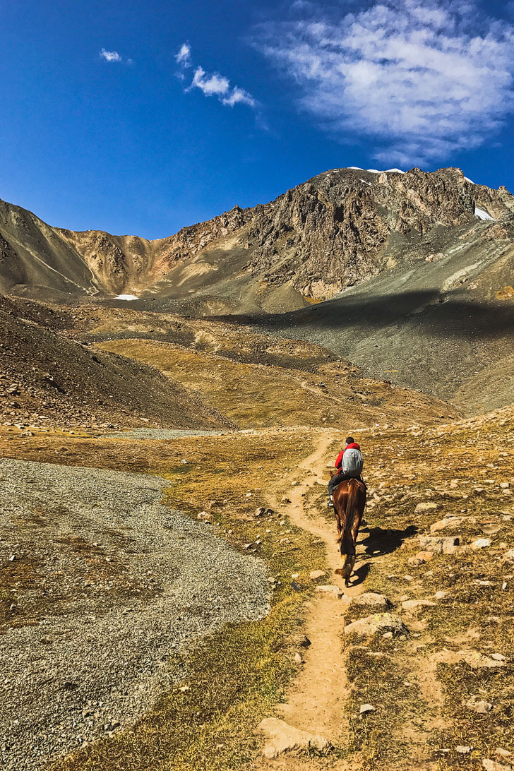
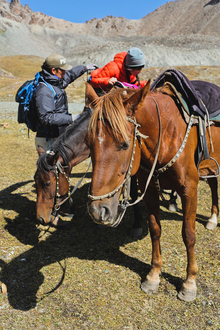
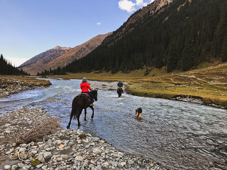
From Altyn Arashan, you can ride a horse to the base of the Alakol North Pass. Along the way, you’ll cross rivers, and hop over to a perpendicular valley.
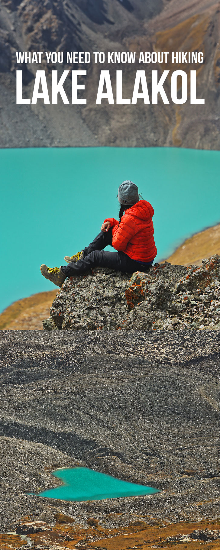
If you’re using this as a photo guide, the photo below is actually us on the way back from Alakol.
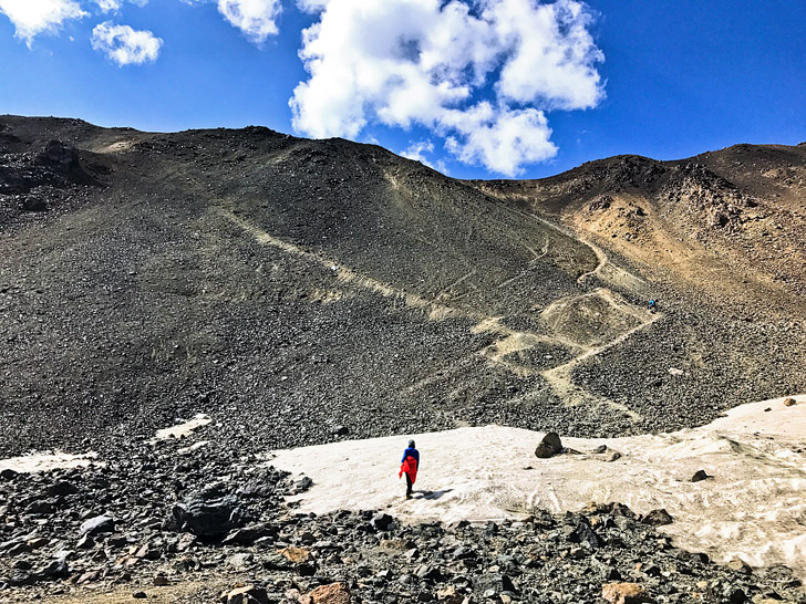
Once you reach the base of the pass, you will leave your horse at the bottom and finish the 1 km to the top on foot. The last kilometer is EXTREMELY steep. The path is made up of loose shale, which makes it slippery. Each step you take, the rocks start sliding down. If you have trouble with heights this makes for a scary jaunt. There was even a portion where Jacob sat down paralyzed with fear. Of course, our guide had no issue and was running and hopping around all over the place.
That’s me at the bottom, but do you see the tiny person in blue on the trail?
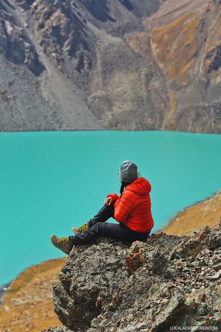
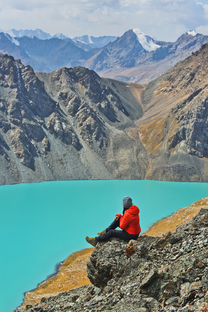
We spent our time on top of the pass taking photos and eating lunch. I’m sure you can also make it down to the lake if you want, but be sure to talk to your guide about it to confirm. We were short on time, so we headed back after.
DIRECTIONS FOR THE TRADITIONAL + MOST POPULAR ROUTE
Marshrutka #101 will take you directly to the trailhead for 8 som. It takes roughly 20 mins. You can catch it almost anywhere along Toktogol St. which is where most of the guest houses are. You’ll want to take it to the last stop which is near the gates of the park, the Marshrutka will turn around and the driver will probably shoo you out.
Day 1: Karakol to Sirota Campsite
Distance: 22 km
Time: 5-6 hours
The first day starts off easy. You will primarily be walking alongside a river, so you shouldn’t get lost as long as you don’t veer off onto one of the smaller paths. Eventually, you will see a bridge over the river to your left with huge pine trees on either side. Cross the bridge, then head straight up.
More paths will appear, but just be sure you continue heading east into the valley. There will be some trail markers every so often (usually red-paint on rocks), but if you focus on staying on the most obvious trail, you should get to the campsite with no problem. After about an hour and a half, you’ll come across a small river. Follow this up to the wooden cabin on the left side of the valley.
Day 2: Sirota Campsite to Alakol Lake
Distance: 4 km
Time: 2-3 hours
Head up the trail with the river to your right. There should be plenty of markers, and you’ll know you’re on the right track when you come across a waterfall at the top of the valley.
Follow the cairns until the summit, where you’ll get the first look of the beautiful lake. If you plan on staying the night near the lake, you have plenty of time to summit one of the surrounding peaks.
A lot of people don’t bother staying at Lake Alakol, but if we visited again, we would absolutely camp here. It’s so beautiful and it gives you the chance to have a sunset and sunrise at the lake. If you don’t want to camp here, combine day 2 and 3, but be sure to start early.
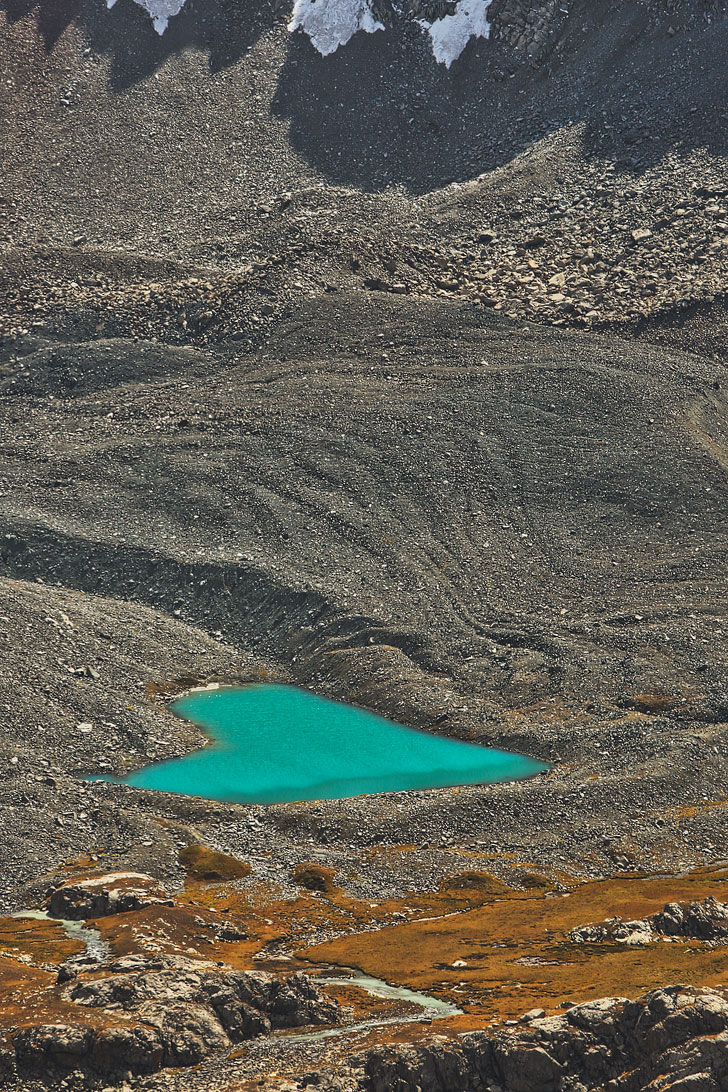
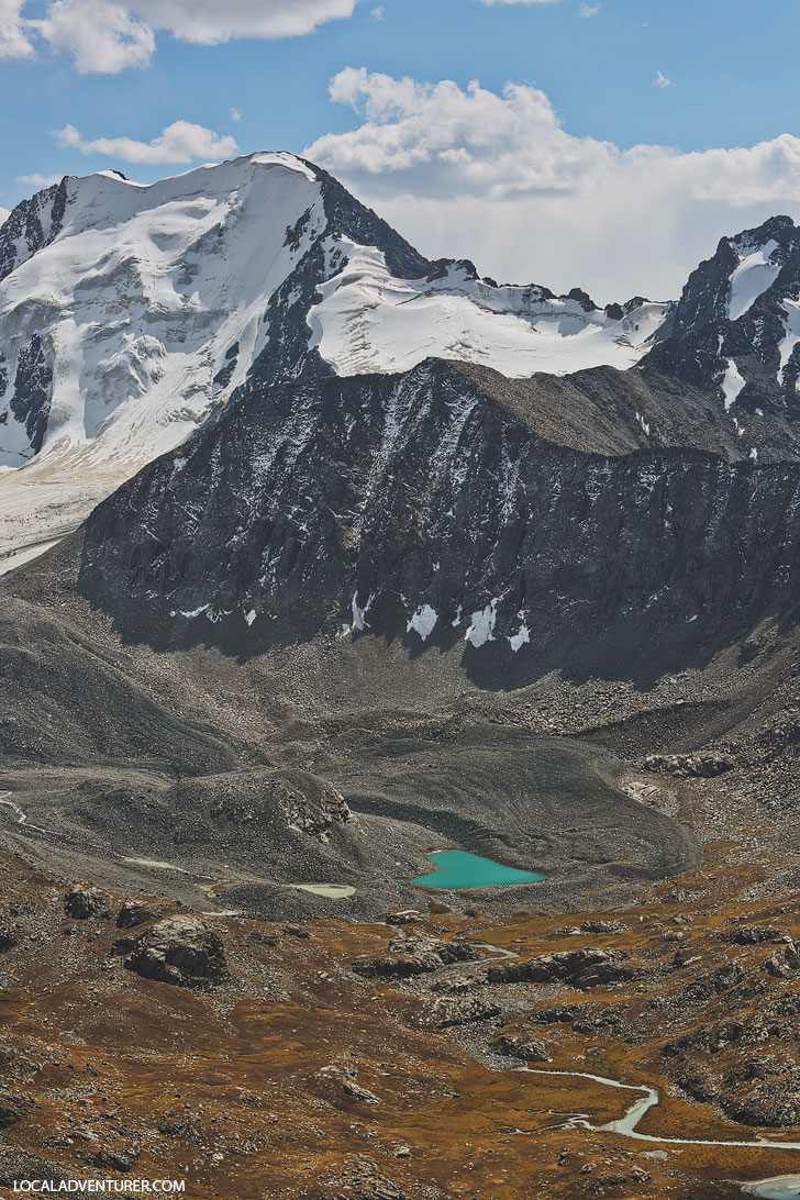
You can also see Heart Lake from a distance. It only looks like a heart from this perspective, not if you get closer.
Day 3: Ala-Kul Lake to Altyn Arashan
Distance: 15 km
Time: 4-5 hours
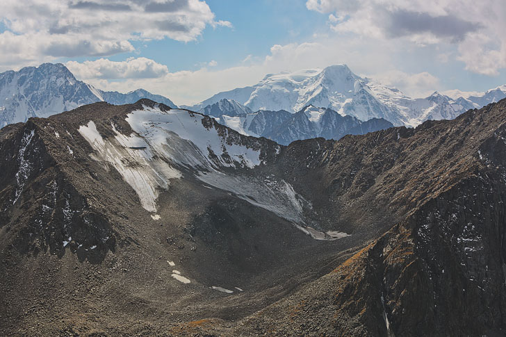
Follow the trail leading up to the pass on the northeast side of the lake. It’s a tough climb, so be sure to mentally prepare yourself. Once you’re at the top, turn around to get your last looks at the lake, and then comes the scary part.
This connects to our experience so you know how sketchy it is to head down. From here, follow the valley and the most obvious path. You will eventually run into a large river, where you’ll stay to the left of it. Follow the river down staying as close to it as possible (you should never veer off more than a few meters away) and you’ll find yourself at Altyn Arashan, where there is a bridge to take you to the other side.
Day 4: Altyn Arashan to Aksu
Distance: 16km
Time: 4-5 hours
I personally would hire a driver to take you out to Aksu. It’s a rough and bumpy ride but saves you a lot of time. If you do decide to walk it, the road is very obvious. If you ever feel lost, just say “Aksu” to any of the locals and they will point you in the right direction.
Once you arrive back in Aksu, you can grab a taxi back to Karakol for roughly 400 som. It will take about 25-30 minutes.
BEST TIME TO HIKE TO ALAKOL
The best time to be in the mountains in Kyrgyzstan is between July and September. The weather is nicer, the days are longer, and you get a chance to catch the wildflowers.
This is one of the most popular hikes in the country, so if you prefer to avoid people on the trails, visit during the shoulder seasons. You can go between May and June or September and mid-October. The weather will be less predictable though and there may be snow at higher elevations.
SHOULD I HIRE A GUIDE & PORTERS
It really depends on how comfortable you are in the backcountry. There are a few things to consider when making this decision.
How in shape are you? We’re not hardcore hikers, but we thought we were in decent shape going into these hikes. We were wrong! A lot of the elevation changes happen quickly and steeply. We barely made it through and we only had to carry a daypack. I’m not sure if we would have made it with full packs. Kyrgyzstan is a mountainous country and these guys live in the mountains. Expect what they call moderate hikes to be difficult hikes and difficult hikes to be mountaineering.
Do you get altitude sickness? You don’t really get a chance to acclimate to the elevation. If altitude sickness is a worry, it’s nice to have a guide who can help assist with that. We found ourselves with our hands on our knees trying to catch our breath A LOT.
How good are you at navigating and dealing with getting lost? The trails in Kyrgyzstan can be really confusing. Since the locals bring livestock into the mountains, there are trails everywhere! Markers are also uncommon on most trails. The good thing is if you’re going in the summer, there will be plenty of people on the trail that you can ask.
What is your budget? Guides can cost between 1200-2500 KGS per day. In addition to that, you should plan on tipping your guides $6 USD per person per day and any porters/cooks $3 USD per person per day. If you are doing it on your own, the entrance fee is 250 KGS per person. You will also pay rangers an additional 150 KGS per tent.
If we were to do it again, we would still hire a guide, but we saw a ton of people doing it on their own. All those people, however, also asked our guide for directions.
WHAT TO PACK FOR YOUR HIKE
If you hire a guide, talk to them beforehand about what they will provide. If you’re doing it on your own, be sure that you are prepared. We had a guide and porters, but these are still some of the items we would recommend.
- Backpack: Jacob used the Lowepro Whistler Bag, since he was carrying the camera gear, but it was a huge mistake. He should have brought his backpacking pack. I used the Osprey Ace 50 Pack.
- Down Jacket: Depending on the time of year it can get cold at night. We went during shoulder season so we really needed them.
- Hiking Pants: I had these Columbia convertible pants which would work in the summer as well. Jacob had the Mountain Hardwear Dragon Pants which were great for shoulder season but would probably be too hot in the summer.
- Waterproof Jacket: You never know when it will rain, so it’s always to better to be prepared. Our Arc’teryx Beta SL Jackets (Hers + His) were perfect for this.
- Hat, Buff and/or Balaclava: You should absolutely bring a hat to shade you from the sun. If you’re going in colder weather, a buff or balaclava is nice to keep you warm.
- Waterproof Hiking Boots: There will be times you’ll need to cross shallow creeks or puddles. We both love our Danner Mountain 600 (Hers + His) hiking boots.
- Down Booties: Do you get cold feet at night? These down booties are the BEST to keep you warm (we also use these shoe bags to pack them)!
- Sleeping Bag: We went in colder weather so Esther brought her Feathered Friends Murre Ex 0 Degree Bag. Jacob used one they provided and brought his Sea to Summit Liner for extra warmth.
- Sleeping Pad: We love our sleeping pads because they’re really light but still comfortable.
- Water Bladder: The Platypus Big Zip ones are our favorite. They are easy to fill and clean and having a bladder makes water easily accessible.
- Water Filter: Locals don’t bother with filtering the water, but we prefer to be safe. This one is super light and works well.
- Headlamp: Always good to have for early mornings and after the sun goes down.
- Quick-Dry Towel: Whether you want a cushier travel towel or light version to save space and weight, it’s good to have one handy.
- Personal Toiletries and Meds: Just bring what you need. These Lewis N Clark Travel Pouches are great and lightweight.
- Ziplock Bags: We always travel with a few of them. You can use them to carry out garbage or protect your phone/passport when it rains.
- Toilet Paper: We rolled some up and put it in a ziplock bag.
- Trekking Poles: REI Flash Carbon Trekking Poles ware lightweight and fit in our packs when we travel.
- Phone Charger: Keep your phone on airplane mode to conserve battery since there isn’t any service in the mountains, and bring a phone charger if you’re out there for a few days.
- Map: Buy a map in town for around 150 KGS.
PHOTOGRAPHY TIPS
- Best time of day to shoot: Because the lake sits in a deep valley, the best time to shoot the lake is either dawn or dusk. In this case, it may not be as brilliant of a blue. The middle of a sunny day will give you the best brightest blue color of the lake.
- Drones: If you’re flying a drone, be careful since it can get really windy up there. We had the DJI Spark with us and there were moments I was nervous the wind would take it away.
- Our gear and lenses: We brought our Canon 5D Mark III for photos and Sony RX100 Mark IV for video. We also had a 35mm for wide shots and 70-200mm for tight shots.
- Your camera is only useful if it’s easily accessible. We used the BlackRapid Backpack Sling with the Tripod Plate to keep ours out and available.
- We brought a lightweight tripod with us but didn’t end up using it. Although if you’re camping, you may want one to shoot stars at night.
Don’t forget to spend some time in Karakol exploring the city before or after the hike! What’s the last hike you’ve done?
DID YOU ENJOY THE POST? PIN IT FOR LATER

SEE MORE ABOUT KYRGYZSTAN
⟡⟡⟡⟡⟡
15 THINGS YOU MUST KNOW BEFORE VISITING KYRGYZSTAN
21 UNIQUE THINGS TO DO IN KARAKOL
HOW TO HIKE TO BOZ UCHUK LAKES
“Discovery consists not of seeking new lands but in seeing with new eyes” – M. Proust

ESTHER + JACOB
Esther and Jacob are the founders of Local Adventurer, which is one of the top 50 travel blogs in the world. They believe that adventure can be found both near and far and hope to inspire others to explore locally. They explore a new city every year and are currently in NYC.
![]()
![]()
![]()
![]()
![]()
![]()

Hi Esther, thank you for the detail write up for Alakol and Arashan, so informative! I’m planning my trip Kyrgyzstan next month. May I ask if you hire guide, porter and cook (3 of them) for both you (2 hiker)? Possible to share how do they charge for porter (per day, per kg) and cook?
Our guide was Daniyar – he helped plan everything and can let you know how much everything will be. Reach out to him here: https://www.facebook.com/daniyar.alymbekov
Hi,
The idea to be on horseback is a brilliant idea. Thus, can do 1 day trip to Alakul Lake but provided must know how to ride a horse. Can someone novice like me do that? I’m a trekkers but not good on horse riding.
Thanks,
Regards,
Romzi
I think so! There are some steep areas, but I would say I’m ver inexperienced with horses too and I was okay. It helps if there is a guide too in case something goes wrong.
What an absolutely beautiful site! That lake is gorgeous. I think I would hire a guide. Even in places we’re familiar with, we like to have a guide – it doesn’t hurt to have someone who knows the area well and can give you a wealth of information and stories you wouldn’t know otherwise!
Wow that looks absolutely stunning. The geology looks very volcanic with the dark soil. One day I must visit Kyrgyzstan, my kinda trek!
Yes, it’s beautiful, Shameer! Hope you make it out there one day!
The colour of that lake is out of this world. You can’t beat a bit of glacial melt and a sprinkle of rock flour. I think for the extra few bucks hiring a guide is worth it. I think the extra information that you’d learn would be worth its weight in gold.
Isn’t it? I couldn’t believe my eyes. Completely agree! I generally like having one since we tend to get lost a lot haha